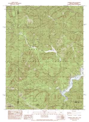
Carberry Creek Topo Map Oregon
To zoom in, hover over the map of Carberry Creek
USGS Topo Quad 42123a2 - 1:24,000 scale
| Topo Map Name: | Carberry Creek |
| USGS Topo Quad ID: | 42123a2 |
| Print Size: | ca. 21 1/4" wide x 27" high |
| Southeast Coordinates: | 42° N latitude / 123.125° W longitude |
| Map Center Coordinates: | 42.0625° N latitude / 123.1875° W longitude |
| U.S. States: | OR, CA |
| Filename: | o42123a2.jpg |
| Download Map JPG Image: | Carberry Creek topo map 1:24,000 scale |
| Map Type: | Topographic |
| Topo Series: | 7.5´ |
| Map Scale: | 1:24,000 |
| Source of Map Images: | United States Geological Survey (USGS) |
| Alternate Map Versions: |
Carberry Creek OR 1983, updated 1983 Download PDF Buy paper map Carberry Creek OR 1996, updated 1998 Download PDF Buy paper map Carberry Creek OR 2011 Download PDF Buy paper map Carberry Creek OR 2014 Download PDF Buy paper map |
| FStopo: | US Forest Service topo Carberry Creek is available: Download FStopo PDF Download FStopo TIF |
1:24,000 Topo Quads surrounding Carberry Creek
> Back to 42123a1 at 1:100,000 scale
> Back to 42122a1 at 1:250,000 scale
> Back to U.S. Topo Maps home
Carberry Creek topo map: Gazetteer
Carberry Creek: Bars
Seattle Bar (historical) elevation 599m 1965′Carberry Creek: Flats
Baker Flat elevation 699m 2293′Carberry Creek: Gaps
Cougar Gap elevation 1639m 5377′Young Gap elevation 1053m 3454′
Carberry Creek: Mines
Bobbit Mine elevation 734m 2408′Jay Bird Mine elevation 906m 2972′
Steamboat Mine elevation 993m 3257′
Carberry Creek: Populated Places
Copper elevation 594m 1948′Steamboat elevation 763m 2503′
Carberry Creek: Post Offices
Copper Post Office (historical) elevation 594m 1948′Steamboat Post Office (historical) elevation 763m 2503′
Watkins Post Office (historical) elevation 632m 2073′
Carberry Creek: Ridges
Bearwallow Ridge elevation 1636m 5367′Whisky Ridge elevation 1770m 5807′
Carberry Creek: Streams
Brush Creek elevation 711m 2332′Carberry Creek elevation 594m 1948′
Cougar Creek elevation 616m 2020′
Elliott Creek elevation 610m 2001′
Grouse Creek elevation 611m 2004′
Horse Creek elevation 661m 2168′
Indian Creek elevation 651m 2135′
Manzanita Creek elevation 594m 1948′
O'Brien Creek elevation 848m 2782′
Osier Creek elevation 796m 2611′
Slick Rock Creek elevation 867m 2844′
Steve Fork elevation 752m 2467′
Sturgis Fork elevation 752m 2467′
Trail Creek elevation 851m 2791′
Carberry Creek: Summits
Billy Mountain elevation 998m 3274′Burnt Peak elevation 1435m 4708′
Collings Mountain elevation 1073m 3520′
Kinney Mountain elevation 1333m 4373′
Steamboat Mountain elevation 1237m 4058′
Stricklin Butte elevation 1574m 5164′
Carberry Creek: Valleys
Bailey Gulch elevation 753m 2470′Broadenaxe Gulch elevation 778m 2552′
China Gulch elevation 706m 2316′
Dark Canyon elevation 846m 2775′
Hacker Gulch elevation 594m 1948′
Lime Gulch elevation 657m 2155′
Mocks Gulch elevation 827m 2713′
Panther Gulch elevation 594m 1948′
Quartz Gulch elevation 961m 3152′
Saw Pit Gulch elevation 877m 2877′
Sawmill Gulch elevation 625m 2050′
Straight Gulch elevation 733m 2404′
Stricklin Gulch elevation 680m 2230′
Sutton Gulch elevation 756m 2480′
Wingdam Gulch elevation 873m 2864′
Carberry Creek digital topo map on disk
Buy this Carberry Creek topo map showing relief, roads, GPS coordinates and other geographical features, as a high-resolution digital map file on DVD:


