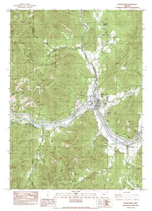
Rogue River Topo Map Oregon
To zoom in, hover over the map of Rogue River
USGS Topo Quad 42123d2 - 1:24,000 scale
| Topo Map Name: | Rogue River |
| USGS Topo Quad ID: | 42123d2 |
| Print Size: | ca. 21 1/4" wide x 27" high |
| Southeast Coordinates: | 42.375° N latitude / 123.125° W longitude |
| Map Center Coordinates: | 42.4375° N latitude / 123.1875° W longitude |
| U.S. State: | OR |
| Filename: | o42123d2.jpg |
| Download Map JPG Image: | Rogue River topo map 1:24,000 scale |
| Map Type: | Topographic |
| Topo Series: | 7.5´ |
| Map Scale: | 1:24,000 |
| Source of Map Images: | United States Geological Survey (USGS) |
| Alternate Map Versions: |
Rogue River OR 1983, updated 1983 Download PDF Buy paper map Rogue River OR 2011 Download PDF Buy paper map Rogue River OR 2014 Download PDF Buy paper map |
1:24,000 Topo Quads surrounding Rogue River
> Back to 42123a1 at 1:100,000 scale
> Back to 42122a1 at 1:250,000 scale
> Back to U.S. Topo Maps home
Rogue River topo map: Gazetteer
Rogue River: Bars
Seaman Bar elevation 297m 974′Rogue River: Canals
Evans Creek Lateral elevation 344m 1128′Rogue River: Dams
Savage Rapids Dam elevation 294m 964′Rogue River: Mines
Owl Hollow Mine elevation 785m 2575′Shasta Mine elevation 551m 1807′
Rogue River: Parks
Classick Bicentennial Park elevation 306m 1003′Coyote Evans Wayside elevation 306m 1003′
Fleming Memorial Park elevation 306m 1003′
Palmerton Park elevation 307m 1007′
Pierce Riffle County Park elevation 289m 948′
Ponderosa Park elevation 348m 1141′
Savage Rapids County Park elevation 295m 967′
Valley of the Rogue State Park elevation 309m 1013′
Rogue River: Populated Places
Foots Creek elevation 306m 1003′Rogue River elevation 306m 1003′
Starvation Heights elevation 406m 1332′
Rogue River: Post Offices
Bolt Post Office (historical) elevation 306m 1003′Foots Creek Post Office (historical) elevation 306m 1003′
Gold River Post Office (historical) elevation 294m 964′
Rogue River Post Office elevation 306m 1003′
Rogue River: Rapids
Savage Rapids elevation 293m 961′Rogue River: Reservoirs
Cold Springs Reservoir elevation 384m 1259′Smith Reservoir elevation 353m 1158′
Rogue River: Slopes
Big Bald Spot elevation 751m 2463′Little Bald Spot elevation 698m 2290′
Rogue River: Springs
Martin Spring elevation 422m 1384′Turner Spring elevation 416m 1364′
Rogue River: Streams
Bee Creek elevation 317m 1040′Birdseye Creek elevation 309m 1013′
Boyd Creek elevation 386m 1266′
Cold Springs Creek elevation 360m 1181′
Evans Creek elevation 302m 990′
Fall Creek elevation 348m 1141′
Fielder Creek elevation 329m 1079′
Foots Creek elevation 304m 997′
Left Fork Birdseye elevation 373m 1223′
Left Fork Fielder Creek elevation 419m 1374′
Little Savage Creek elevation 302m 990′
Maple Creek elevation 311m 1020′
Right Fork Fielder Creek elevation 417m 1368′
Right Fork Foots Creek elevation 353m 1158′
Savage Creek elevation 298m 977′
South Fork Trimble Creek elevation 369m 1210′
Trimble Creek elevation 362m 1187′
Ward Creek elevation 309m 1013′
White Spring Branch elevation 320m 1049′
Rogue River: Summits
Fielder Mountain elevation 1137m 3730′Old Baldy elevation 1205m 3953′
Rogue River: Valleys
Bear Gulch elevation 553m 1814′Briar Gulch elevation 345m 1131′
Briar Gulch elevation 385m 1263′
Gold Gulch elevation 330m 1082′
Lucy Gulch elevation 442m 1450′
Maple Gulch elevation 360m 1181′
Millers Gulch elevation 315m 1033′
Oak Gulch elevation 438m 1437′
Owl Hollow elevation 819m 2687′
Reservoir Gulch elevation 593m 1945′
Schieffelin Gulch elevation 321m 1053′
Sugarpine Gulch elevation 309m 1013′
Rogue River digital topo map on disk
Buy this Rogue River topo map showing relief, roads, GPS coordinates and other geographical features, as a high-resolution digital map file on DVD:


