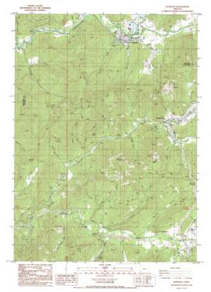
Glendale Topo Map Oregon
To zoom in, hover over the map of Glendale
USGS Topo Quad 42123f4 - 1:24,000 scale
| Topo Map Name: | Glendale |
| USGS Topo Quad ID: | 42123f4 |
| Print Size: | ca. 21 1/4" wide x 27" high |
| Southeast Coordinates: | 42.625° N latitude / 123.375° W longitude |
| Map Center Coordinates: | 42.6875° N latitude / 123.4375° W longitude |
| U.S. State: | OR |
| Filename: | o42123f4.jpg |
| Download Map JPG Image: | Glendale topo map 1:24,000 scale |
| Map Type: | Topographic |
| Topo Series: | 7.5´ |
| Map Scale: | 1:24,000 |
| Source of Map Images: | United States Geological Survey (USGS) |
| Alternate Map Versions: |
Glendale OR 1986, updated 1986 Download PDF Buy paper map Glendale OR 1996, updated 1999 Download PDF Buy paper map Glendale OR 2011 Download PDF Buy paper map Glendale OR 2014 Download PDF Buy paper map |
| FStopo: | US Forest Service topo Glendale is available: Download FStopo PDF Download FStopo TIF |
1:24,000 Topo Quads surrounding Glendale
> Back to 42123e1 at 1:100,000 scale
> Back to 42122a1 at 1:250,000 scale
> Back to U.S. Topo Maps home
Glendale topo map: Gazetteer
Glendale: Gaps
Smith Hill Summit elevation 484m 1587′Glendale: Mines
Aman Ranch Placer elevation 405m 1328′Glory Hole Placer elevation 449m 1473′
Goff Placer elevation 432m 1417′
Steam Beer Placer elevation 333m 1092′
Glendale: Parks
Wolf Creek County Park elevation 376m 1233′Wolf Creek Inn State Park elevation 385m 1263′
Glendale: Populated Places
Glendale elevation 437m 1433′Leland elevation 331m 1085′
Sunny Valley elevation 388m 1272′
Wolf Creek elevation 386m 1266′
Glendale: Post Offices
Altamont Post Office (historical) elevation 362m 1187′Glendale Post Office elevation 437m 1433′
Leland Post Office (historical) elevation 331m 1085′
Reuben Post Office (historical) elevation 417m 1368′
Rowes Post Office (historical) elevation 408m 1338′
Sunny Valley Post Office elevation 388m 1272′
Wolf Creek Post Office elevation 386m 1266′
Glendale: Reservoirs
Dollar Log Ponds elevation 430m 1410′Ehlig Reservoir elevation 352m 1154′
Glendale Reservoir elevation 542m 1778′
Hayward Pond elevation 442m 1450′
Mill Creek Reservoir elevation 496m 1627′
Superior Log Pond elevation 428m 1404′
Twin Harbor Log Pond elevation 549m 1801′
Wolf Creek Pools elevation 374m 1227′
Woolfolk Reservoir elevation 402m 1318′
Glendale: Springs
Stranns Spring elevation 434m 1423′Twin Harbor Loop Spring elevation 620m 2034′
Glendale: Streams
Angora Creek elevation 283m 928′Cedar Creek elevation 454m 1489′
Cindy Creek elevation 451m 1479′
Coyote Creek elevation 382m 1253′
Dog Creek elevation 330m 1082′
Japanese Creek elevation 328m 1076′
Laundry Creek elevation 816m 2677′
McCullough Creek elevation 416m 1364′
Mill Creek elevation 427m 1400′
Mount Creek elevation 401m 1315′
Perkins Creek elevation 402m 1318′
Rat Creek elevation 358m 1174′
Rattlesnake Creek elevation 409m 1341′
Rattlesnake Creek elevation 404m 1325′
Right Fork Rat Creek elevation 378m 1240′
Salmon Creek elevation 363m 1190′
Section Creek elevation 425m 1394′
Stevens Creek elevation 431m 1414′
Tom East Creek elevation 308m 1010′
Totten Creek elevation 418m 1371′
Tunnel Creek elevation 427m 1400′
Windy Creek elevation 426m 1397′
Wolf Creek elevation 293m 961′
Glendale: Summits
London Peak elevation 867m 2844′Malone Peak elevation 894m 2933′
Sugarloaf elevation 785m 2575′
Glendale: Tunnels
Tunnel 8 elevation 473m 1551′Glendale: Valleys
Bear Gulch elevation 361m 1184′Brimston Gulch elevation 342m 1122′
Brushy Gulch elevation 329m 1079′
Coon Gulch elevation 391m 1282′
Dunbar Gulch elevation 411m 1348′
Farmer Gulch elevation 386m 1266′
Fisher Gulch elevation 423m 1387′
Flume Gulch elevation 335m 1099′
Hades Gulch elevation 354m 1161′
Hughes Gulch elevation 349m 1145′
Mackin Gulch elevation 352m 1154′
Ramsey Gulch elevation 369m 1210′
Water Tank Gulch elevation 362m 1187′
Whiskey Gulch elevation 413m 1354′
Glendale digital topo map on disk
Buy this Glendale topo map showing relief, roads, GPS coordinates and other geographical features, as a high-resolution digital map file on DVD:


