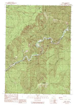
Marial Topo Map Oregon
To zoom in, hover over the map of Marial
USGS Topo Quad 42123f8 - 1:24,000 scale
| Topo Map Name: | Marial |
| USGS Topo Quad ID: | 42123f8 |
| Print Size: | ca. 21 1/4" wide x 27" high |
| Southeast Coordinates: | 42.625° N latitude / 123.875° W longitude |
| Map Center Coordinates: | 42.6875° N latitude / 123.9375° W longitude |
| U.S. State: | OR |
| Filename: | o42123f8.jpg |
| Download Map JPG Image: | Marial topo map 1:24,000 scale |
| Map Type: | Topographic |
| Topo Series: | 7.5´ |
| Map Scale: | 1:24,000 |
| Source of Map Images: | United States Geological Survey (USGS) |
| Alternate Map Versions: |
Marial OR 1989, updated 1989 Download PDF Buy paper map Marial OR 1998, updated 2001 Download PDF Buy paper map Marial OR 2011 Download PDF Buy paper map Marial OR 2014 Download PDF Buy paper map |
| FStopo: | US Forest Service topo Marial is available: Download FStopo PDF Download FStopo TIF |
1:24,000 Topo Quads surrounding Marial
> Back to 42123e1 at 1:100,000 scale
> Back to 42122a1 at 1:250,000 scale
> Back to U.S. Topo Maps home
Marial topo map: Gazetteer
Marial: Areas
Clay Hill Stillwater elevation 61m 200′Marial: Bars
Blossom Bar elevation 85m 278′Brushy Bar elevation 71m 232′
Gleason Bar elevation 85m 278′
Half Moon Bar elevation 97m 318′
Paradise Bar elevation 105m 344′
Solitude Bar elevation 75m 246′
Marial: Cliffs
Inspiration Point elevation 142m 465′Marial: Falls
Stair Creek Falls elevation 157m 515′Marial: Flats
Tucker Flat elevation 134m 439′Marial: Populated Places
Marial elevation 100m 328′Marial: Post Offices
Marial Post Office (historical) elevation 100m 328′Marial: Rapids
Blossom Bar Rapids elevation 86m 282′Brushy Bar Riffle elevation 72m 236′
China Bar Rapids elevation 102m 334′
Clay Hill Rapids elevation 59m 193′
Coffeepot elevation 96m 314′
Devils Stairs elevation 101m 331′
Half Moon Riffle elevation 77m 252′
Narrows elevation 99m 324′
Paradise Riffle elevation 80m 262′
Solitude Riffle elevation 75m 246′
Tacoma Rapids elevation 79m 259′
Tichenor Riffle elevation 71m 232′
Marial: Ridges
Clay Hill elevation 744m 2440′Devils Backbone elevation 451m 1479′
Panther Ridge elevation 1016m 3333′
Marial: Springs
Sulphur Spring elevation 238m 780′Marial: Streams
Blossom Bar Creek elevation 87m 285′Brushy Bar Creek elevation 84m 275′
Burns Creek elevation 114m 374′
Clay Hill Creek elevation 112m 367′
Dostler Creek elevation 120m 393′
East Creek elevation 72m 236′
Fall Creek elevation 82m 269′
Jackson Creek elevation 99m 324′
Marks Creek elevation 120m 393′
Panther Creek elevation 646m 2119′
Paradise Creek elevation 90m 295′
Price Creek elevation 144m 472′
Rocky Bar Creek elevation 101m 331′
Slide Creek elevation 111m 364′
Stair Creek elevation 106m 347′
Tate Creek elevation 79m 259′
West Fork Clay Hill Creek elevation 237m 777′
Marial: Summits
Bobs Garden Mountain elevation 1301m 4268′Hanging Rock elevation 1175m 3854′
Mule Mountain elevation 837m 2746′
Pinnacle Point elevation 691m 2267′
Marial: Trails
Bobs Garden Trail elevation 1041m 3415′Marial: Valleys
Huggins Canyon elevation 86m 282′Mule Creek Canyon elevation 114m 374′
Marial digital topo map on disk
Buy this Marial topo map showing relief, roads, GPS coordinates and other geographical features, as a high-resolution digital map file on DVD:


