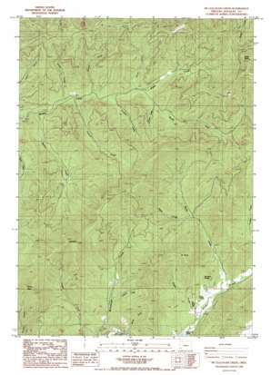
Mccullough Creek Topo Map Oregon
To zoom in, hover over the map of Mccullough Creek
USGS Topo Quad 42123g4 - 1:24,000 scale
| Topo Map Name: | Mccullough Creek |
| USGS Topo Quad ID: | 42123g4 |
| Print Size: | ca. 21 1/4" wide x 27" high |
| Southeast Coordinates: | 42.75° N latitude / 123.375° W longitude |
| Map Center Coordinates: | 42.8125° N latitude / 123.4375° W longitude |
| U.S. State: | OR |
| Filename: | o42123g4.jpg |
| Download Map JPG Image: | Mccullough Creek topo map 1:24,000 scale |
| Map Type: | Topographic |
| Topo Series: | 7.5´ |
| Map Scale: | 1:24,000 |
| Source of Map Images: | United States Geological Survey (USGS) |
| Alternate Map Versions: |
Mc Cullough Creek OR 1986, updated 1986 Download PDF Buy paper map McCullough Creek OR 2011 Download PDF Buy paper map McCullough Creek OR 2014 Download PDF Buy paper map |
1:24,000 Topo Quads surrounding Mccullough Creek
> Back to 42123e1 at 1:100,000 scale
> Back to 42122a1 at 1:250,000 scale
> Back to U.S. Topo Maps home
Mccullough Creek topo map: Gazetteer
Mccullough Creek: Capes
Fir Point elevation 942m 3090′Mccullough Creek: Parks
Cow Creek Game Refuge elevation 1050m 3444′Mccullough Creek: Springs
Bernstein Spring elevation 555m 1820′Flory Spring elevation 470m 1541′
Mccullough Creek: Streams
Brush Creek elevation 488m 1601′Deeds Creek elevation 444m 1456′
Deets Creek elevation 590m 1935′
Gravel Creek elevation 460m 1509′
Hunter Creek elevation 514m 1686′
Lawson Creek elevation 529m 1735′
Lunsbury Creek elevation 487m 1597′
Martin Creek elevation 431m 1414′
Panther Creek elevation 477m 1564′
Peavine Creek elevation 462m 1515′
Smith Creek elevation 457m 1499′
South Fork Middle Creek elevation 488m 1601′
Spring Creek elevation 423m 1387′
Wood Creek elevation 466m 1528′
Mccullough Creek: Summits
Grayback elevation 1225m 4019′Panther Butte elevation 1066m 3497′
Silver Butte elevation 1194m 3917′
Mccullough Creek: Trails
Grayback Trail elevation 793m 2601′South Fork Trail elevation 754m 2473′
Stag Trail elevation 930m 3051′
Mccullough Creek digital topo map on disk
Buy this Mccullough Creek topo map showing relief, roads, GPS coordinates and other geographical features, as a high-resolution digital map file on DVD:


