Rasler Creek Topo Map Oregon
To zoom in, hover over the map of Rasler Creek
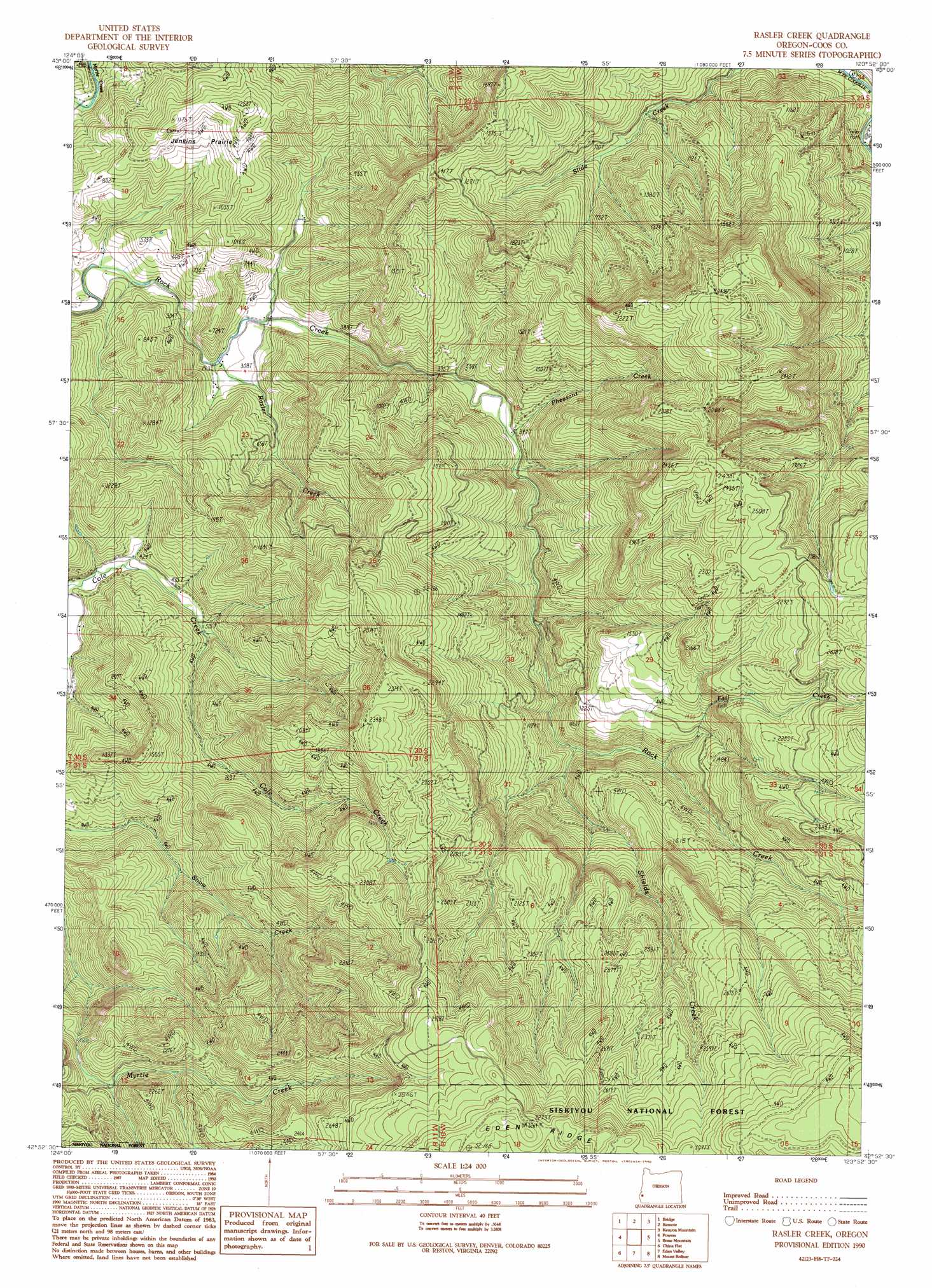
USGS Topo Quad 42123h8 - 1:24,000 scale
| Topo Map Name: | Rasler Creek |
| USGS Topo Quad ID: | 42123h8 |
| Print Size: | ca. 21 1/4" wide x 27" high |
| Southeast Coordinates: | 42.875° N latitude / 123.875° W longitude |
| Map Center Coordinates: | 42.9375° N latitude / 123.9375° W longitude |
| U.S. State: | OR |
| Filename: | o42123h8.jpg |
| Download Map JPG Image: | Rasler Creek topo map 1:24,000 scale |
| Map Type: | Topographic |
| Topo Series: | 7.5´ |
| Map Scale: | 1:24,000 |
| Source of Map Images: | United States Geological Survey (USGS) |
| Alternate Map Versions: |
Rasler Creek OR 1990, updated 1990 Download PDF Buy paper map Rasler Creek OR 1998, updated 2001 Download PDF Buy paper map Rasler Creek OR 2011 Download PDF Buy paper map Rasler Creek OR 2014 Download PDF Buy paper map |
| FStopo: | US Forest Service topo Rasler Creek is available: Download FStopo PDF Download FStopo TIF |
1:24,000 Topo Quads surrounding Rasler Creek
Coquille |
Mckinley |
Dora |
Sitkum |
Mount Gurney |
Myrtle Point |
Bridge |
Remote |
Kenyon Mountain |
Camas Valley |
Dement Creek |
Powers |
Rasler Creek |
Bone Mountain |
Chipmunk Ridge |
Barklow Mountain |
China Flat |
Eden Ridge Valley |
Mount Bolivar |
Dutchman Butte |
Ophir Mountain |
Illahe |
Marial |
Kelsey Peak |
Bunker Creek |
> Back to 42123e1 at 1:100,000 scale
> Back to 42122a1 at 1:250,000 scale
> Back to U.S. Topo Maps home
Rasler Creek topo map: Gazetteer
Rasler Creek: Areas
Jenkins Prairie elevation 272m 892′Rasler Creek: Streams
Fall Creek elevation 257m 843′Pheasant Creek elevation 117m 383′
Rasler Creek elevation 80m 262′
Shields Creek elevation 206m 675′
Rasler Creek digital topo map on disk
Buy this Rasler Creek topo map showing relief, roads, GPS coordinates and other geographical features, as a high-resolution digital map file on DVD: