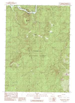
Quosatana Butte Topo Map Oregon
To zoom in, hover over the map of Quosatana Butte
USGS Topo Quad 42124d2 - 1:24,000 scale
| Topo Map Name: | Quosatana Butte |
| USGS Topo Quad ID: | 42124d2 |
| Print Size: | ca. 21 1/4" wide x 27" high |
| Southeast Coordinates: | 42.375° N latitude / 124.125° W longitude |
| Map Center Coordinates: | 42.4375° N latitude / 124.1875° W longitude |
| U.S. State: | OR |
| Filename: | o42124d2.jpg |
| Download Map JPG Image: | Quosatana Butte topo map 1:24,000 scale |
| Map Type: | Topographic |
| Topo Series: | 7.5´ |
| Map Scale: | 1:24,000 |
| Source of Map Images: | United States Geological Survey (USGS) |
| Alternate Map Versions: |
Quosatana Butte OR 1989, updated 1989 Download PDF Buy paper map Quosatana Butte OR 1998, updated 2001 Download PDF Buy paper map Quosatana Butte OR 2011 Download PDF Buy paper map Quosatana Butte OR 2014 Download PDF Buy paper map |
| FStopo: | US Forest Service topo Quosatana Butte is available: Download FStopo PDF Download FStopo TIF |
1:24,000 Topo Quads surrounding Quosatana Butte
> Back to 42124a1 at 1:100,000 scale
> Back to 42124a1 at 1:250,000 scale
> Back to U.S. Topo Maps home
Quosatana Butte topo map: Gazetteer
Quosatana Butte: Flats
Wildhorse Prairie elevation 1094m 3589′Quosatana Butte: Parks
Rogue National Wild and Scenic River elevation 87m 285′Quosatana Butte: Post Offices
Quosation Post Office (historical) elevation 97m 318′Quosatana Butte: Rapids
Bacon Flat Riffle elevation 16m 52′Big Fish Riffle elevation 369m 1210′
Coal Riffle elevation 18m 59′
Hayes Eddy elevation 16m 52′
Lowery Riffle elevation 87m 285′
Quosatana Creek Riffle elevation 94m 308′
Quosatana Butte: Streams
Bill Moore Creek elevation 22m 72′Bradford Creek elevation 27m 88′
Little Silver Creek elevation 19m 62′
Quosatana Creek elevation 14m 45′
South Fork Lawson Creek elevation 615m 2017′
Quosatana Butte: Summits
Quosatana Butte elevation 993m 3257′Saddle Mountain elevation 1294m 4245′
Skookumhouse Butte elevation 662m 2171′
Sugarloaf Mountain elevation 1077m 3533′
Quosatana Butte: Valleys
Skookumhouse Canyon elevation 137m 449′Quosatana Butte digital topo map on disk
Buy this Quosatana Butte topo map showing relief, roads, GPS coordinates and other geographical features, as a high-resolution digital map file on DVD:


