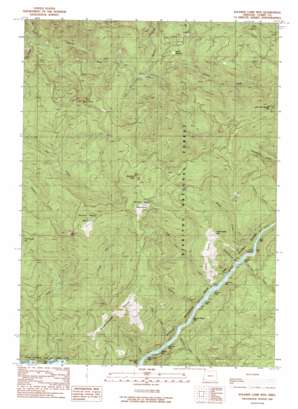
Soldier Camp Mountain Topo Map Oregon
To zoom in, hover over the map of Soldier Camp Mountain
USGS Topo Quad 42124e2 - 1:24,000 scale
| Topo Map Name: | Soldier Camp Mountain |
| USGS Topo Quad ID: | 42124e2 |
| Print Size: | ca. 21 1/4" wide x 27" high |
| Southeast Coordinates: | 42.5° N latitude / 124.125° W longitude |
| Map Center Coordinates: | 42.5625° N latitude / 124.1875° W longitude |
| U.S. State: | OR |
| Filename: | o42124e2.jpg |
| Download Map JPG Image: | Soldier Camp Mountain topo map 1:24,000 scale |
| Map Type: | Topographic |
| Topo Series: | 7.5´ |
| Map Scale: | 1:24,000 |
| Source of Map Images: | United States Geological Survey (USGS) |
| Alternate Map Versions: |
Soldier Camp Mtn OR 1989, updated 1989 Download PDF Buy paper map Soldier Camp Mountain OR 1998, updated 2001 Download PDF Buy paper map Soldier Camp Mountain OR 2011 Download PDF Buy paper map Soldier Camp Mountain OR 2014 Download PDF Buy paper map |
| FStopo: | US Forest Service topo Soldier Camp Mountain is available: Download FStopo PDF Download FStopo TIF |
1:24,000 Topo Quads surrounding Soldier Camp Mountain
> Back to 42124e1 at 1:100,000 scale
> Back to 42124a1 at 1:250,000 scale
> Back to U.S. Topo Maps home
Soldier Camp Mountain topo map: Gazetteer
Soldier Camp Mountain: Bends
Bacon Flat elevation 18m 59′Soldier Camp Mountain: Flats
Skookumhouse Paririe elevation 637m 2089′Steffin Meadow elevation 435m 1427′
Soldier Camp Mountain: Pillars
Sawtooth Rock elevation 1022m 3353′Soldier Camp Mountain: Rapids
Auberry Riffle elevation 20m 65′Bear Riffle elevation 22m 72′
Combs Riffle elevation 20m 65′
Nail Keg Riffle elevation 20m 65′
New Riffle elevation 20m 65′
Rachels Delight Riffle elevation 20m 65′
Sherman Riffle elevation 23m 75′
Shindler Riffle elevation 20m 65′
Silver Creek Riffle elevation 27m 88′
Slide Creek Riffle elevation 32m 104′
Tom East Riffle elevation 22m 72′
Upper Coal Riffle elevation 33m 108′
Soldier Camp Mountain: Ridges
Adams Prairie elevation 527m 1729′Soldier Camp Mountain: Streams
Auberry Creek elevation 20m 65′Boulder Creek elevation 239m 784′
Bridge Creek elevation 21m 68′
Dog Creek elevation 20m 65′
Iron Creek elevation 224m 734′
JoAnn Creek elevation 61m 200′
Nail Keg Creek elevation 34m 111′
North Fork Lobster Creek elevation 130m 426′
Schoolhouse Creek elevation 21m 68′
Silver Creek elevation 21m 68′
Slide Creek elevation 23m 75′
South Fork Lobster Creek elevation 132m 433′
Tom East Creek elevation 20m 65′
Wake Up Rilea Creek elevation 26m 85′
Soldier Camp Mountain: Summits
Fall Mountain elevation 659m 2162′Lake of the Woods Mountain elevation 1001m 3284′
Potato Illahe Mountain elevation 551m 1807′
Second Prairie Mountain elevation 840m 2755′
Soldier Camp Mountain elevation 990m 3248′
Soldier Camp Mountain: Trails
Lower River Trail elevation 43m 141′Soldier Camp Mountain: Valleys
Bear Canyon elevation 20m 65′Little Canyon elevation 20m 65′
Soldier Camp Mountain digital topo map on disk
Buy this Soldier Camp Mountain topo map showing relief, roads, GPS coordinates and other geographical features, as a high-resolution digital map file on DVD:


