Dement Creek Topo Map Oregon
To zoom in, hover over the map of Dement Creek
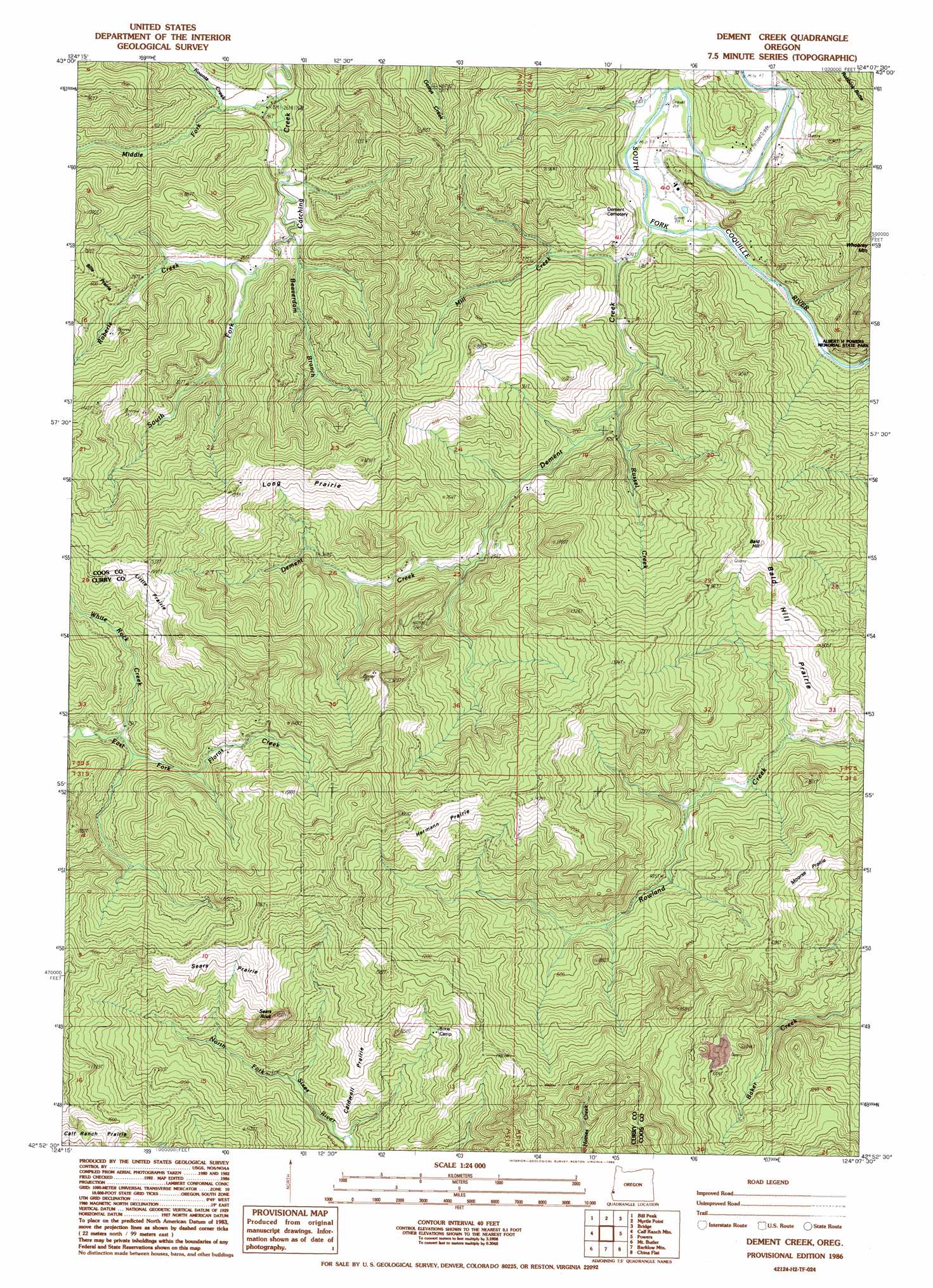
USGS Topo Quad 42124h2 - 1:24,000 scale
| Topo Map Name: | Dement Creek |
| USGS Topo Quad ID: | 42124h2 |
| Print Size: | ca. 21 1/4" wide x 27" high |
| Southeast Coordinates: | 42.875° N latitude / 124.125° W longitude |
| Map Center Coordinates: | 42.9375° N latitude / 124.1875° W longitude |
| U.S. State: | OR |
| Filename: | o42124h2.jpg |
| Download Map JPG Image: | Dement Creek topo map 1:24,000 scale |
| Map Type: | Topographic |
| Topo Series: | 7.5´ |
| Map Scale: | 1:24,000 |
| Source of Map Images: | United States Geological Survey (USGS) |
| Alternate Map Versions: |
Dement Creek OR 1986, updated 1986 Download PDF Buy paper map Dement Creek OR 1996, updated 1999 Download PDF Buy paper map Dement Creek OR 2011 Download PDF Buy paper map Dement Creek OR 2014 Download PDF Buy paper map |
| FStopo: | US Forest Service topo Dement Creek is available: Download FStopo PDF Download FStopo TIF |
1:24,000 Topo Quads surrounding Dement Creek
Bullards |
Riverton |
Coquille |
Mckinley |
Dora |
Bandon |
Bill Peak |
Myrtle Point |
Bridge |
Remote |
Langlois |
Calf Ranch Mountain |
Dement Creek |
Powers |
Rasler Creek |
Sixes |
Mount Butler |
Barklow Mountain |
China Flat |
Eden Ridge Valley |
Port Orford |
Father Mountain |
Ophir Mountain |
Illahe |
Marial |
> Back to 42124e1 at 1:100,000 scale
> Back to 42124a1 at 1:250,000 scale
> Back to U.S. Topo Maps home
Dement Creek topo map: Gazetteer
Dement Creek: Areas
Bills Prairie elevation 221m 725′Dement Creek: Parks
Albert H Powers Memorial State Park elevation 57m 187′Dement Creek: Post Offices
Custer Post Office (historical) elevation 233m 764′Roland Post Office (historical) elevation 77m 252′
Dement Creek: Streams
Beaverdam Branch elevation 62m 203′Dement Creek elevation 26m 85′
Koontz Creek elevation 57m 187′
Middle Fork Catching Creek elevation 50m 164′
Mill Creek elevation 24m 78′
Roberts Creek elevation 70m 229′
Russel Creek elevation 24m 78′
South Fork Catching Creek elevation 64m 209′
White Rock Creek elevation 230m 754′
Dement Creek digital topo map on disk
Buy this Dement Creek topo map showing relief, roads, GPS coordinates and other geographical features, as a high-resolution digital map file on DVD: