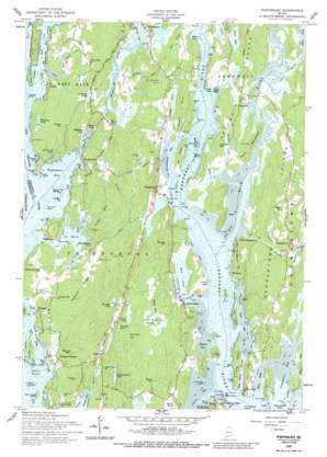
Phippsburg Topo Map Maine
To zoom in, hover over the map of Phippsburg
USGS Topo Quad 43069g7 - 1:24,000 scale
| Topo Map Name: | Phippsburg |
| USGS Topo Quad ID: | 43069g7 |
| Print Size: | ca. 21 1/4" wide x 27" high |
| Southeast Coordinates: | 43.75° N latitude / 69.75° W longitude |
| Map Center Coordinates: | 43.8125° N latitude / 69.8125° W longitude |
| U.S. State: | ME |
| Filename: | o43069g7.jpg |
| Download Map JPG Image: | Phippsburg topo map 1:24,000 scale |
| Map Type: | Topographic |
| Topo Series: | 7.5´ |
| Map Scale: | 1:24,000 |
| Source of Map Images: | United States Geological Survey (USGS) |
| Alternate Map Versions: |
Phippsburg ME 1957, updated 1959 Download PDF Buy paper map Phippsburg ME 1957, updated 1988 Download PDF Buy paper map Phippsburg ME 2000, updated 2001 Download PDF Buy paper map Phippsburg ME 2011 Download PDF Buy paper map Phippsburg ME 2014 Download PDF Buy paper map |
1:24,000 Topo Quads surrounding Phippsburg
> Back to 43069e1 at 1:100,000 scale
> Back to 43068a1 at 1:250,000 scale
> Back to U.S. Topo Maps home
Phippsburg topo map: Gazetteer
Phippsburg: Bars
Bragdon Rock elevation 0m 0′Dry Ledges elevation 0m 0′
Hen Island Ledge elevation 0m 0′
Jack Rock elevation 0m 0′
Lithgow Rock elevation 0m 0′
Parker Flats elevation 0m 0′
Perkins Island Ledge elevation 0m 0′
Seal Rocks elevation 0m 0′
Phippsburg: Bays
Atkins Bay elevation 0m 0′Back Cove elevation 0m 0′
Brighams Cove elevation 5m 16′
Dam Cove elevation 0m 0′
Drummore Bay elevation 0m 0′
Fisher Eddy elevation 0m 0′
Heal Eddy elevation 0m 0′
Merry Cove elevation 0m 0′
Mill Cove elevation 0m 0′
Morse Cove elevation 0m 0′
Sagadahoc Bay elevation 0m 0′
Sebasco Harbor elevation 0m 0′
The Basin elevation 0m 0′
Todd Bay elevation 0m 0′
Tottman Cove elevation 0m 0′
Winnegance Bay elevation 0m 0′
Wyman Bay elevation 0m 0′
Phippsburg: Bridges
Arrowsic-Georgetown Bridge elevation 3m 9′Phippsburg: Capes
Bald Head elevation 13m 42′Basin Point elevation 2m 6′
Birch Point elevation 4m 13′
Bluff Head elevation 4m 13′
Denny Reed Point elevation 6m 19′
Elwell Point elevation 2m 6′
Gilbert Head elevation 20m 65′
Green Point elevation 1m 3′
Green Point elevation 5m 16′
Harbor Island Point elevation 0m 0′
Hatch Point elevation 0m 0′
Hunnewell Point elevation 2m 6′
Indian Point elevation 6m 19′
Indian Point elevation 0m 0′
Kennebec Point elevation 7m 22′
Little Cox Head elevation 1m 3′
Sabino Head elevation 3m 9′
Squirrel Point elevation 4m 13′
Weasel Point elevation 0m 0′
Phippsburg: Channels
Long Island Narrows elevation 9m 29′Striped Bass Passage elevation 0m 0′
Phippsburg: Dams
Houghton Pond Dam elevation 28m 91′Wah-Tuh Lake Dam elevation 1m 3′
Phippsburg: Islands
Basin Island elevation 14m 45′Burnt Coat Island elevation 12m 39′
Bushy Island elevation 0m 0′
Crow Islands elevation 0m 0′
Dix Island elevation 6m 19′
Georgetown Island elevation 41m 134′
Goat Island elevation 0m 0′
Harbor Island elevation 8m 26′
Hen Island elevation 1m 3′
Jennys Nubble elevation 4m 13′
Lamb Island elevation 1m 3′
Lee Island elevation 21m 68′
Long Island elevation 11m 36′
Marr Island elevation 14m 45′
Merritt Island elevation 9m 29′
North Sugarloaf Island elevation 6m 19′
Perkins Island elevation 13m 42′
Pettis Rocks elevation 0m 0′
Ram Island elevation 0m 0′
Seal Island elevation 0m 0′
Phippsburg: Lakes
Birchwood Pond elevation 29m 95′Blaisdell Pond elevation 35m 114′
Campbell Pond elevation 16m 52′
Duley Pond elevation 39m 127′
Meetinghouse Pond elevation 23m 75′
Mill Pond elevation 2m 6′
Old Mill Pond elevation 1m 3′
Sewell Pond elevation 5m 16′
Sprague Pond elevation 20m 65′
Phippsburg: Mines
Old Mica Mine elevation 60m 196′Phippsburg: Parks
Fort Baldwin Memorial Park elevation 21m 68′Fort Popham State Historic Site elevation 1m 3′
Phippsburg: Populated Places
Arrowsic elevation 13m 42′Ashdale elevation 12m 39′
Bay Point elevation 24m 78′
Brighams Cove elevation 8m 26′
Brightwater elevation 21m 68′
Fort Popham elevation 1m 3′
Marrtown elevation 8m 26′
Meadowbrook elevation 6m 19′
Parker Head elevation 11m 36′
Perry Cove elevation 12m 39′
Phippsburg elevation 15m 49′
Popham Beach elevation 1m 3′
Sabino elevation 21m 68′
Sebasco elevation 17m 55′
Sebasco Estates elevation 8m 26′
West Georgetown elevation 11m 36′
Winnegance elevation 13m 42′
Wynburg (historical) elevation 9m 29′
Phippsburg: Reservoirs
Houghton Pond elevation 28m 91′Old Mill Pond elevation 18m 59′
Wah-Tuh Lake elevation 1m 3′
Phippsburg: Ridges
Pasture Ridge elevation 55m 180′The Reach elevation 24m 78′
Phippsburg: Streams
Back River elevation 0m 0′Bay Creek elevation 4m 13′
Cutting Creek elevation 1m 3′
Dam Cove Creek elevation 9m 29′
Minot Creek elevation 0m 0′
Newtown Creek elevation 0m 0′
North Creek elevation 0m 0′
Parker Head Creek elevation 1m 3′
Pasture Brook elevation 0m 0′
Phippsburg: Summits
Batchelder Hill elevation 37m 121′Bowie Hill elevation 38m 124′
Bridge Hill elevation 47m 154′
Cox Head elevation 41m 134′
Cushman Hill elevation 59m 193′
Elbow Hill elevation 55m 180′
Fuller Mountain elevation 81m 265′
Hall Hill elevation 22m 72′
Higgins Mountain elevation 79m 259′
Meetinghouse Hill elevation 50m 164′
Merritt Mountain elevation 67m 219′
Newtown Hill elevation 35m 114′
Parker Head elevation 49m 160′
Perry Hill elevation 44m 144′
Pitchpine Hill elevation 56m 183′
Rich Hill elevation 50m 164′
Rogers Neck elevation 48m 157′
Sam Day Hill elevation 43m 141′
Sewell Hill elevation 38m 124′
Tarrs Mountain elevation 51m 167′
West Georgetown Hill elevation 64m 209′
West Side Hill elevation 50m 164′
Phippsburg: Swamps
Parker Head Swamp elevation 17m 55′Swett Marsh elevation 2m 6′
Traffton Meadow elevation 16m 52′
Phippsburg digital topo map on disk
Buy this Phippsburg topo map showing relief, roads, GPS coordinates and other geographical features, as a high-resolution digital map file on DVD:
Maine, New Hampshire, Rhode Island & Eastern Massachusetts
Buy digital topo maps: Maine, New Hampshire, Rhode Island & Eastern Massachusetts


