Biddeford Pool Topo Map Maine
To zoom in, hover over the map of Biddeford Pool
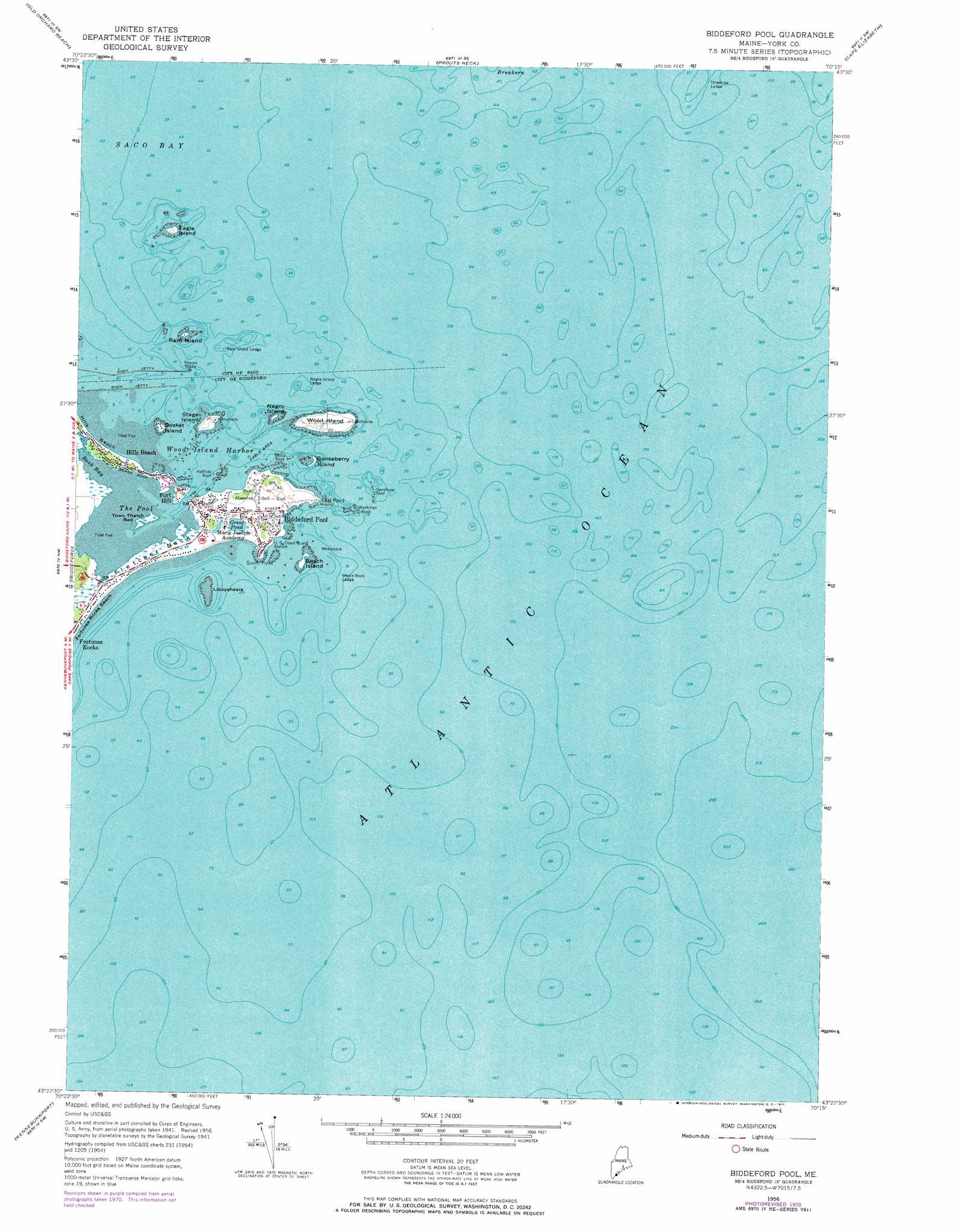
USGS Topo Quad 43070d3 - 1:24,000 scale
| Topo Map Name: | Biddeford Pool |
| USGS Topo Quad ID: | 43070d3 |
| Print Size: | ca. 21 1/4" wide x 27" high |
| Southeast Coordinates: | 43.375° N latitude / 70.25° W longitude |
| Map Center Coordinates: | 43.4375° N latitude / 70.3125° W longitude |
| U.S. State: | ME |
| Filename: | o43070d3.jpg |
| Download Map JPG Image: | Biddeford Pool topo map 1:24,000 scale |
| Map Type: | Topographic |
| Topo Series: | 7.5´ |
| Map Scale: | 1:24,000 |
| Source of Map Images: | United States Geological Survey (USGS) |
| Alternate Map Versions: |
Biddeford Pool ME 1956, updated 1958 Download PDF Buy paper map Biddeford Pool ME 1956, updated 1967 Download PDF Buy paper map Biddeford Pool ME 1956, updated 1971 Download PDF Buy paper map Biddeford Pool ME 1975, updated 1979 Download PDF Buy paper map Biddeford Pool ME 2011 Download PDF Buy paper map Biddeford Pool ME 2014 Download PDF Buy paper map |
1:24,000 Topo Quads surrounding Biddeford Pool
Standish |
Gorham |
Portland West |
Portland East |
South Harpswell |
Bar Mills |
Old Orchard Beach |
Prouts Neck |
Cape Elizabeth |
|
Kennebunk |
Biddeford |
Biddeford Pool |
||
Wells |
Kennebunkport |
|||
York Beach |
> Back to 43070a1 at 1:100,000 scale
> Back to 43070a1 at 1:250,000 scale
> Back to U.S. Topo Maps home
Biddeford Pool topo map: Gazetteer
Biddeford Pool: Bars
Dansbury Reef elevation 0m 0′East Point elevation 7m 22′
Halftide Rock elevation 0m 0′
Libbyshears elevation 0m 0′
Negro Island Ledge elevation 0m 0′
Philip Rock elevation 0m 0′
Ram Island Ledge elevation 0m 0′
Sharps Rocks elevation 0m 0′
Threetree Ledge elevation 0m 0′
Washman Rock elevation 0m 0′
Whale Rock Ledge elevation 0m 0′
Whaleback elevation 0m 0′
Biddeford Pool: Bays
Back Bay elevation 0m 0′Saco Bay elevation 0m 0′
The Pool elevation 0m 0′
Wood Island Harbor elevation 0m 0′
Biddeford Pool: Beaches
Fortunes Rocks Beach elevation 0m 0′Hills Beach elevation 0m 0′
Biddeford Pool: Capes
Fletcher Neck elevation 2m 6′South Point elevation 0m 0′
Biddeford Pool: Islands
Basket Island elevation 7m 22′Beach Island elevation 0m 0′
Eagle Island elevation 5m 16′
Gooseberry Island elevation 0m 0′
Negro Island elevation 0m 0′
Ram Island elevation 0m 0′
Stage Island elevation 7m 22′
Wood Island elevation 6m 19′
Biddeford Pool: Lakes
Great Pond elevation 3m 9′Biddeford Pool: Parks
East Point Sanctuary elevation 10m 32′Biddeford Pool: Populated Places
Biddeford Pool elevation 5m 16′Biddeford Pool: Streams
Saco River elevation 0m 0′Biddeford Pool: Summits
Fort Hill elevation 7m 22′Biddeford Pool: Swamps
Town Thatch Bed elevation 0m 0′Biddeford Pool digital topo map on disk
Buy this Biddeford Pool topo map showing relief, roads, GPS coordinates and other geographical features, as a high-resolution digital map file on DVD:
Maine, New Hampshire, Rhode Island & Eastern Massachusetts
Buy digital topo maps: Maine, New Hampshire, Rhode Island & Eastern Massachusetts