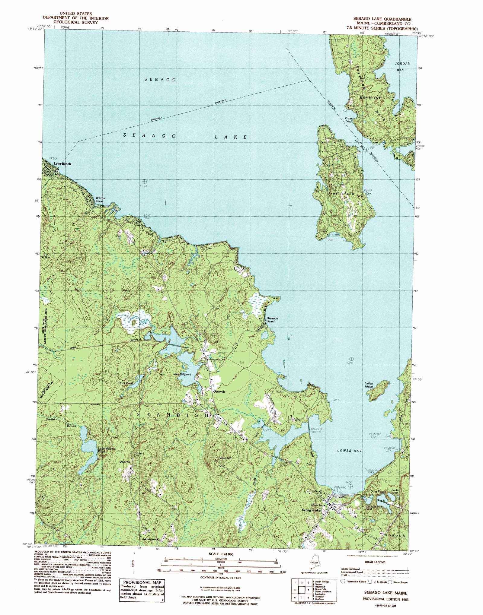
Sebago Lake Topo Map Maine
To zoom in, hover over the map of Sebago Lake
USGS Topo Quad 43070g5 - 1:24,000 scale
| Topo Map Name: | Sebago Lake |
| USGS Topo Quad ID: | 43070g5 |
| Print Size: | ca. 21 1/4" wide x 27" high |
| Southeast Coordinates: | 43.75° N latitude / 70.5° W longitude |
| Map Center Coordinates: | 43.8125° N latitude / 70.5625° W longitude |
| U.S. State: | ME |
| Filename: | o43070g5.jpg |
| Download Map JPG Image: | Sebago Lake topo map 1:24,000 scale |
| Map Type: | Topographic |
| Topo Series: | 7.5´ |
| Map Scale: | 1:24,000 |
| Source of Map Images: | United States Geological Survey (USGS) |
| Alternate Map Versions: |
Sebago Lake ME 1983, updated 1984 Download PDF Buy paper map Sebago Lake ME 1983, updated 1984 Download PDF Buy paper map Sebago Lake ME 2011 Download PDF Buy paper map Sebago Lake ME 2014 Download PDF Buy paper map |
1:24,000 Topo Quads surrounding Sebago Lake
Pleasant Mountain |
Bridgton |
Casco |
Mechanic Falls |
Minot |
Hiram |
North Sebago |
Naples |
Raymond |
Gray |
Cornish |
Steep Falls |
Sebago Lake |
North Windham |
Cumberland Center |
Limerick |
Limington |
Standish |
Gorham |
Portland West |
Mousam Lake |
Waterboro |
Bar Mills |
Old Orchard Beach |
Prouts Neck |
> Back to 43070e1 at 1:100,000 scale
> Back to 43070a1 at 1:250,000 scale
> Back to U.S. Topo Maps home
Sebago Lake topo map: Gazetteer
Sebago Lake: Bays
Lower Bay elevation 81m 265′Sebago Lake: Capes
Raymond Neck elevation 90m 295′Sebago Lake: Channels
The Notch elevation 81m 265′Sebago Lake: Cliffs
Fryes Leap elevation 93m 305′Sebago Lake: Dams
Rich Mill Pond Dam elevation 87m 285′Sebago Lake: Islands
Frye Island elevation 114m 374′Indian Island elevation 97m 318′
Sebago Lake: Lakes
Duck Pond elevation 100m 328′Little Watchic Pond elevation 93m 305′
Otter Ponds elevation 75m 246′
Snake Pond elevation 79m 259′
Sebago Lake: Parks
Steep Falls Wildlife Management Area elevation 95m 311′Sebago Lake: Populated Places
Frye Island elevation 82m 269′Harmon Beach elevation 83m 272′
Long Beach elevation 82m 269′
Richville elevation 88m 288′
Sebago Lake elevation 88m 288′
Wards Cove elevation 84m 275′
Sebago Lake: Reservoirs
Half Moon Pond elevation 75m 246′Rich Millpond elevation 87m 285′
Sebago Lake: Streams
Sticky River elevation 82m 269′Sebago Lake: Summits
Oak Hill elevation 176m 577′Rich Hill elevation 156m 511′
Sebago Lake digital topo map on disk
Buy this Sebago Lake topo map showing relief, roads, GPS coordinates and other geographical features, as a high-resolution digital map file on DVD:
Maine, New Hampshire, Rhode Island & Eastern Massachusetts
Buy digital topo maps: Maine, New Hampshire, Rhode Island & Eastern Massachusetts