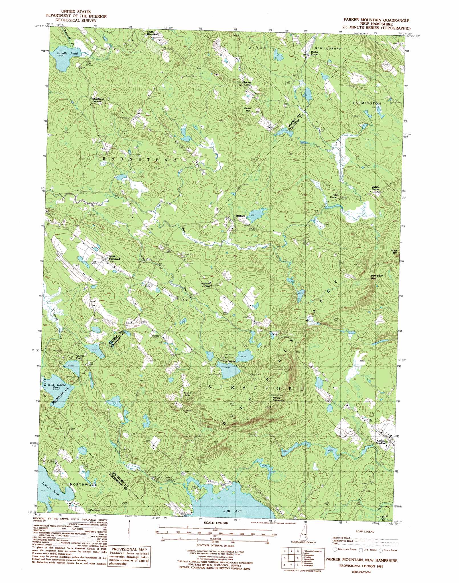
Parker Mountain Topo Map New Hampshire
To zoom in, hover over the map of Parker Mountain
USGS Topo Quad 43071c2 - 1:24,000 scale
| Topo Map Name: | Parker Mountain |
| USGS Topo Quad ID: | 43071c2 |
| Print Size: | ca. 21 1/4" wide x 27" high |
| Southeast Coordinates: | 43.25° N latitude / 71.125° W longitude |
| Map Center Coordinates: | 43.3125° N latitude / 71.1875° W longitude |
| U.S. State: | NH |
| Filename: | o43071c2.jpg |
| Download Map JPG Image: | Parker Mountain topo map 1:24,000 scale |
| Map Type: | Topographic |
| Topo Series: | 7.5´ |
| Map Scale: | 1:24,000 |
| Source of Map Images: | United States Geological Survey (USGS) |
| Alternate Map Versions: |
Parker Mountain NH 1987, updated 1987 Download PDF Buy paper map Parker Mountain NH 1987, updated 1987 Download PDF Buy paper map Parker Mountain NH 2012 Download PDF Buy paper map Parker Mountain NH 2015 Download PDF Buy paper map |
1:24,000 Topo Quads surrounding Parker Mountain
Laconia |
West Alton |
Wolfeboro |
Sanbornville |
Great East Lake |
Belmont |
Gilmanton Ironworks |
Alton |
Farmington |
Milton |
Loudon |
Pittsfield |
Parker Mountain |
Baxter Lake |
Rochester |
Suncook |
Gossville |
Northwood |
Barrington |
Dover West |
Manchester North |
Candia |
Mount Pawtuckaway |
Epping |
Newmarket |
> Back to 43071a1 at 1:100,000 scale
> Back to 43070a1 at 1:250,000 scale
> Back to U.S. Topo Maps home
Parker Mountain topo map: Gazetteer
Parker Mountain: Gaps
Barn Door Gap elevation 290m 951′Parker Mountain: Lakes
Adams Pond elevation 204m 669′Brindle Pond elevation 187m 613′
Wild Goose Pond elevation 192m 629′
Willey Ponds elevation 248m 813′
Parker Mountain: Populated Places
Center Strafford elevation 181m 593′Dexter Corner elevation 281m 921′
Hills Corner elevation 239m 784′
Leighton Corners elevation 219m 718′
Lockes Corner elevation 332m 1089′
South Barnstead elevation 227m 744′
Strafford elevation 193m 633′
Welshs Corner elevation 274m 898′
Parker Mountain: Streams
Little River elevation 154m 505′Shinglemill Brook elevation 192m 629′
Parker Mountain: Summits
Blue Hills Range elevation 342m 1122′Drews Hill elevation 331m 1085′
Evans Mountain elevation 370m 1213′
Parker Mountain elevation 401m 1315′
Sanders Ledge elevation 341m 1118′
Parker Mountain digital topo map on disk
Buy this Parker Mountain topo map showing relief, roads, GPS coordinates and other geographical features, as a high-resolution digital map file on DVD:
Maine, New Hampshire, Rhode Island & Eastern Massachusetts
Buy digital topo maps: Maine, New Hampshire, Rhode Island & Eastern Massachusetts