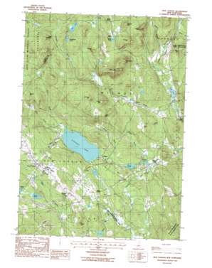
New London Topo Map New Hampshire
To zoom in, hover over the map of New London
USGS Topo Quad 43071d8 - 1:24,000 scale
| Topo Map Name: | New London |
| USGS Topo Quad ID: | 43071d8 |
| Print Size: | ca. 21 1/4" wide x 27" high |
| Southeast Coordinates: | 43.375° N latitude / 71.875° W longitude |
| Map Center Coordinates: | 43.4375° N latitude / 71.9375° W longitude |
| U.S. State: | NH |
| Filename: | o43071d8.jpg |
| Download Map JPG Image: | New London topo map 1:24,000 scale |
| Map Type: | Topographic |
| Topo Series: | 7.5´ |
| Map Scale: | 1:24,000 |
| Source of Map Images: | United States Geological Survey (USGS) |
| Alternate Map Versions: |
New London NH 1987, updated 1987 Download PDF Buy paper map New London NH 1998, updated 2001 Download PDF Buy paper map New London NH 2012 Download PDF Buy paper map New London NH 2015 Download PDF Buy paper map |
1:24,000 Topo Quads surrounding New London
> Back to 43071a1 at 1:100,000 scale
> Back to 43070a1 at 1:250,000 scale
> Back to U.S. Topo Maps home
New London topo map: Gazetteer
New London: Airports
Eagles Nest Airport elevation 299m 980′New London: Crossings
Interchange 11 elevation 347m 1138′New London: Dams
Cascade Brook Dam elevation 243m 797′Chase Pond Dam elevation 216m 708′
Pleasant Lake Dam elevation 245m 803′
Tannery Pond Dam elevation 208m 682′
New London: Lakes
Butterfield Pond elevation 413m 1354′Clark Pond elevation 339m 1112′
Eagle Pond elevation 201m 659′
Piper Pond elevation 405m 1328′
White Pond elevation 369m 1210′
New London: Populated Places
Crockett Corner elevation 350m 1148′East Springfield elevation 422m 1384′
Elkins elevation 247m 810′
New London elevation 392m 1286′
North Wilmot elevation 368m 1207′
Pages Corner elevation 279m 915′
South Danbury elevation 215m 705′
West Andover elevation 203m 666′
Wilmot elevation 263m 862′
Wilmot Flat elevation 212m 695′
New London: Post Offices
Elkins Post Office elevation 246m 807′New London Post Office elevation 390m 1279′
New London: Reservoirs
Cascade Marsh elevation 243m 797′Chase Pond elevation 216m 708′
Pleasant Lake elevation 245m 803′
Tannery Pond elevation 208m 682′
New London: Streams
Baker Brook elevation 242m 793′Beverly Brook elevation 231m 757′
Cassey Brook elevation 206m 675′
Great Brook elevation 249m 816′
Kimpton Brook elevation 201m 659′
Little Brook elevation 251m 823′
Red Brook elevation 249m 816′
Walker Brook elevation 205m 672′
White Brook elevation 249m 816′
Whitney Brook elevation 206m 675′
New London: Summits
Bannock Hill elevation 405m 1328′Bean Hill elevation 366m 1200′
Bog Mountain elevation 529m 1735′
Cross Hill elevation 325m 1066′
Eagles Nest elevation 385m 1263′
Emery Hill elevation 471m 1545′
Farnum Hill elevation 465m 1525′
Jones Hill elevation 440m 1443′
Morgan Hill elevation 539m 1768′
Old English Hill elevation 452m 1482′
Philbrick Hill elevation 494m 1620′
Rowell Hill elevation 392m 1286′
Stearns Hill elevation 479m 1571′
New London: Swamps
Chadwick Meadows Marsh elevation 290m 951′Chandler Brook Wetlands elevation 255m 836′
New London digital topo map on disk
Buy this New London topo map showing relief, roads, GPS coordinates and other geographical features, as a high-resolution digital map file on DVD:
Maine, New Hampshire, Rhode Island & Eastern Massachusetts
Buy digital topo maps: Maine, New Hampshire, Rhode Island & Eastern Massachusetts


