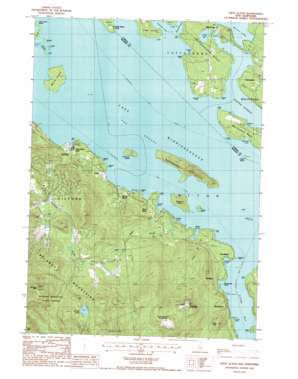
West Alton Topo Map New Hampshire
To zoom in, hover over the map of West Alton
USGS Topo Quad 43071e3 - 1:24,000 scale
| Topo Map Name: | West Alton |
| USGS Topo Quad ID: | 43071e3 |
| Print Size: | ca. 21 1/4" wide x 27" high |
| Southeast Coordinates: | 43.5° N latitude / 71.25° W longitude |
| Map Center Coordinates: | 43.5625° N latitude / 71.3125° W longitude |
| U.S. State: | NH |
| Filename: | o43071e3.jpg |
| Download Map JPG Image: | West Alton topo map 1:24,000 scale |
| Map Type: | Topographic |
| Topo Series: | 7.5´ |
| Map Scale: | 1:24,000 |
| Source of Map Images: | United States Geological Survey (USGS) |
| Alternate Map Versions: |
West Alton NH 1987, updated 1987 Download PDF Buy paper map West Alton NH 1987, updated 1987 Download PDF Buy paper map West Alton NH 2012 Download PDF Buy paper map West Alton NH 2015 Download PDF Buy paper map |
1:24,000 Topo Quads surrounding West Alton
> Back to 43071e1 at 1:100,000 scale
> Back to 43070a1 at 1:250,000 scale
> Back to U.S. Topo Maps home
West Alton topo map: Gazetteer
West Alton: Airports
Lakes Region Airport elevation 176m 577′West Alton: Bays
Alton Bay elevation 153m 501′Edmunds Cove elevation 153m 501′
Glidden Cove elevation 153m 501′
Johnson Cove elevation 153m 501′
Minge Cove elevation 153m 501′
Orchard Cove elevation 153m 501′
Smalls Cove elevation 155m 508′
The Basin elevation 156m 511′
Umbrella Point elevation 153m 501′
Wingate Cove elevation 153m 501′
Winter Harbor elevation 153m 501′
Woodmans Cove elevation 153m 501′
Youngs Cove elevation 153m 501′
West Alton: Capes
Ayers Point elevation 154m 505′Carr Point elevation 158m 518′
Coleman Point elevation 153m 501′
Echo Point elevation 160m 524′
Forty Point elevation 158m 518′
Millstone Point elevation 153m 501′
Pick Point elevation 155m 508′
Pumpkin Point elevation 155m 508′
Rum Point elevation 155m 508′
Rum Point elevation 153m 501′
Sleepers Point elevation 159m 521′
Smith Point elevation 155m 508′
Swetts Point elevation 157m 515′
Thomas Point elevation 154m 505′
Tuftonboro Neck elevation 193m 633′
Wolfeboro Neck elevation 157m 515′
West Alton: Channels
The Broads elevation 153m 501′West Alton: Islands
Breezy Island elevation 153m 501′Camp Island elevation 155m 508′
Camp Islands elevation 154m 505′
Cut Island elevation 154m 505′
Diamond Island elevation 178m 583′
Duds Island elevation 153m 501′
Echo Island elevation 153m 501′
Fish Island elevation 153m 501′
Forty Islands elevation 153m 501′
Little Birch Island elevation 154m 505′
Little Camp Island elevation 155m 508′
Littlemark Island elevation 153m 501′
Moose Island elevation 153m 501′
Parker Island elevation 154m 505′
Rattlesnake Island elevation 241m 790′
Redhead Island elevation 158m 518′
Sandy Island elevation 160m 524′
Ship Island elevation 153m 501′
Sleepers Island elevation 212m 695′
Welch Island elevation 172m 564′
West Alton: Lakes
Lake Winnipesaukee elevation 153m 501′Mirror Lake elevation 155m 508′
Round Pond elevation 503m 1650′
West Alton: Parks
Belknap Mountain State Forest elevation 589m 1932′Ellacoya State Park elevation 203m 666′
Ellacoya State Recreational Vehicle Park elevation 154m 505′
Libby Park elevation 164m 538′
Mount Major State Park elevation 538m 1765′
West Alton: Populated Places
Ames elevation 157m 515′Brookhurst elevation 161m 528′
Keewayden elevation 195m 639′
Lake Shore Park elevation 164m 538′
Mirror Lake elevation 163m 534′
Mount Major elevation 160m 524′
Samoset elevation 183m 600′
Spring Haven elevation 171m 561′
West Alton elevation 184m 603′
Woodlands elevation 160m 524′
Yale Estates elevation 337m 1105′
West Alton: Ranges
Belknap Mountains elevation 726m 2381′West Alton: Streams
Minge Brook elevation 153m 501′Poorfarm Brook elevation 155m 508′
West Alton Brook elevation 154m 505′
West Alton: Summits
Belknap Mountain elevation 726m 2381′Cedar Mountain elevation 331m 1085′
Mount Major elevation 528m 1732′
Straightback Mountain elevation 570m 1870′
West Alton: Trails
Mount Washington Boat Route elevation 153m 501′West Alton digital topo map on disk
Buy this West Alton topo map showing relief, roads, GPS coordinates and other geographical features, as a high-resolution digital map file on DVD:
Maine, New Hampshire, Rhode Island & Eastern Massachusetts
Buy digital topo maps: Maine, New Hampshire, Rhode Island & Eastern Massachusetts


