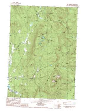
Mount Cardigan Topo Map New Hampshire
To zoom in, hover over the map of Mount Cardigan
USGS Topo Quad 43071f8 - 1:24,000 scale
| Topo Map Name: | Mount Cardigan |
| USGS Topo Quad ID: | 43071f8 |
| Print Size: | ca. 21 1/4" wide x 27" high |
| Southeast Coordinates: | 43.625° N latitude / 71.875° W longitude |
| Map Center Coordinates: | 43.6875° N latitude / 71.9375° W longitude |
| U.S. State: | NH |
| Filename: | o43071f8.jpg |
| Download Map JPG Image: | Mount Cardigan topo map 1:24,000 scale |
| Map Type: | Topographic |
| Topo Series: | 7.5´ |
| Map Scale: | 1:24,000 |
| Source of Map Images: | United States Geological Survey (USGS) |
| Alternate Map Versions: |
Mt. Cardigan NH 1987, updated 1987 Download PDF Buy paper map Mt. Cardigan NH 1998, updated 2001 Download PDF Buy paper map Mount Cardigan NH 2012 Download PDF Buy paper map Mount Cardigan NH 2015 Download PDF Buy paper map |
1:24,000 Topo Quads surrounding Mount Cardigan
> Back to 43071e1 at 1:100,000 scale
> Back to 43070a1 at 1:250,000 scale
> Back to U.S. Topo Maps home
Mount Cardigan topo map: Gazetteer
Mount Cardigan: Basins
Orange Basin elevation 398m 1305′Mount Cardigan: Forests
Province Road State Forest elevation 441m 1446′Mount Cardigan: Lakes
Bryant Pond elevation 578m 1896′Derby Pond elevation 632m 2073′
Mirror Lake elevation 289m 948′
Mount Cardigan: Parks
Mount Cardigan State Park elevation 930m 3051′Mount Cardigan: Populated Places
Bucks Corner elevation 383m 1256′Orange elevation 375m 1230′
Mount Cardigan: Ridges
Spruce Ridge elevation 605m 1984′Mount Cardigan: Streams
Atwell Brook elevation 241m 790′Bucks Brook elevation 364m 1194′
Merrill Brook elevation 359m 1177′
Number Seven Brook elevation 473m 1551′
Mount Cardigan: Summits
Hoyt Hill elevation 611m 2004′Kimball Hill elevation 634m 2080′
Kimball Hill elevation 490m 1607′
Mount Cardigan elevation 956m 3136′
Mount Tug elevation 713m 2339′
Mowglis Mountain elevation 722m 2368′
Orange Mountain elevation 782m 2565′
The Pinnacle elevation 656m 2152′
Thompson Hill elevation 709m 2326′
Tuttle Hill elevation 519m 1702′
Mount Cardigan: Trails
Clark Trail elevation 609m 1998′Holt Trail elevation 437m 1433′
Manning Trail elevation 500m 1640′
Mowglis Trail elevation 766m 2513′
West Ridge Trail elevation 762m 2500′
Mount Cardigan digital topo map on disk
Buy this Mount Cardigan topo map showing relief, roads, GPS coordinates and other geographical features, as a high-resolution digital map file on DVD:
Maine, New Hampshire, Rhode Island & Eastern Massachusetts
Buy digital topo maps: Maine, New Hampshire, Rhode Island & Eastern Massachusetts


