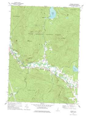
Rumney Topo Map New Hampshire
To zoom in, hover over the map of Rumney
USGS Topo Quad 43071g7 - 1:24,000 scale
| Topo Map Name: | Rumney |
| USGS Topo Quad ID: | 43071g7 |
| Print Size: | ca. 21 1/4" wide x 27" high |
| Southeast Coordinates: | 43.75° N latitude / 71.75° W longitude |
| Map Center Coordinates: | 43.8125° N latitude / 71.8125° W longitude |
| U.S. State: | NH |
| Filename: | o43071g7.jpg |
| Download Map JPG Image: | Rumney topo map 1:24,000 scale |
| Map Type: | Topographic |
| Topo Series: | 7.5´ |
| Map Scale: | 1:24,000 |
| Source of Map Images: | United States Geological Survey (USGS) |
| Alternate Map Versions: |
Rumney NH 1973, updated 1975 Download PDF Buy paper map Rumney NH 1995, updated 2000 Download PDF Buy paper map Rumney NH 2012 Download PDF Buy paper map Rumney NH 2015 Download PDF Buy paper map |
| FStopo: | US Forest Service topo Rumney is available: Download FStopo PDF Download FStopo TIF |
1:24,000 Topo Quads surrounding Rumney
> Back to 43071e1 at 1:100,000 scale
> Back to 43070a1 at 1:250,000 scale
> Back to U.S. Topo Maps home
Rumney topo map: Gazetteer
Rumney: Airports
Plymouth Municipal Airport elevation 156m 511′Rumney: Benches
Bald Ledge elevation 518m 1699′Rumney: Cliffs
Eagle Cliff elevation 581m 1906′Rumney: Dams
Stinson Lake Dam elevation 404m 1325′Rumney: Lakes
Loon Lake elevation 149m 488′Rumney: Populated Places
North Groton elevation 379m 1243′Quincy elevation 158m 518′
Rumney elevation 155m 508′
Rumney Depot elevation 159m 521′
Stinson Lake elevation 406m 1332′
West Plymouth elevation 157m 515′
West Rumney elevation 163m 534′
Rumney: Reservoirs
Stinson Lake elevation 397m 1302′Rumney: Ridges
Fletcher Mountain elevation 626m 2053′Rumney: Streams
Halls Brook elevation 153m 501′Red Brook elevation 666m 2185′
Stinson Brook elevation 150m 492′
Rumney: Summits
Rattlesnake Mountain elevation 479m 1571′Stinson Mountain elevation 878m 2880′
Upper Rattlesnake Mountain elevation 648m 2125′
Willoughby Mountain elevation 712m 2335′
Rumney: Trails
Rattlesnake Mountain Trail elevation 436m 1430′Stevens Brook Trail elevation 614m 2014′
Stinson Mountain Trail elevation 556m 1824′
Rumney: Valleys
Groton Hollow elevation 165m 541′Rumney digital topo map on disk
Buy this Rumney topo map showing relief, roads, GPS coordinates and other geographical features, as a high-resolution digital map file on DVD:
Maine, New Hampshire, Rhode Island & Eastern Massachusetts
Buy digital topo maps: Maine, New Hampshire, Rhode Island & Eastern Massachusetts


