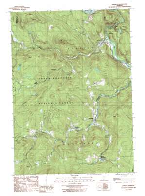
Jamaica Topo Map Vermont
To zoom in, hover over the map of Jamaica
USGS Topo Quad 43072a7 - 1:24,000 scale
| Topo Map Name: | Jamaica |
| USGS Topo Quad ID: | 43072a7 |
| Print Size: | ca. 21 1/4" wide x 27" high |
| Southeast Coordinates: | 43° N latitude / 72.75° W longitude |
| Map Center Coordinates: | 43.0625° N latitude / 72.8125° W longitude |
| U.S. State: | VT |
| Filename: | o43072a7.jpg |
| Download Map JPG Image: | Jamaica topo map 1:24,000 scale |
| Map Type: | Topographic |
| Topo Series: | 7.5´ |
| Map Scale: | 1:24,000 |
| Source of Map Images: | United States Geological Survey (USGS) |
| Alternate Map Versions: |
Jamaica VT 1986, updated 1987 Download PDF Buy paper map Jamaica VT 1997, updated 2000 Download PDF Buy paper map Jamaica VT 2012 Download PDF Buy paper map Jamaica VT 2015 Download PDF Buy paper map |
| FStopo: | US Forest Service topo Jamaica is available: Download FStopo PDF Download FStopo TIF |
1:24,000 Topo Quads surrounding Jamaica
> Back to 43072a1 at 1:100,000 scale
> Back to 43072a1 at 1:250,000 scale
> Back to U.S. Topo Maps home
Jamaica topo map: Gazetteer
Jamaica: Bends
Salmon Hole elevation 329m 1079′Jamaica: Dams
Ball Mountain Dam elevation 209m 685′Jamaica: Forests
Winhall Town Forest elevation 659m 2162′Jamaica: Lakes
Adam Pond elevation 272m 892′Forester Pond elevation 532m 1745′
Jamaica: Parks
Jamaica State Park elevation 223m 731′Jamaica: Populated Places
Jamaica elevation 218m 715′Pikes Falls elevation 454m 1489′
Podunk elevation 577m 1893′
South Wardsboro elevation 481m 1578′
Wardsboro elevation 321m 1053′
Wardsboro Center elevation 353m 1158′
West Jamaica elevation 467m 1532′
West Wardsboro elevation 440m 1443′
Jamaica: Reservoirs
Ball Mountain Lake elevation 209m 685′Jamaica: Streams
Ball Mountain Brook elevation 200m 656′Cobb Brook elevation 240m 787′
Dover Brook elevation 436m 1430′
Kidder Brook elevation 462m 1515′
North Branch Ball Mountain Brook elevation 315m 1033′
Waite Brook elevation 381m 1250′
Jamaica: Summits
Ball Mountain elevation 534m 1751′College Hill elevation 633m 2076′
Little Ball Mountain elevation 280m 918′
Mundal Hill elevation 646m 2119′
Sage Hill elevation 641m 2103′
Stacey Mountain elevation 584m 1916′
The Pinnacle elevation 771m 2529′
Jamaica: Trails
Overlook Trail elevation 237m 777′Railroad Bed Trail elevation 226m 741′
Jamaica digital topo map on disk
Buy this Jamaica topo map showing relief, roads, GPS coordinates and other geographical features, as a high-resolution digital map file on DVD:
New York, Vermont, Connecticut & Western Massachusetts
Buy digital topo maps: New York, Vermont, Connecticut & Western Massachusetts


