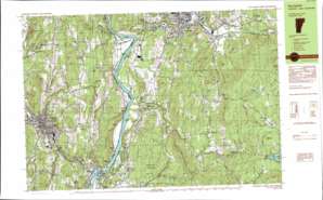
Claremont South Topo Map New Hampshire
To zoom in, hover over the map of Claremont South
USGS Topo Quad 43072c3 - 1:25,000 scale
| Topo Map Name: | Claremont South |
| USGS Topo Quad ID: | 43072c3 |
| Print Size: | ca. 39" wide x 24" high |
| Southeast Coordinates: | 43.25° N latitude / 72.25° W longitude |
| Map Center Coordinates: | 43.3125° N latitude / 72.375° W longitude |
| U.S. State: | NH |
| Filename: | k43072c3.jpg |
| Download Map JPG Image: | Claremont South topo map 1:25,000 scale |
| Map Type: | Topographic |
| Topo Series: | 7.5´x15´ |
| Map Scale: | 1:25,000 |
| Source of Map Images: | United States Geological Survey (USGS) |
| Alternate Map Versions: |
Springfield NH 1984, updated 1984 Download PDF Buy paper map |
1:24,000 Topo Quads surrounding Claremont South
> Back to 43072a1 at 1:100,000 scale
> Back to 43072a1 at 1:250,000 scale
> Back to U.S. Topo Maps home
Claremont South topo map: Gazetteer
Claremont South: Airports
Claremont Airport elevation 164m 538′Claremont South: Bridges
Baltimore Covered Bridge elevation 136m 446′Bridge Street Bridge elevation 100m 328′
Cheshire Toll Bridge elevation 85m 278′
Cheshire Toll Bridge elevation 85m 278′
Park Street Bridge elevation 123m 403′
Riverside Bridge elevation 136m 446′
Wrights Bridge elevation 184m 603′
Claremont South: Crossings
Interchange 7 elevation 108m 354′Claremont South: Dams
Claremont Paper Company Dam elevation 142m 465′Fellows Dam elevation 165m 541′
Hall Pond Dam elevation 314m 1030′
Marshall Pond Dam elevation 494m 1620′
Springfield Reservoir Dam elevation 207m 679′
Claremont South: Falls
Black River Falls elevation 125m 410′Claremont South: Forests
Hubbard Hill State Forest elevation 241m 790′Springfield Town Forest elevation 336m 1102′
Springfield Town Forest elevation 287m 941′
Claremont South: Islands
Glidden Island elevation 86m 282′Hubbard Island elevation 98m 321′
Jarvis Island elevation 93m 305′
Walcott Island elevation 87m 285′
Claremont South: Lakes
Bloodsucker Pond elevation 285m 935′Crescent Lake elevation 369m 1210′
Claremont South: Parks
Broad Street Park elevation 170m 557′Central Business District Historic District elevation 169m 554′
Freedom Park elevation 146m 479′
Lower Village District elevation 162m 531′
Monadnock Park elevation 162m 531′
Moody Park elevation 172m 564′
Riverside Park elevation 208m 682′
Skitchewaug State Wildlife Management Area elevation 240m 787′
Spaulding Wildlife Management Area elevation 319m 1046′
Springfield Downtown Historic District elevation 129m 423′
State Fish and Wildlife Management Area elevation 85m 278′
State Fish and Wildlife Management Area elevation 85m 278′
The Commons Park elevation 164m 538′
Tremont Square elevation 148m 485′
Claremont South: Populated Places
Claremont Junction elevation 142m 465′Crescent Lake elevation 381m 1250′
Goulds Mill elevation 89m 291′
Hardscrabble Corner elevation 191m 626′
North Charlestown elevation 112m 367′
Puckershire elevation 183m 600′
Quaker City elevation 214m 702′
Springfield elevation 122m 400′
Springfield Junction elevation 114m 374′
Unity elevation 445m 1459′
Weathersfield Bow elevation 114m 374′
West Unity elevation 263m 862′
Claremont South: Post Offices
Claremont Post Office elevation 172m 564′Springfield Post Office elevation 117m 383′
Claremont South: Reservoirs
Hall Pond elevation 314m 1030′Marshall Pond elevation 494m 1620′
Springfield Reservoir elevation 207m 679′
Sugar River Reservoir elevation 142m 465′
Tyler Reservoir elevation 303m 994′
Claremont South: Streams
Barkmill Brook elevation 88m 288′Beaver Brook elevation 86m 282′
Beaver Brook elevation 203m 666′
Black River elevation 93m 305′
Blood Brook elevation 88m 288′
Chase Brook elevation 212m 695′
Copeland Brook elevation 301m 987′
Gully Brook elevation 87m 285′
Hackett Brook elevation 288m 944′
Hubbard Brook elevation 132m 433′
Little Sugar River elevation 86m 282′
Meadow Brook elevation 381m 1250′
Meadow Brook elevation 89m 291′
North Branch Black River elevation 147m 482′
Ox Brook elevation 86m 282′
Pierce Brook elevation 255m 836′
Quabbinnight Brook elevation 162m 531′
Sawyer Brook elevation 200m 656′
Seavers Brook elevation 102m 334′
Sleeper Brook elevation 371m 1217′
Smith Brook elevation 132m 433′
Spencer Brook elevation 89m 291′
Spring Farm Brook elevation 168m 551′
Swett Brook elevation 205m 672′
Claremont South: Summits
Alden Hill elevation 307m 1007′Bible Hill elevation 422m 1384′
Breed Hill elevation 490m 1607′
Butterfield Hill elevation 322m 1056′
Calavant Hill elevation 234m 767′
Camp Hill elevation 471m 1545′
Chestnut Hill elevation 229m 751′
Downer Hill elevation 378m 1240′
Fifield Hill elevation 363m 1190′
Flatrock Hill elevation 301m 987′
Gove Hill elevation 589m 1932′
Hedgehog Hill elevation 446m 1463′
Hubbard Hill elevation 314m 1030′
Oak Hill elevation 180m 590′
Perry Hill elevation 241m 790′
Perry Mountain elevation 429m 1407′
Pike Hill elevation 308m 1010′
Pond Hill elevation 344m 1128′
Pudding Hill elevation 393m 1289′
Pudding Hill elevation 364m 1194′
Quimby Hill elevation 421m 1381′
Randall Hill elevation 301m 987′
Rattlesnake Hill elevation 310m 1017′
Rattlesnake Hill elevation 185m 606′
Skitchewaug Mountain elevation 265m 869′
Straw Hill elevation 403m 1322′
Unity Mountain elevation 569m 1866′
Claremont South digital topo map on disk
Buy this Claremont South topo map showing relief, roads, GPS coordinates and other geographical features, as a high-resolution digital map file on DVD:
New York, Vermont, Connecticut & Western Massachusetts
Buy digital topo maps: New York, Vermont, Connecticut & Western Massachusetts


