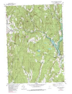
South Strafford Topo Map Vermont
To zoom in, hover over the map of South Strafford
USGS Topo Quad 43072g3 - 1:24,000 scale
| Topo Map Name: | South Strafford |
| USGS Topo Quad ID: | 43072g3 |
| Print Size: | ca. 21 1/4" wide x 27" high |
| Southeast Coordinates: | 43.75° N latitude / 72.25° W longitude |
| Map Center Coordinates: | 43.8125° N latitude / 72.3125° W longitude |
| U.S. State: | VT |
| Filename: | o43072g3.jpg |
| Download Map JPG Image: | South Strafford topo map 1:24,000 scale |
| Map Type: | Topographic |
| Topo Series: | 7.5´ |
| Map Scale: | 1:24,000 |
| Source of Map Images: | United States Geological Survey (USGS) |
| Alternate Map Versions: |
South Strafford VT 1981, updated 1981 Download PDF Buy paper map South Strafford VT 1981, updated 1989 Download PDF Buy paper map South Strafford VT 2012 Download PDF Buy paper map South Strafford VT 2015 Download PDF Buy paper map |
1:24,000 Topo Quads surrounding South Strafford
> Back to 43072e1 at 1:100,000 scale
> Back to 43072a1 at 1:250,000 scale
> Back to U.S. Topo Maps home
South Strafford topo map: Gazetteer
South Strafford: Bridges
Thetford Center Covered Bridge elevation 172m 564′Union Village Covered Bridge elevation 126m 413′
South Strafford: Dams
Forsythe Pond Dam elevation 181m 593′Norford Lake Dam elevation 300m 984′
Payson Dam elevation 256m 839′
Union Village Dam elevation 165m 541′
South Strafford: Forests
Norwich Town Forest elevation 432m 1417′South Strafford: Mines
Elizabeth Mine elevation 342m 1122′South Strafford: Parks
Justin Smith Morrill Homestead State Historic Site elevation 285m 935′Union Village Dam Recreation Area elevation 127m 416′
South Strafford: Populated Places
Campbell Corner elevation 219m 718′Copper Flat elevation 249m 816′
Goodrich Four Corners elevation 188m 616′
Rices Mills elevation 175m 574′
South Strafford elevation 280m 918′
Union Village elevation 144m 472′
West Norwich elevation 351m 1151′
South Strafford: Reservoirs
Mud Pond elevation 183m 600′Norford Lake elevation 300m 984′
South Strafford: Streams
Abbott Brook elevation 211m 692′Alger Brook elevation 274m 898′
Avery Brook elevation 128m 419′
Barker Brook elevation 183m 600′
Copperas Brook elevation 234m 767′
Fullon Brook elevation 188m 616′
Jackson Brook elevation 182m 597′
Lord Brook elevation 176m 577′
West Branch Ompompanoosuc River elevation 172m 564′
South Strafford: Summits
Blood Mountain elevation 275m 902′Center Hill elevation 485m 1591′
Childs Hill elevation 408m 1338′
Copperas Hill elevation 453m 1486′
Davidson Hill elevation 505m 1656′
Gile Mountain elevation 565m 1853′
Gove Hill elevation 388m 1272′
Grannyhand Hill elevation 414m 1358′
Hubbard Hill elevation 305m 1000′
Morrill Mountain elevation 504m 1653′
Preston Hill elevation 429m 1407′
Richardson Hill elevation 497m 1630′
Sargent Hill elevation 360m 1181′
Stone Hill elevation 484m 1587′
Westinghouse Hill elevation 368m 1207′
Whitcomb Hill elevation 559m 1833′
South Strafford digital topo map on disk
Buy this South Strafford topo map showing relief, roads, GPS coordinates and other geographical features, as a high-resolution digital map file on DVD:
New York, Vermont, Connecticut & Western Massachusetts
Buy digital topo maps: New York, Vermont, Connecticut & Western Massachusetts


