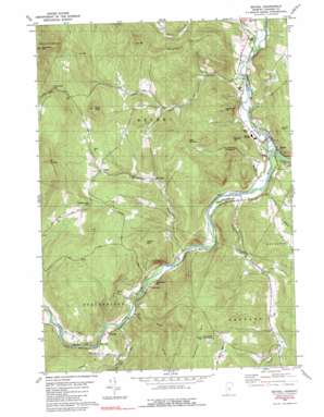
Bethel Topo Map Vermont
To zoom in, hover over the map of Bethel
USGS Topo Quad 43072g6 - 1:24,000 scale
| Topo Map Name: | Bethel |
| USGS Topo Quad ID: | 43072g6 |
| Print Size: | ca. 21 1/4" wide x 27" high |
| Southeast Coordinates: | 43.75° N latitude / 72.625° W longitude |
| Map Center Coordinates: | 43.8125° N latitude / 72.6875° W longitude |
| U.S. State: | VT |
| Filename: | o43072g6.jpg |
| Download Map JPG Image: | Bethel topo map 1:24,000 scale |
| Map Type: | Topographic |
| Topo Series: | 7.5´ |
| Map Scale: | 1:24,000 |
| Source of Map Images: | United States Geological Survey (USGS) |
| Alternate Map Versions: |
Bethel VT 1980, updated 1981 Download PDF Buy paper map Bethel VT 1980, updated 1990 Download PDF Buy paper map Bethel VT 1980, updated 1990 Download PDF Buy paper map Bethel VT 2012 Download PDF Buy paper map Bethel VT 2015 Download PDF Buy paper map |
1:24,000 Topo Quads surrounding Bethel
> Back to 43072e1 at 1:100,000 scale
> Back to 43072a1 at 1:250,000 scale
> Back to U.S. Topo Maps home
Bethel topo map: Gazetteer
Bethel: Bridges
Gilead Brook Covered Bridge elevation 200m 656′Bethel: Dams
Bethel Mills Dam elevation 194m 636′Bethel: Forests
Bethel Town Forest elevation 411m 1348′Bethel: Gaps
Rochester Gap elevation 635m 2083′Stockbridge Gap elevation 481m 1578′
Bethel: Parks
Bethel Village Historic District elevation 170m 557′Rood State Park elevation 170m 557′
Bethel: Pillars
Heap Pinnacle elevation 489m 1604′Bethel: Populated Places
Bethel elevation 177m 580′Camp Brook elevation 329m 1079′
Gaysville elevation 192m 629′
Lilliesville elevation 305m 1000′
Lympus elevation 384m 1259′
Riverside elevation 207m 679′
West Bethel elevation 332m 1089′
Bethel: Streams
Camp Brook elevation 174m 570′Cleveland Brook elevation 162m 531′
Gilead Brook elevation 179m 587′
Lilliesville Brook elevation 185m 606′
Little Stony Brook elevation 200m 656′
Locust Creek elevation 180m 590′
Pond Brook elevation 286m 938′
Stoddard Brook elevation 160m 524′
Stony Brook elevation 199m 652′
Third Branch White River elevation 160m 524′
Bethel: Summits
Blueberry Mountain elevation 388m 1272′Cowdrey Outlook elevation 623m 2043′
Delectable Mountain elevation 612m 2007′
Lee Hill elevation 596m 1955′
Mount Lympus elevation 759m 2490′
Naught Hill elevation 313m 1026′
Oak Hill elevation 530m 1738′
Pauls Peak elevation 611m 2004′
Rochester Mountain elevation 868m 2847′
Shaw Hill elevation 318m 1043′
Vulture Mountain elevation 446m 1463′
Woodbury Hill elevation 421m 1381′
Bethel digital topo map on disk
Buy this Bethel topo map showing relief, roads, GPS coordinates and other geographical features, as a high-resolution digital map file on DVD:
New York, Vermont, Connecticut & Western Massachusetts
Buy digital topo maps: New York, Vermont, Connecticut & Western Massachusetts


