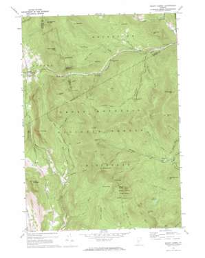
Mount Carmel Topo Map Vermont
To zoom in, hover over the map of Mount Carmel
USGS Topo Quad 43072g8 - 1:24,000 scale
| Topo Map Name: | Mount Carmel |
| USGS Topo Quad ID: | 43072g8 |
| Print Size: | ca. 21 1/4" wide x 27" high |
| Southeast Coordinates: | 43.75° N latitude / 72.875° W longitude |
| Map Center Coordinates: | 43.8125° N latitude / 72.9375° W longitude |
| U.S. State: | VT |
| Filename: | o43072g8.jpg |
| Download Map JPG Image: | Mount Carmel topo map 1:24,000 scale |
| Map Type: | Topographic |
| Topo Series: | 7.5´ |
| Map Scale: | 1:24,000 |
| Source of Map Images: | United States Geological Survey (USGS) |
| Alternate Map Versions: |
Mount Carmel VT 1970, updated 1972 Download PDF Buy paper map Mount Carmel VT 1997, updated 2000 Download PDF Buy paper map Mount Carmel VT 2012 Download PDF Buy paper map Mount Carmel VT 2015 Download PDF Buy paper map |
| FStopo: | US Forest Service topo Mount Carmel is available: Download FStopo PDF Download FStopo TIF |
1:24,000 Topo Quads surrounding Mount Carmel
> Back to 43072e1 at 1:100,000 scale
> Back to 43072a1 at 1:250,000 scale
> Back to U.S. Topo Maps home
Mount Carmel topo map: Gazetteer
Mount Carmel: Cliffs
The Great Cliff elevation 860m 2821′Mount Carmel: Flats
Beaver Meadows elevation 589m 1932′Souphouse Flat elevation 470m 1541′
Mount Carmel: Forests
Mount Carmel State Forest elevation 932m 3057′Proctor Village Municipal Forest elevation 613m 2011′
Mount Carmel: Gaps
Bloodroot Gap elevation 945m 3100′Brandon Gap elevation 664m 2178′
Telephone Gap elevation 705m 2312′
Wetmore Gap elevation 793m 2601′
Mount Carmel: Populated Places
Michigan elevation 442m 1450′Mount Carmel: Springs
Boiling Spring elevation 684m 2244′Mount Carmel: Streams
Baker Brook elevation 413m 1354′Bear Brook elevation 530m 1738′
Beaudry Brook elevation 411m 1348′
Bee Brook elevation 509m 1669′
Chittenden Brook elevation 361m 1184′
Hayes Brook elevation 424m 1391′
Horrid Brook elevation 566m 1856′
Joe Smith Brook elevation 402m 1318′
Kettle Brook elevation 549m 1801′
Kiln Brook elevation 335m 1099′
Michigan Brook elevation 437m 1433′
Morrill Brook elevation 452m 1482′
Perkins Brook elevation 329m 1079′
Pine Brook elevation 364m 1194′
Puss and Kill Brook elevation 549m 1801′
Slab Bridge Brook elevation 452m 1482′
Smith Brook elevation 445m 1459′
Steam Mill Brook elevation 413m 1354′
Mount Carmel: Summits
Bear Mountain elevation 910m 2985′Bloodroot Mountain elevation 1061m 3480′
Cape Lookoff Mountain elevation 1017m 3336′
Corporation Mountain elevation 954m 3129′
Farr Peak elevation 1072m 3517′
Gillespie Peak elevation 1021m 3349′
Goshen Mountain elevation 1002m 3287′
Hawk Mountain elevation 777m 2549′
Jones Mountain elevation 625m 2050′
Little Pico Mountain elevation 664m 2178′
Mount Carmel elevation 1027m 3369′
Mount Horrid elevation 977m 3205′
Mount Nickwaket elevation 837m 2746′
Round Mountain elevation 1019m 3343′
The Cape elevation 800m 2624′
Thousand Acre Hill elevation 727m 2385′
Mount Carmel: Trails
Bloodroot Mountain Trail elevation 659m 2162′Chittenden Brook Cross-Country Ski Trail elevation 561m 1840′
Chittenden Brook Trail elevation 631m 2070′
New Boston Trail elevation 682m 2237′
Wetmore Gap Trail elevation 605m 1984′
Mount Carmel digital topo map on disk
Buy this Mount Carmel topo map showing relief, roads, GPS coordinates and other geographical features, as a high-resolution digital map file on DVD:
New York, Vermont, Connecticut & Western Massachusetts
Buy digital topo maps: New York, Vermont, Connecticut & Western Massachusetts


