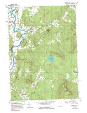
Piermont Topo Map New Hampshire
To zoom in, hover over the map of Piermont
USGS Topo Quad 43072h1 - 1:24,000 scale
| Topo Map Name: | Piermont |
| USGS Topo Quad ID: | 43072h1 |
| Print Size: | ca. 21 1/4" wide x 27" high |
| Southeast Coordinates: | 43.875° N latitude / 72° W longitude |
| Map Center Coordinates: | 43.9375° N latitude / 72.0625° W longitude |
| U.S. States: | NH, VT |
| Filename: | o43072h1.jpg |
| Download Map JPG Image: | Piermont topo map 1:24,000 scale |
| Map Type: | Topographic |
| Topo Series: | 7.5´ |
| Map Scale: | 1:24,000 |
| Source of Map Images: | United States Geological Survey (USGS) |
| Alternate Map Versions: |
Piermont NH 1979, updated 1984 Download PDF Buy paper map Piermont NH 1979, updated 1992 Download PDF Buy paper map Piermont NH 1996, updated 2001 Download PDF Buy paper map Piermont NH 2012 Download PDF Buy paper map Piermont NH 2015 Download PDF Buy paper map |
| FStopo: | US Forest Service topo Piermont is available: Download FStopo PDF Download FStopo TIF |
1:24,000 Topo Quads surrounding Piermont
> Back to 43072e1 at 1:100,000 scale
> Back to 43072a1 at 1:250,000 scale
> Back to U.S. Topo Maps home
Piermont topo map: Gazetteer
Piermont: Lakes
Indian Pond elevation 341m 1118′Piermont: Populated Places
Orfordville elevation 207m 679′Piermont elevation 158m 518′
Piermont: Ridges
Blackberry Hill elevation 295m 967′Cottonstone Mountain elevation 464m 1522′
Piermont: Streams
Archertown Brook elevation 163m 534′Bean Brook elevation 148m 485′
Clough Brook elevation 216m 708′
Eastman Brook elevation 119m 390′
Indian Pond Brook elevation 120m 393′
Waits River elevation 122m 400′
Piermont: Summits
Blooms Mountain elevation 433m 1420′Dame Hill elevation 343m 1125′
Echo Hill elevation 254m 833′
Indian Pond Mountain elevation 594m 1948′
Mount Cube elevation 881m 2890′
Peaked Mountain elevation 435m 1427′
Strawberry Hill elevation 367m 1204′
Sunday Mountain elevation 553m 1814′
Piermont: Trails
Grimes Hill Road elevation 349m 1145′Piermont: Valleys
Clay Hollow elevation 120m 393′Piermont digital topo map on disk
Buy this Piermont topo map showing relief, roads, GPS coordinates and other geographical features, as a high-resolution digital map file on DVD:
New York, Vermont, Connecticut & Western Massachusetts
Buy digital topo maps: New York, Vermont, Connecticut & Western Massachusetts


