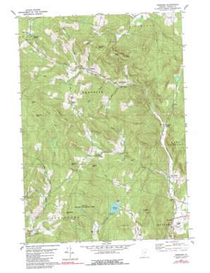
Vershire Topo Map Vermont
To zoom in, hover over the map of Vershire
USGS Topo Quad 43072h3 - 1:24,000 scale
| Topo Map Name: | Vershire |
| USGS Topo Quad ID: | 43072h3 |
| Print Size: | ca. 21 1/4" wide x 27" high |
| Southeast Coordinates: | 43.875° N latitude / 72.25° W longitude |
| Map Center Coordinates: | 43.9375° N latitude / 72.3125° W longitude |
| U.S. State: | VT |
| Filename: | o43072h3.jpg |
| Download Map JPG Image: | Vershire topo map 1:24,000 scale |
| Map Type: | Topographic |
| Topo Series: | 7.5´ |
| Map Scale: | 1:24,000 |
| Source of Map Images: | United States Geological Survey (USGS) |
| Alternate Map Versions: |
Vershire VT 1981, updated 1981 Download PDF Buy paper map Vershire VT 1981, updated 1991 Download PDF Buy paper map Vershire VT 1981, updated 1991 Download PDF Buy paper map Vershire VT 1981, updated 1991 Download PDF Buy paper map Vershire VT 2012 Download PDF Buy paper map Vershire VT 2015 Download PDF Buy paper map |
1:24,000 Topo Quads surrounding Vershire
> Back to 43072e1 at 1:100,000 scale
> Back to 43072a1 at 1:250,000 scale
> Back to U.S. Topo Maps home
Vershire topo map: Gazetteer
Vershire: Airports
Post Mills Airport elevation 210m 688′Vershire: Benches
Eagle Ledge elevation 548m 1797′Goodhue Ledge elevation 507m 1663′
Vershire: Dams
Miller Pond Dam elevation 428m 1404′Vershire: Forests
West Fairlee Municipal Forest elevation 372m 1220′Vershire: Gaps
Eagle Hollow Notch elevation 383m 1256′Vershire: Lakes
Miller Pond elevation 401m 1315′Vershire: Mines
Ely Mine elevation 431m 1414′Vershire: Parks
Podunk Wildlife Management Area elevation 472m 1548′Vershire: Populated Places
Beanville elevation 285m 935′Brimstone Corner elevation 237m 777′
Copperfield (historical) elevation 346m 1135′
Mill Village elevation 310m 1017′
Old City elevation 366m 1200′
Post Mills elevation 215m 705′
South Vershire elevation 416m 1364′
Vershire elevation 362m 1187′
Vershire Center elevation 513m 1683′
Vershire Heights elevation 558m 1830′
West Fairlee elevation 226m 741′
Vershire: Post Offices
Post Mills Post Office elevation 210m 688′Vershire: Reservoirs
Miller Pond elevation 428m 1404′Whitehouse Pond elevation 554m 1817′
Vershire: Summits
Colton Hill elevation 727m 2385′Cooks Hill elevation 500m 1640′
Gilman Hill elevation 614m 2014′
Hawkins Mountain elevation 712m 2335′
McMaster Hill elevation 572m 1876′
Patterson Mountain elevation 696m 2283′
Tug Mountain elevation 544m 1784′
Vershire digital topo map on disk
Buy this Vershire topo map showing relief, roads, GPS coordinates and other geographical features, as a high-resolution digital map file on DVD:
New York, Vermont, Connecticut & Western Massachusetts
Buy digital topo maps: New York, Vermont, Connecticut & Western Massachusetts


