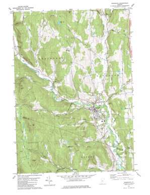
Randolph Topo Map Vermont
To zoom in, hover over the map of Randolph
USGS Topo Quad 43072h6 - 1:24,000 scale
| Topo Map Name: | Randolph |
| USGS Topo Quad ID: | 43072h6 |
| Print Size: | ca. 21 1/4" wide x 27" high |
| Southeast Coordinates: | 43.875° N latitude / 72.625° W longitude |
| Map Center Coordinates: | 43.9375° N latitude / 72.6875° W longitude |
| U.S. State: | VT |
| Filename: | o43072h6.jpg |
| Download Map JPG Image: | Randolph topo map 1:24,000 scale |
| Map Type: | Topographic |
| Topo Series: | 7.5´ |
| Map Scale: | 1:24,000 |
| Source of Map Images: | United States Geological Survey (USGS) |
| Alternate Map Versions: |
Randolph VT 1981, updated 1981 Download PDF Buy paper map Randolph VT 1981, updated 1982 Download PDF Buy paper map Randolph VT 2012 Download PDF Buy paper map Randolph VT 2015 Download PDF Buy paper map |
1:24,000 Topo Quads surrounding Randolph
> Back to 43072e1 at 1:100,000 scale
> Back to 43072a1 at 1:250,000 scale
> Back to U.S. Topo Maps home
Randolph topo map: Gazetteer
Randolph: Forests
Randolph Municipal Forest elevation 357m 1171′Randolph: Lakes
Mud Pond elevation 432m 1417′Randolph: Parks
Depot Square Historic District elevation 216m 708′Randolph Center Historic District elevation 220m 721′
Randolph-Town Recreation Center elevation 205m 672′
Randolph: Pillars
General Thomas Monument elevation 423m 1387′Randolph: Populated Places
Beanville elevation 219m 718′Braintree Hill elevation 483m 1584′
Dowdey Corner elevation 299m 980′
East Braintree elevation 226m 741′
Peth elevation 263m 862′
Randolph elevation 217m 711′
West Braintree elevation 236m 774′
Randolph: Post Offices
Randolph Post Office elevation 213m 698′Randolph: Reservoirs
Randolph Reservoir elevation 284m 931′Randolph: Streams
Adams Brook elevation 196m 643′Ayers Brook elevation 205m 672′
Batchellor Brook elevation 298m 977′
Battles Brook elevation 266m 872′
Brackett Brook elevation 254m 833′
Cahee Brook elevation 254m 833′
Dunham Brook elevation 243m 797′
Farnsworth Brook elevation 233m 764′
Flint Brook elevation 226m 741′
Maple Brook elevation 187m 613′
Riford Brook elevation 222m 728′
Smith Brook elevation 195m 639′
Spear Brook elevation 208m 682′
Thayer Brook elevation 206m 675′
Toddy Brook elevation 445m 1459′
Trout Brook elevation 191m 626′
Randolph: Summits
Alexander Hill elevation 561m 1840′Deer Mountain elevation 641m 2103′
Ferry Hill elevation 587m 1925′
Hebard Hill elevation 453m 1486′
Oak Hill elevation 577m 1893′
Riford Hill elevation 516m 1692′
Randolph digital topo map on disk
Buy this Randolph topo map showing relief, roads, GPS coordinates and other geographical features, as a high-resolution digital map file on DVD:
New York, Vermont, Connecticut & Western Massachusetts
Buy digital topo maps: New York, Vermont, Connecticut & Western Massachusetts


