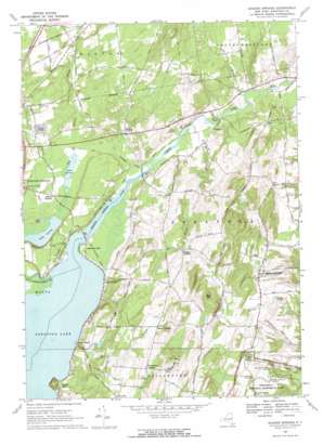
Quaker Springs Topo Map New York
To zoom in, hover over the map of Quaker Springs
USGS Topo Quad 43073a6 - 1:24,000 scale
| Topo Map Name: | Quaker Springs |
| USGS Topo Quad ID: | 43073a6 |
| Print Size: | ca. 21 1/4" wide x 27" high |
| Southeast Coordinates: | 43° N latitude / 73.625° W longitude |
| Map Center Coordinates: | 43.0625° N latitude / 73.6875° W longitude |
| U.S. State: | NY |
| Filename: | o43073a6.jpg |
| Download Map JPG Image: | Quaker Springs topo map 1:24,000 scale |
| Map Type: | Topographic |
| Topo Series: | 7.5´ |
| Map Scale: | 1:24,000 |
| Source of Map Images: | United States Geological Survey (USGS) |
| Alternate Map Versions: |
Quaker Springs NY 1934 Download PDF Buy paper map Quaker Springs NY 1967, updated 1970 Download PDF Buy paper map Quaker Springs NY 1967, updated 1970 Download PDF Buy paper map Quaker Springs NY 2011 Download PDF Buy paper map Quaker Springs NY 2013 Download PDF Buy paper map Quaker Springs NY 2016 Download PDF Buy paper map |
1:24,000 Topo Quads surrounding Quaker Springs
> Back to 43073a1 at 1:100,000 scale
> Back to 43072a1 at 1:250,000 scale
> Back to U.S. Topo Maps home
Quaker Springs topo map: Gazetteer
Quaker Springs: Bridges
Bryants Bridge elevation 61m 200′Staffords Bridge elevation 62m 203′
Quaker Springs: Lakes
Lake Lonely elevation 62m 203′Owl Pond elevation 63m 206′
Saratoga Lake elevation 62m 203′
Quaker Springs: Parks
Kaydeross Park elevation 63m 206′Quaker Springs: Populated Places
Beacon Hill elevation 83m 272′Brookview elevation 71m 232′
Burgoyne elevation 67m 219′
Carlyle Estates elevation 83m 272′
Cedar Bluffs elevation 66m 216′
Deans Corners elevation 98m 321′
East Ridge elevation 82m 269′
Floral Estates elevation 80m 262′
Gates elevation 73m 239′
Gilbert Corners elevation 67m 219′
Hearthwood North elevation 94m 308′
Highland Hills elevation 106m 347′
Interlaken elevation 81m 265′
Ketchums Corners elevation 121m 396′
Knoll Spring Park elevation 86m 282′
Lakeside Mobile Home Park elevation 70m 229′
Lost Valley Estates elevation 83m 272′
Louden Meadows elevation 82m 269′
Maple Shade elevation 64m 209′
Meadowbrook elevation 84m 275′
Pyramid Pines Mobile Home Park elevation 97m 318′
Quaker Springs elevation 87m 285′
Regatta View elevation 79m 259′
Saratoga Lake elevation 62m 203′
Scidmore Woods elevation 91m 298′
Snake Hill elevation 67m 219′
Waters Edge elevation 72m 236′
Wayville elevation 111m 364′
Wood Knolls elevation 100m 328′
Woodlands elevation 85m 278′
Quaker Springs: Streams
Bog Meadow Brook elevation 63m 206′Cold Brook elevation 61m 200′
Kayaderosseras Creek elevation 62m 203′
Mill Branch elevation 62m 203′
Spring Run elevation 63m 206′
Sucker Brook elevation 61m 200′
Quaker Springs: Summits
Bear Hill elevation 185m 606′Quaker Springs: Swamps
Bear Swamp elevation 64m 209′Quaker Springs: Trails
Wilkinson National Recreation Trail elevation 83m 272′Quaker Springs digital topo map on disk
Buy this Quaker Springs topo map showing relief, roads, GPS coordinates and other geographical features, as a high-resolution digital map file on DVD:
New York, Vermont, Connecticut & Western Massachusetts
Buy digital topo maps: New York, Vermont, Connecticut & Western Massachusetts


