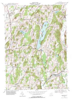
Cossayuna Topo Map New York
To zoom in, hover over the map of Cossayuna
USGS Topo Quad 43073b4 - 1:24,000 scale
| Topo Map Name: | Cossayuna |
| USGS Topo Quad ID: | 43073b4 |
| Print Size: | ca. 21 1/4" wide x 27" high |
| Southeast Coordinates: | 43.125° N latitude / 73.375° W longitude |
| Map Center Coordinates: | 43.1875° N latitude / 73.4375° W longitude |
| U.S. State: | NY |
| Filename: | o43073b4.jpg |
| Download Map JPG Image: | Cossayuna topo map 1:24,000 scale |
| Map Type: | Topographic |
| Topo Series: | 7.5´ |
| Map Scale: | 1:24,000 |
| Source of Map Images: | United States Geological Survey (USGS) |
| Alternate Map Versions: |
Cossayuna NY 1944, updated 1958 Download PDF Buy paper map Cossayuna NY 1944, updated 1966 Download PDF Buy paper map Cossayuna NY 1944, updated 1981 Download PDF Buy paper map Cossayuna NY 2010 Download PDF Buy paper map Cossayuna NY 2013 Download PDF Buy paper map Cossayuna NY 2016 Download PDF Buy paper map |
1:24,000 Topo Quads surrounding Cossayuna
> Back to 43073a1 at 1:100,000 scale
> Back to 43072a1 at 1:250,000 scale
> Back to U.S. Topo Maps home
Cossayuna topo map: Gazetteer
Cossayuna: Islands
Big Island elevation 159m 521′Cossayuna: Lakes
Barkley Pond elevation 162m 531′Carter Pond elevation 133m 436′
Cossayuna Lake elevation 146m 479′
McDougall Lake elevation 172m 564′
Summit Lake elevation 222m 728′
The Old Fly elevation 203m 666′
Cossayuna: Parks
Carters Pond State Wildlife Management Area elevation 134m 439′Cossayuna: Populated Places
Argyle elevation 87m 285′Cossayuna elevation 146m 479′
East Greenwich elevation 127m 416′
Fitch Point elevation 130m 426′
North Greenwich elevation 144m 472′
South Argyle elevation 130m 426′
Spraguetown elevation 149m 488′
West Hebron elevation 147m 482′
Cossayuna: Streams
Black Creek elevation 122m 400′Flaxmill Brook elevation 124m 406′
Gillis Brook elevation 85m 278′
Livingston Brook elevation 122m 400′
West Branch Black Creek elevation 139m 456′
Whittaker Brook elevation 120m 393′
Cossayuna: Summits
Barkley Mountain elevation 191m 626′Browns Mountain elevation 259m 849′
Murdock Mountain elevation 306m 1003′
Scotch Hill elevation 238m 780′
Stewart Hill elevation 281m 921′
Cossayuna: Swamps
Peat Swamp elevation 134m 439′Shaw Fly elevation 175m 574′
Cossayuna digital topo map on disk
Buy this Cossayuna topo map showing relief, roads, GPS coordinates and other geographical features, as a high-resolution digital map file on DVD:
New York, Vermont, Connecticut & Western Massachusetts
Buy digital topo maps: New York, Vermont, Connecticut & Western Massachusetts


