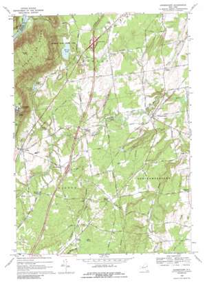
Gansevoort Topo Map New York
To zoom in, hover over the map of Gansevoort
USGS Topo Quad 43073b6 - 1:24,000 scale
| Topo Map Name: | Gansevoort |
| USGS Topo Quad ID: | 43073b6 |
| Print Size: | ca. 21 1/4" wide x 27" high |
| Southeast Coordinates: | 43.125° N latitude / 73.625° W longitude |
| Map Center Coordinates: | 43.1875° N latitude / 73.6875° W longitude |
| U.S. State: | NY |
| Filename: | o43073b6.jpg |
| Download Map JPG Image: | Gansevoort topo map 1:24,000 scale |
| Map Type: | Topographic |
| Topo Series: | 7.5´ |
| Map Scale: | 1:24,000 |
| Source of Map Images: | United States Geological Survey (USGS) |
| Alternate Map Versions: |
Gansevoort NY 1935 Download PDF Buy paper map Gansevoort NY 1968 Download PDF Buy paper map Gansevoort NY 1968, updated 1969 Download PDF Buy paper map Gansevoort NY 1968, updated 1989 Download PDF Buy paper map Gansevoort NY 2010 Download PDF Buy paper map Gansevoort NY 2013 Download PDF Buy paper map Gansevoort NY 2016 Download PDF Buy paper map |
1:24,000 Topo Quads surrounding Gansevoort
> Back to 43073a1 at 1:100,000 scale
> Back to 43072a1 at 1:250,000 scale
> Back to U.S. Topo Maps home
Gansevoort topo map: Gazetteer
Gansevoort: Airports
Heber Airpark elevation 61m 200′Russell Field elevation 80m 262′
Shaw Field elevation 55m 180′
Gansevoort: Crossings
Interchange 16 elevation 95m 311′Interchange 17 elevation 94m 308′
Gansevoort: Lakes
Moreau Lake elevation 101m 331′Saddle Lake elevation 104m 341′
Gansevoort: Parks
Moreau Lake State Park elevation 105m 344′Gansevoort: Populated Places
Adirondack Estates elevation 94m 308′Ashfords Way elevation 120m 393′
Ballard Corners elevation 96m 314′
Castlewood elevation 88m 288′
Clarks Corner elevation 69m 226′
English Village elevation 106m 347′
Forest Hills elevation 86m 282′
Fortsville elevation 89m 291′
Fox Run Estates elevation 94m 308′
Gansevoort elevation 73m 239′
Grants Woods elevation 125m 410′
Gurn Spring elevation 97m 318′
Hickory Forest elevation 80m 262′
Queens Court elevation 96m 314′
Rimbrave Estates elevation 91m 298′
Sandy Oaks elevation 105m 344′
Schuyler Heights elevation 70m 229′
Shelley Trailer Park elevation 79m 259′
Stonegate elevation 89m 291′
Strawberry Acres elevation 104m 341′
Tanager Woods elevation 78m 255′
Terrel Hills elevation 85m 278′
Travers Corners elevation 99m 324′
Whispering Pines Mobile Home Park elevation 94m 308′
Wilton elevation 106m 347′
Gansevoort: Ridges
Palmer Ridge elevation 110m 360′Gansevoort: Streams
Cole Brook elevation 39m 127′Delegan Brook elevation 76m 249′
Hurds Brook elevation 65m 213′
Little Snook Kill elevation 85m 278′
Rice Brook elevation 42m 137′
Gansevoort: Summits
Grant Mountain elevation 380m 1246′Gansevoort: Swamps
Miller Swamp elevation 99m 324′Gansevoort digital topo map on disk
Buy this Gansevoort topo map showing relief, roads, GPS coordinates and other geographical features, as a high-resolution digital map file on DVD:
New York, Vermont, Connecticut & Western Massachusetts
Buy digital topo maps: New York, Vermont, Connecticut & Western Massachusetts


