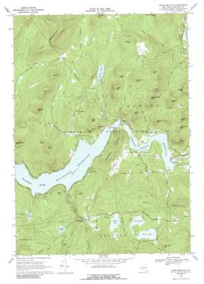
Conklingville Topo Map New York
To zoom in, hover over the map of Conklingville
USGS Topo Quad 43073c8 - 1:24,000 scale
| Topo Map Name: | Conklingville |
| USGS Topo Quad ID: | 43073c8 |
| Print Size: | ca. 21 1/4" wide x 27" high |
| Southeast Coordinates: | 43.25° N latitude / 73.875° W longitude |
| Map Center Coordinates: | 43.3125° N latitude / 73.9375° W longitude |
| U.S. State: | NY |
| Filename: | o43073c8.jpg |
| Download Map JPG Image: | Conklingville topo map 1:24,000 scale |
| Map Type: | Topographic |
| Topo Series: | 7.5´ |
| Map Scale: | 1:24,000 |
| Source of Map Images: | United States Geological Survey (USGS) |
| Alternate Map Versions: |
Conklingville NY 1966, updated 1970 Download PDF Buy paper map Conklingville NY 1966, updated 1989 Download PDF Buy paper map Conklingville NY 2010 Download PDF Buy paper map Conklingville NY 2013 Download PDF Buy paper map Conklingville NY 2016 Download PDF Buy paper map |
1:24,000 Topo Quads surrounding Conklingville
> Back to 43073a1 at 1:100,000 scale
> Back to 43072a1 at 1:250,000 scale
> Back to U.S. Topo Maps home
Conklingville topo map: Gazetteer
Conklingville: Dams
Conklingville Dam elevation 240m 787′Conklingville: Falls
Eggleston Falls elevation 301m 987′Conklingville: Lakes
Efner Lake elevation 356m 1167′Hunt Lake elevation 377m 1236′
Jenny Lake elevation 377m 1236′
Conklingville: Populated Places
Allentown elevation 299m 980′Conklingville elevation 239m 784′
Overlook elevation 265m 869′
Conklingville: Reservoirs
Bell Brook Pond elevation 316m 1036′Davignon Pond elevation 354m 1161′
Fly Pond elevation 282m 925′
Great Sacandaga Lake elevation 240m 787′
Stewarts Bridge Reservoir elevation 211m 692′
Conklingville: Streams
Allentown Creek elevation 235m 770′Bell Brook elevation 235m 770′
Black Pond Creek elevation 281m 921′
Breen Brook elevation 215m 705′
Daly Creek elevation 235m 770′
Efner Lake Brook elevation 321m 1053′
Hunt Brook elevation 377m 1236′
Joel Brook elevation 377m 1236′
Man Shanty Brook elevation 215m 705′
Mink Brook elevation 235m 770′
Nick Creek elevation 326m 1069′
Palmer Lake Creek elevation 281m 921′
Parker Brook elevation 237m 777′
Conklingville: Summits
Birds Nest Mountain elevation 405m 1328′Clute Mountain elevation 526m 1725′
Cooks Hill elevation 366m 1200′
Corn Hill elevation 526m 1725′
Day Center Mountain elevation 502m 1646′
Dillon Mountain elevation 539m 1768′
Dwyer Mountain elevation 486m 1594′
Flat Hill elevation 584m 1916′
Gilbert Hill elevation 440m 1443′
Gray Hill elevation 338m 1108′
Hammond Lot Mountain elevation 410m 1345′
Hughes Mountain elevation 470m 1541′
Indian Cobble Mountain elevation 550m 1804′
Jeffers Mountain elevation 426m 1397′
Jones Mountain elevation 407m 1335′
Kings Mountain elevation 469m 1538′
Mace Hill elevation 494m 1620′
Menzie Mountain elevation 479m 1571′
O'Keefe Mountain elevation 481m 1578′
Peaked Hill elevation 557m 1827′
Pond Mountain elevation 562m 1843′
Redmond Hill elevation 507m 1663′
Springer Mountain elevation 531m 1742′
Swears Mountain elevation 442m 1450′
Waite Mountain elevation 443m 1453′
West Mountain elevation 478m 1568′
White Mountain elevation 468m 1535′
Woodcock Mountain elevation 357m 1171′
Conklingville digital topo map on disk
Buy this Conklingville topo map showing relief, roads, GPS coordinates and other geographical features, as a high-resolution digital map file on DVD:
New York, Vermont, Connecticut & Western Massachusetts
Buy digital topo maps: New York, Vermont, Connecticut & Western Massachusetts


