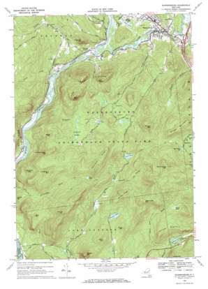
Warrensburg Topo Map New York
To zoom in, hover over the map of Warrensburg
USGS Topo Quad 43073d7 - 1:24,000 scale
| Topo Map Name: | Warrensburg |
| USGS Topo Quad ID: | 43073d7 |
| Print Size: | ca. 21 1/4" wide x 27" high |
| Southeast Coordinates: | 43.375° N latitude / 73.75° W longitude |
| Map Center Coordinates: | 43.4375° N latitude / 73.8125° W longitude |
| U.S. State: | NY |
| Filename: | o43073d7.jpg |
| Download Map JPG Image: | Warrensburg topo map 1:24,000 scale |
| Map Type: | Topographic |
| Topo Series: | 7.5´ |
| Map Scale: | 1:24,000 |
| Source of Map Images: | United States Geological Survey (USGS) |
| Alternate Map Versions: |
Warrensburg NY 1966, updated 1969 Download PDF Buy paper map Warrensburg NY 1966, updated 1969 Download PDF Buy paper map Warrensburg NY 2010 Download PDF Buy paper map Warrensburg NY 2013 Download PDF Buy paper map Warrensburg NY 2016 Download PDF Buy paper map |
1:24,000 Topo Quads surrounding Warrensburg
> Back to 43073a1 at 1:100,000 scale
> Back to 43072a1 at 1:250,000 scale
> Back to U.S. Topo Maps home
Warrensburg topo map: Gazetteer
Warrensburg: Crossings
Interchange 23 elevation 213m 698′Warrensburg: Lakes
Berry Pond elevation 419m 1374′Echo Lake elevation 214m 702′
Gay Pond elevation 417m 1368′
Hidden Lake elevation 226m 741′
Stewart Lake elevation 326m 1069′
Viele Pond elevation 406m 1332′
Warrensburg: Populated Places
Athol elevation 240m 787′Big Hollow elevation 455m 1492′
Warrensburg elevation 227m 744′
Warrensburg: Reservoirs
Big Hollow Reservoir elevation 451m 1479′Warrensburg: Ridges
Hemlock Ridge elevation 502m 1646′Hickory Ridge elevation 508m 1666′
Warrensburg: Streams
Big Brook elevation 195m 639′Cold Brook elevation 173m 567′
Crazy Creek elevation 183m 600′
Ferguson Brook elevation 180m 590′
Number Nine Brook elevation 181m 593′
Patterson Brook elevation 192m 629′
Podunk Brook elevation 297m 974′
Schroon River elevation 183m 600′
Warrensburg: Summits
Bald Mountain elevation 602m 1975′Black Spruce Mountain elevation 716m 2349′
Eddy Mountain elevation 410m 1345′
Howe Mountain elevation 433m 1420′
Huckleberry Mountain elevation 527m 1729′
Joe Baker Sag elevation 319m 1046′
Kenyon Mountain elevation 435m 1427′
Morton Mountain elevation 324m 1062′
Number Seven Mountain elevation 532m 1745′
Patent Line Mountain elevation 588m 1929′
Phoebe Mountain elevation 618m 2027′
Pine Mountain elevation 540m 1771′
Potash Mountain elevation 530m 1738′
Shingle Mountain elevation 595m 1952′
Sugarloaf Mountain elevation 420m 1377′
Taylor Mountain elevation 452m 1482′
The Three Sisters elevation 529m 1735′
Thomas Mountain elevation 591m 1938′
Wegley Mountain elevation 472m 1548′
Warrensburg: Swamps
Lockwood Swamp elevation 363m 1190′Warrensburg digital topo map on disk
Buy this Warrensburg topo map showing relief, roads, GPS coordinates and other geographical features, as a high-resolution digital map file on DVD:
New York, Vermont, Connecticut & Western Massachusetts
Buy digital topo maps: New York, Vermont, Connecticut & Western Massachusetts


