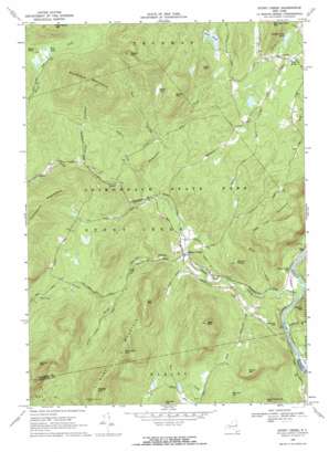
Stony Creek Topo Map New York
To zoom in, hover over the map of Stony Creek
USGS Topo Quad 43073d8 - 1:24,000 scale
| Topo Map Name: | Stony Creek |
| USGS Topo Quad ID: | 43073d8 |
| Print Size: | ca. 21 1/4" wide x 27" high |
| Southeast Coordinates: | 43.375° N latitude / 73.875° W longitude |
| Map Center Coordinates: | 43.4375° N latitude / 73.9375° W longitude |
| U.S. State: | NY |
| Filename: | o43073d8.jpg |
| Download Map JPG Image: | Stony Creek topo map 1:24,000 scale |
| Map Type: | Topographic |
| Topo Series: | 7.5´ |
| Map Scale: | 1:24,000 |
| Source of Map Images: | United States Geological Survey (USGS) |
| Alternate Map Versions: |
Stony Creek NY 1968, updated 1969 Download PDF Buy paper map Stony Creek NY 2010 Download PDF Buy paper map Stony Creek NY 2013 Download PDF Buy paper map Stony Creek NY 2016 Download PDF Buy paper map |
1:24,000 Topo Quads surrounding Stony Creek
> Back to 43073a1 at 1:100,000 scale
> Back to 43072a1 at 1:250,000 scale
> Back to U.S. Topo Maps home
Stony Creek topo map: Gazetteer
Stony Creek: Lakes
Bear Pond elevation 390m 1279′Number Nine Pond elevation 343m 1125′
Wolf Pond elevation 501m 1643′
Stony Creek: Populated Places
Stony Creek elevation 252m 826′Stony Creek: Ridges
Walnut Ridge elevation 389m 1276′Stony Creek: Streams
Buttermilk Brook elevation 171m 561′Fodder Brook elevation 361m 1184′
Kenyontown Creek elevation 279m 915′
Kidder Brook elevation 309m 1013′
Roaring Branch elevation 249m 816′
Stony Creek elevation 175m 574′
Twin Brooks elevation 330m 1082′
Vanauken Brook elevation 401m 1315′
Wills Creek elevation 183m 600′
Stony Creek: Summits
Baldhead Mountain elevation 871m 2857′Bear Mountain elevation 599m 1965′
Bryan Mountain elevation 487m 1597′
Burnt Mountain elevation 618m 2027′
Canada Hill elevation 431m 1414′
Cave Knoll elevation 520m 1706′
Deer Leap Mountain elevation 533m 1748′
Garner Hill elevation 421m 1381′
Gill Mountain elevation 575m 1886′
Hadley Mountain elevation 807m 2647′
Holmes Hill elevation 271m 889′
Little Mountain elevation 517m 1696′
Moose Mountain elevation 852m 2795′
Roundtop Mountain elevation 735m 2411′
Spruce Mountain elevation 806m 2644′
West Mountain elevation 759m 2490′
Stony Creek: Swamps
Welch Vly elevation 508m 1666′Stony Creek digital topo map on disk
Buy this Stony Creek topo map showing relief, roads, GPS coordinates and other geographical features, as a high-resolution digital map file on DVD:
New York, Vermont, Connecticut & Western Massachusetts
Buy digital topo maps: New York, Vermont, Connecticut & Western Massachusetts


