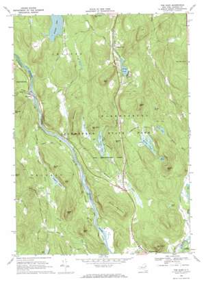
The Glen Topo Map New York
To zoom in, hover over the map of The Glen
USGS Topo Quad 43073e7 - 1:24,000 scale
| Topo Map Name: | The Glen |
| USGS Topo Quad ID: | 43073e7 |
| Print Size: | ca. 21 1/4" wide x 27" high |
| Southeast Coordinates: | 43.5° N latitude / 73.75° W longitude |
| Map Center Coordinates: | 43.5625° N latitude / 73.8125° W longitude |
| U.S. State: | NY |
| Filename: | o43073e7.jpg |
| Download Map JPG Image: | The Glen topo map 1:24,000 scale |
| Map Type: | Topographic |
| Topo Series: | 7.5´ |
| Map Scale: | 1:24,000 |
| Source of Map Images: | United States Geological Survey (USGS) |
| Alternate Map Versions: |
The Glen NY 1968, updated 1970 Download PDF Buy paper map The Glen NY 2010 Download PDF Buy paper map The Glen NY 2013 Download PDF Buy paper map The Glen NY 2016 Download PDF Buy paper map |
1:24,000 Topo Quads surrounding The Glen
> Back to 43073e1 at 1:100,000 scale
> Back to 43072a1 at 1:250,000 scale
> Back to U.S. Topo Maps home
The Glen topo map: Gazetteer
The Glen: Forests
Pack Demonstration Forest elevation 238m 780′The Glen: Lakes
Coon Pond elevation 265m 869′Daggett Pond elevation 269m 882′
Forest Lake elevation 321m 1053′
Kellum Pond elevation 315m 1033′
Mud Pond elevation 338m 1108′
Pack Forest Lake elevation 242m 793′
Penny Pond elevation 381m 1250′
Poker Pond elevation 260m 853′
Tripp Pond elevation 292m 958′
The Glen: Populated Places
Darrowsville elevation 292m 958′The Glen elevation 231m 757′
The Glen: Streams
Ben Wood Brook elevation 244m 800′Burch Brook elevation 255m 836′
Cataract Brook elevation 242m 793′
Glen Creek elevation 219m 718′
Millington Brook elevation 195m 639′
Potter Brook elevation 201m 659′
The Glen: Summits
Ben Wood Mountain elevation 361m 1184′Birch Mountain elevation 511m 1676′
Bull Rock Mountain elevation 489m 1604′
Burch Mountain elevation 395m 1295′
Chase Mountain elevation 489m 1604′
Deadwood Mountain elevation 391m 1282′
Dippikill Mountain elevation 476m 1561′
Hackensack Mountain elevation 411m 1348′
Heath Mountain elevation 391m 1282′
Kellum Mountain elevation 490m 1607′
Moon Mountain elevation 440m 1443′
Pond Mountain elevation 402m 1318′
Potter Mountain elevation 456m 1496′
Remington Mountain elevation 380m 1246′
Spruce Mountain elevation 379m 1243′
Tripp Mountain elevation 490m 1607′
The Glen digital topo map on disk
Buy this The Glen topo map showing relief, roads, GPS coordinates and other geographical features, as a high-resolution digital map file on DVD:
New York, Vermont, Connecticut & Western Massachusetts
Buy digital topo maps: New York, Vermont, Connecticut & Western Massachusetts


