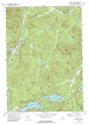
Paradox Lake Topo Map New York
To zoom in, hover over the map of Paradox Lake
USGS Topo Quad 43073h6 - 1:24,000 scale
| Topo Map Name: | Paradox Lake |
| USGS Topo Quad ID: | 43073h6 |
| Print Size: | ca. 21 1/4" wide x 27" high |
| Southeast Coordinates: | 43.875° N latitude / 73.625° W longitude |
| Map Center Coordinates: | 43.9375° N latitude / 73.6875° W longitude |
| U.S. State: | NY |
| Filename: | o43073h6.jpg |
| Download Map JPG Image: | Paradox Lake topo map 1:24,000 scale |
| Map Type: | Topographic |
| Topo Series: | 7.5´ |
| Map Scale: | 1:24,000 |
| Source of Map Images: | United States Geological Survey (USGS) |
| Alternate Map Versions: |
Paradox Lake NY 1973, updated 1976 Download PDF Buy paper map Paradox Lake NY 1973, updated 1988 Download PDF Buy paper map Paradox Lake NY 2010 Download PDF Buy paper map Paradox Lake NY 2013 Download PDF Buy paper map Paradox Lake NY 2016 Download PDF Buy paper map |
1:24,000 Topo Quads surrounding Paradox Lake
> Back to 43073e1 at 1:100,000 scale
> Back to 43072a1 at 1:250,000 scale
> Back to U.S. Topo Maps home
Paradox Lake topo map: Gazetteer
Paradox Lake: Bays
Dark Bay elevation 249m 816′Grosvenor Bay elevation 249m 816′
Legoys Bay elevation 249m 816′
Smith Bay elevation 249m 816′
Paradox Lake: Capes
Briar Point elevation 250m 820′Paradox Lake: Falls
Linsey Falls elevation 256m 839′Paradox Lake: Islands
Birch Island elevation 249m 816′Crawford Island elevation 249m 816′
Grass Island elevation 249m 816′
Paradox Lake: Lakes
Bass Lake elevation 375m 1230′Berrymill Pond elevation 324m 1062′
Bloody Pond elevation 349m 1145′
Bumbo Pond elevation 296m 971′
Carey Marsh elevation 296m 971′
Challis Pond elevation 350m 1148′
Cotters Pond elevation 318m 1043′
Flemings Pond elevation 304m 997′
Gero Pond elevation 279m 915′
Hammond Pond elevation 300m 984′
Hatch Pond elevation 356m 1167′
Johnson Pond elevation 360m 1181′
Moose Mountain Pond elevation 388m 1272′
Palmer Pond elevation 265m 869′
Paradox Lake elevation 249m 816′
Peaked Hill Pond elevation 357m 1171′
Proctor Pond elevation 357m 1171′
Schofield Pond elevation 345m 1131′
Stevens Pond elevation 363m 1190′
Paradox Lake: Populated Places
North Hudson elevation 269m 882′Paradox elevation 266m 872′
Schroon Falls elevation 259m 849′
Severance elevation 256m 839′
Paradox Lake: Ridges
Indian Ridge elevation 471m 1545′Paradox Lake: Streams
Black Brook elevation 264m 866′Burnt Mill Brook elevation 267m 875′
Johnson Pond Brook elevation 250m 820′
Paradox Creek elevation 250m 820′
Paragon Brook elevation 251m 823′
The Branch elevation 257m 843′
Walker Brook elevation 262m 859′
Paradox Lake: Summits
Bald Pate elevation 656m 2152′Berrymill Hill elevation 512m 1679′
Gooseberry Hill elevation 375m 1230′
Little Canada elevation 439m 1440′
Long Sue elevation 514m 1686′
Narrows Mountain elevation 376m 1233′
Owl Pate elevation 746m 2447′
Owl Pate Pond elevation 405m 1328′
Peaked Hill elevation 573m 1879′
Pidgeon Hill elevation 447m 1466′
Schofield Hill elevation 378m 1240′
Sweet Fern Hill elevation 448m 1469′
Woodchuck Hill elevation 413m 1354′
Paradox Lake: Trails
Peaked Hill Trail elevation 371m 1217′Paradox Lake digital topo map on disk
Buy this Paradox Lake topo map showing relief, roads, GPS coordinates and other geographical features, as a high-resolution digital map file on DVD:
New York, Vermont, Connecticut & Western Massachusetts
Buy digital topo maps: New York, Vermont, Connecticut & Western Massachusetts


