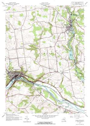
Little Falls Topo Map New York
To zoom in, hover over the map of Little Falls
USGS Topo Quad 43074a7 - 1:24,000 scale
| Topo Map Name: | Little Falls |
| USGS Topo Quad ID: | 43074a7 |
| Print Size: | ca. 21 1/4" wide x 27" high |
| Southeast Coordinates: | 43° N latitude / 74.75° W longitude |
| Map Center Coordinates: | 43.0625° N latitude / 74.8125° W longitude |
| U.S. State: | NY |
| Filename: | o43074a7.jpg |
| Download Map JPG Image: | Little Falls topo map 1:24,000 scale |
| Map Type: | Topographic |
| Topo Series: | 7.5´ |
| Map Scale: | 1:24,000 |
| Source of Map Images: | United States Geological Survey (USGS) |
| Alternate Map Versions: |
Little Falls NY 1943, updated 1960 Download PDF Buy paper map Little Falls NY 1943, updated 1972 Download PDF Buy paper map Little Falls NY 2010 Download PDF Buy paper map Little Falls NY 2013 Download PDF Buy paper map Little Falls NY 2016 Download PDF Buy paper map |
1:24,000 Topo Quads surrounding Little Falls
> Back to 43074a1 at 1:100,000 scale
> Back to 43074a1 at 1:250,000 scale
> Back to U.S. Topo Maps home
Little Falls topo map: Gazetteer
Little Falls: Cliffs
Rollaway elevation 181m 593′Little Falls: Dams
Fivemile Dam elevation 95m 311′Little Falls: Parks
Clinton Park elevation 111m 364′Eastern Park elevation 136m 446′
Moreland Park elevation 252m 826′
Skinner Park elevation 192m 629′
Spofford Square elevation 246m 807′
Western Park elevation 136m 446′
Little Falls: Pillars
Herkimer Monument elevation 109m 357′Little Falls: Populated Places
Dolgeville elevation 241m 790′Fink Basin elevation 124m 406′
Indian Castle elevation 114m 374′
Ingham Mills elevation 158m 518′
Ingham Mills Station elevation 177m 580′
Little Falls elevation 128m 419′
Manheim Center elevation 203m 666′
Little Falls: Post Offices
Dolgeville Post Office elevation 241m 790′Little Falls: Reservoirs
Kyser Lake elevation 202m 662′Little Falls: Streams
Bacon Brook elevation 164m 538′Beaver Creek elevation 226m 741′
Cold Brook elevation 244m 800′
Crum Creek elevation 94m 308′
Middle Sprite Creek elevation 252m 826′
Nowadaga Creek elevation 99m 324′
Ransom Creek elevation 200m 656′
Spruce Creek elevation 244m 800′
Little Falls: Summits
Top Notch elevation 381m 1250′Little Falls digital topo map on disk
Buy this Little Falls topo map showing relief, roads, GPS coordinates and other geographical features, as a high-resolution digital map file on DVD:
New York, Vermont, Connecticut & Western Massachusetts
Buy digital topo maps: New York, Vermont, Connecticut & Western Massachusetts


