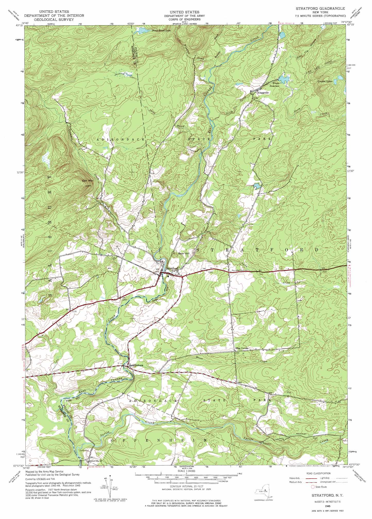
Stratford Topo Map New York
To zoom in, hover over the map of Stratford
USGS Topo Quad 43074b6 - 1:24,000 scale
| Topo Map Name: | Stratford |
| USGS Topo Quad ID: | 43074b6 |
| Print Size: | ca. 21 1/4" wide x 27" high |
| Southeast Coordinates: | 43.125° N latitude / 74.625° W longitude |
| Map Center Coordinates: | 43.1875° N latitude / 74.6875° W longitude |
| U.S. State: | NY |
| Filename: | o43074b6.jpg |
| Download Map JPG Image: | Stratford topo map 1:24,000 scale |
| Map Type: | Topographic |
| Topo Series: | 7.5´ |
| Map Scale: | 1:24,000 |
| Source of Map Images: | United States Geological Survey (USGS) |
| Alternate Map Versions: |
Stratford NY 1945, updated 1946 Download PDF Buy paper map Stratford NY 1945, updated 1960 Download PDF Buy paper map Stratford NY 1945, updated 1966 Download PDF Buy paper map Stratford NY 1945, updated 1977 Download PDF Buy paper map Stratford NY 2010 Download PDF Buy paper map Stratford NY 2013 Download PDF Buy paper map Stratford NY 2016 Download PDF Buy paper map |
1:24,000 Topo Quads surrounding Stratford
Morehouseville |
Piseco Lake |
|||
Jerseyfield Lake |
Tomany Mountain |
|||
Middleville |
Salisbury |
Stratford |
Canada Lake |
Caroga Lake |
Herkimer |
Little Falls |
Oppenheim |
Lassellsville |
Peck Lake |
Jordanville |
Van Hornesville |
Fort Plain |
Canajoharie |
Randall |
> Back to 43074a1 at 1:100,000 scale
> Back to 43074a1 at 1:250,000 scale
> Back to U.S. Topo Maps home
Stratford topo map: Gazetteer
Stratford: Lakes
Conglin Lakes elevation 497m 1630′Stony Brook Lake elevation 552m 1811′
Stratford: Populated Places
Bliss Corner elevation 383m 1256′Emmonsburg elevation 304m 997′
Knappville elevation 420m 1377′
Stratford elevation 325m 1066′
Stratford: Reservoirs
Knapp Reservoir elevation 432m 1417′Stratford: Streams
Ayers Creek elevation 323m 1059′Brandy Brook elevation 401m 1315′
Hart Vly Stream elevation 432m 1417′
Long Lake Outlet elevation 433m 1420′
Moose Creek elevation 299m 980′
North Creek elevation 378m 1240′
Phipps Brook elevation 340m 1115′
Sprite Creek elevation 275m 902′
Stony Brook elevation 383m 1256′
Trammel Creek elevation 332m 1089′
Windfall Creek elevation 395m 1295′
Stratford: Summits
Bear Hill elevation 383m 1256′Oak Mountain elevation 600m 1968′
Stratford digital topo map on disk
Buy this Stratford topo map showing relief, roads, GPS coordinates and other geographical features, as a high-resolution digital map file on DVD:
New York, Vermont, Connecticut & Western Massachusetts
Buy digital topo maps: New York, Vermont, Connecticut & Western Massachusetts