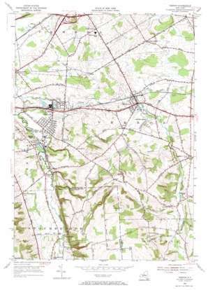
Vernon Topo Map New York
To zoom in, hover over the map of Vernon
USGS Topo Quad 43075a5 - 1:24,000 scale
| Topo Map Name: | Vernon |
| USGS Topo Quad ID: | 43075a5 |
| Print Size: | ca. 21 1/4" wide x 27" high |
| Southeast Coordinates: | 43° N latitude / 75.5° W longitude |
| Map Center Coordinates: | 43.0625° N latitude / 75.5625° W longitude |
| U.S. State: | NY |
| Filename: | o43075a5.jpg |
| Download Map JPG Image: | Vernon topo map 1:24,000 scale |
| Map Type: | Topographic |
| Topo Series: | 7.5´ |
| Map Scale: | 1:24,000 |
| Source of Map Images: | United States Geological Survey (USGS) |
| Alternate Map Versions: |
Vernon NY 1955, updated 1957 Download PDF Buy paper map Vernon NY 1955, updated 1966 Download PDF Buy paper map Vernon NY 2010 Download PDF Buy paper map Vernon NY 2013 Download PDF Buy paper map Vernon NY 2016 Download PDF Buy paper map |
1:24,000 Topo Quads surrounding Vernon
> Back to 43075a1 at 1:100,000 scale
> Back to 43074a1 at 1:250,000 scale
> Back to U.S. Topo Maps home
Vernon topo map: Gazetteer
Vernon: Crossings
Interchange 33 elevation 149m 488′Vernon: Lakes
Sunset Lake elevation 148m 485′Vernon: Populated Places
Bennetts Corners elevation 163m 534′Brewers Corner elevation 201m 659′
Five Chimneys Corner elevation 174m 570′
Kenwood elevation 154m 505′
Quiet Valley Trailer Park elevation 252m 826′
Sconondoa elevation 136m 446′
Sherrill elevation 151m 495′
Valley Mills elevation 177m 580′
Vernon elevation 193m 633′
Vernon Center elevation 244m 800′
Vernon Downs Mobile Home Park elevation 204m 669′
Willow Place elevation 152m 498′
Vernon: Reservoirs
Sherrill Reservoir elevation 195m 639′Vernon: Streams
Beaver Meadow Creek elevation 183m 600′Mud Creek elevation 147m 482′
Porter Brook elevation 239m 784′
Taylor Creek elevation 136m 446′
Vernon: Summits
Eaton Hill elevation 409m 1341′Vernon: Valleys
Stockbridge Valley elevation 142m 465′Vernon digital topo map on disk
Buy this Vernon topo map showing relief, roads, GPS coordinates and other geographical features, as a high-resolution digital map file on DVD:
New York, Vermont, Connecticut & Western Massachusetts
Buy digital topo maps: New York, Vermont, Connecticut & Western Massachusetts


