Newport Topo Map New York
To zoom in, hover over the map of Newport
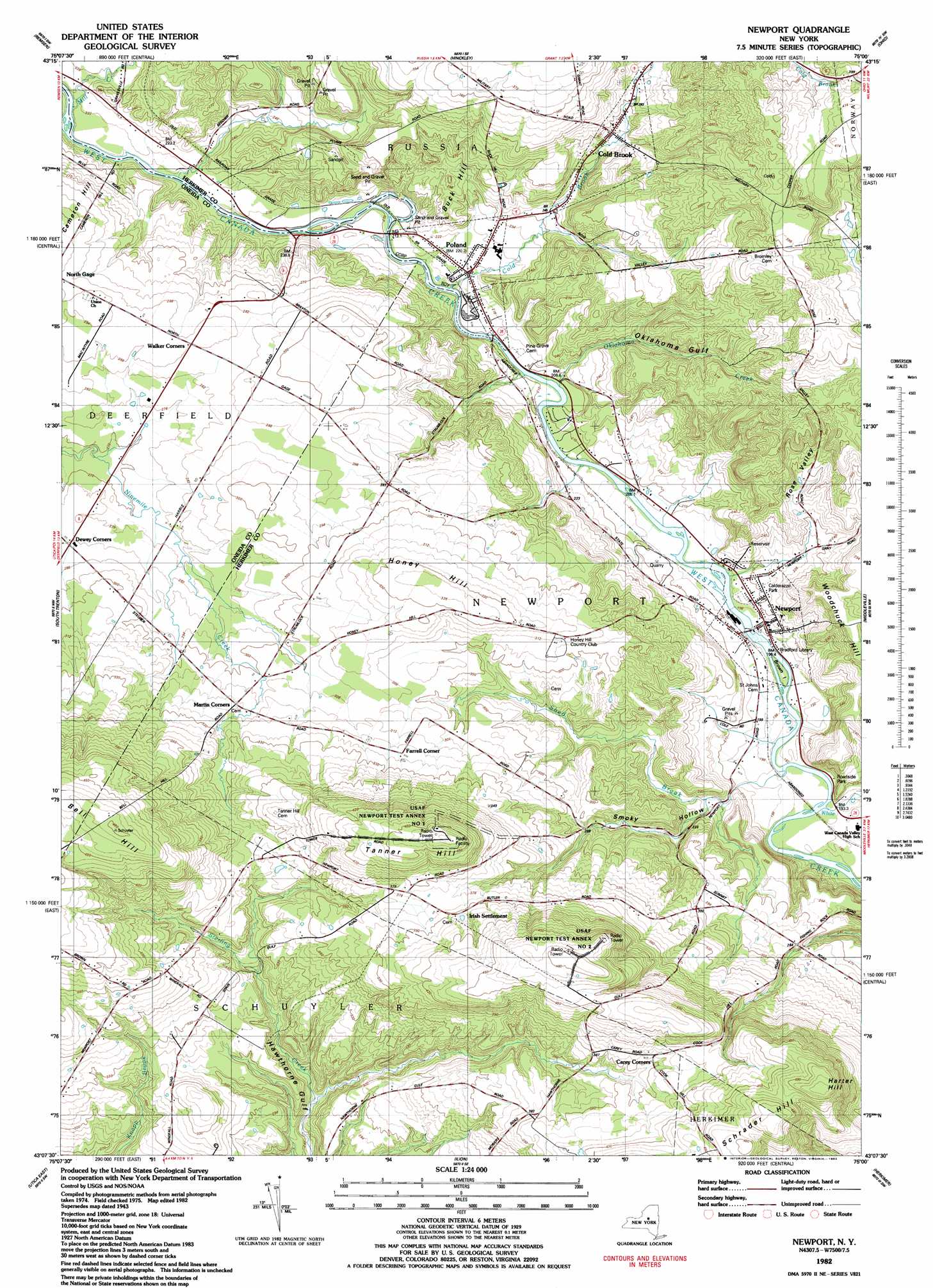
USGS Topo Quad 43075b1 - 1:24,000 scale
| Topo Map Name: | Newport |
| USGS Topo Quad ID: | 43075b1 |
| Print Size: | ca. 21 1/4" wide x 27" high |
| Southeast Coordinates: | 43.125° N latitude / 75° W longitude |
| Map Center Coordinates: | 43.1875° N latitude / 75.0625° W longitude |
| U.S. State: | NY |
| Filename: | o43075b1.jpg |
| Download Map JPG Image: | Newport topo map 1:24,000 scale |
| Map Type: | Topographic |
| Topo Series: | 7.5´ |
| Map Scale: | 1:24,000 |
| Source of Map Images: | United States Geological Survey (USGS) |
| Alternate Map Versions: |
Newport NY 1943, updated 1953 Download PDF Buy paper map Newport NY 1943, updated 1968 Download PDF Buy paper map Newport NY 1943, updated 1980 Download PDF Buy paper map Newport NY 1982, updated 1983 Download PDF Buy paper map Newport NY 2010 Download PDF Buy paper map Newport NY 2013 Download PDF Buy paper map Newport NY 2016 Download PDF Buy paper map |
1:24,000 Topo Quads surrounding Newport
Boonville |
Forestport |
North Wilmurt |
Morehouseville |
|
North Western |
Remsen |
Hinckley |
Jerseyfield Lake |
|
Oriskany |
South Trenton |
Newport |
Middleville |
Salisbury |
Utica West |
Utica East |
Ilion |
Herkimer |
Little Falls |
Cassville |
West Winfield |
Millers Mills |
Jordanville |
Van Hornesville |
> Back to 43075a1 at 1:100,000 scale
> Back to 43074a1 at 1:250,000 scale
> Back to U.S. Topo Maps home
Newport topo map: Gazetteer
Newport: Islands
Brown Island elevation 196m 643′Newport: Populated Places
Brayton Corners elevation 284m 931′Cold Brook elevation 288m 944′
Farrel Corner elevation 321m 1053′
Irish Settlement elevation 396m 1299′
Newport elevation 202m 662′
Poland elevation 216m 708′
Newport: Streams
Cold Brook elevation 207m 679′Mill Creek elevation 214m 702′
Shed Brook elevation 187m 613′
White Creek elevation 181m 593′
Newport: Summits
Bell Hill elevation 480m 1574′Buck Hill elevation 283m 928′
Harter Hill elevation 501m 1643′
Schrader Hill elevation 495m 1624′
Tanner Hill elevation 475m 1558′
Newport: Valleys
Oklahoma Gulf elevation 206m 675′Rose Valley elevation 209m 685′
Smoky Hollow elevation 208m 682′
Newport digital topo map on disk
Buy this Newport topo map showing relief, roads, GPS coordinates and other geographical features, as a high-resolution digital map file on DVD:
New York, Vermont, Connecticut & Western Massachusetts
Buy digital topo maps: New York, Vermont, Connecticut & Western Massachusetts