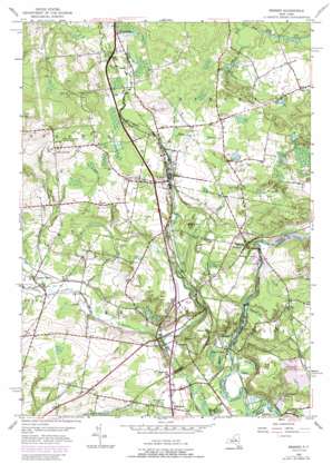
Remsen Topo Map New York
To zoom in, hover over the map of Remsen
USGS Topo Quad 43075c2 - 1:24,000 scale
| Topo Map Name: | Remsen |
| USGS Topo Quad ID: | 43075c2 |
| Print Size: | ca. 21 1/4" wide x 27" high |
| Southeast Coordinates: | 43.25° N latitude / 75.125° W longitude |
| Map Center Coordinates: | 43.3125° N latitude / 75.1875° W longitude |
| U.S. State: | NY |
| Filename: | o43075c2.jpg |
| Download Map JPG Image: | Remsen topo map 1:24,000 scale |
| Map Type: | Topographic |
| Topo Series: | 7.5´ |
| Map Scale: | 1:24,000 |
| Source of Map Images: | United States Geological Survey (USGS) |
| Alternate Map Versions: |
Remsen NY 1955, updated 1957 Download PDF Buy paper map Remsen NY 1955, updated 1966 Download PDF Buy paper map Remsen NY 1955, updated 1979 Download PDF Buy paper map Remsen NY 1955, updated 1989 Download PDF Buy paper map Remsen NY 2010 Download PDF Buy paper map Remsen NY 2013 Download PDF Buy paper map Remsen NY 2016 Download PDF Buy paper map |
1:24,000 Topo Quads surrounding Remsen
> Back to 43075a1 at 1:100,000 scale
> Back to 43074a1 at 1:250,000 scale
> Back to U.S. Topo Maps home
Remsen topo map: Gazetteer
Remsen: Airports
Beaver Meadow Heliport elevation 366m 1200′Remsen City Airport elevation 385m 1263′
Remsen: Parks
Baron Von Steuben Memorial Park elevation 429m 1407′Baron Von Steuben Monument elevation 428m 1404′
Trenton Assembly Park elevation 225m 738′
Remsen: Populated Places
Barneveld elevation 244m 800′Mapledale elevation 243m 797′
Mapledale Acres elevation 243m 797′
Prospect elevation 361m 1184′
Remsen elevation 361m 1184′
Steuben Valley elevation 249m 816′
Trenton Falls elevation 230m 754′
Remsen: Reservoirs
Evans Pond elevation 359m 1177′Lake Julia elevation 366m 1200′
Remsen: Streams
Beaver Meadow Brook elevation 359m 1177′Cady Brook elevation 300m 984′
Drumlin Brook elevation 237m 777′
Frank Jones Brook elevation 370m 1213′
Mud Brook elevation 364m 1194′
Shepards Brook elevation 237m 777′
Steuben Creek elevation 232m 761′
Trout Brook elevation 230m 754′
Remsen: Summits
Fox Hill elevation 354m 1161′Starr Hill elevation 545m 1788′
Remsen: Valleys
Trenton Chasm elevation 225m 738′Remsen digital topo map on disk
Buy this Remsen topo map showing relief, roads, GPS coordinates and other geographical features, as a high-resolution digital map file on DVD:
New York, Vermont, Connecticut & Western Massachusetts
Buy digital topo maps: New York, Vermont, Connecticut & Western Massachusetts


