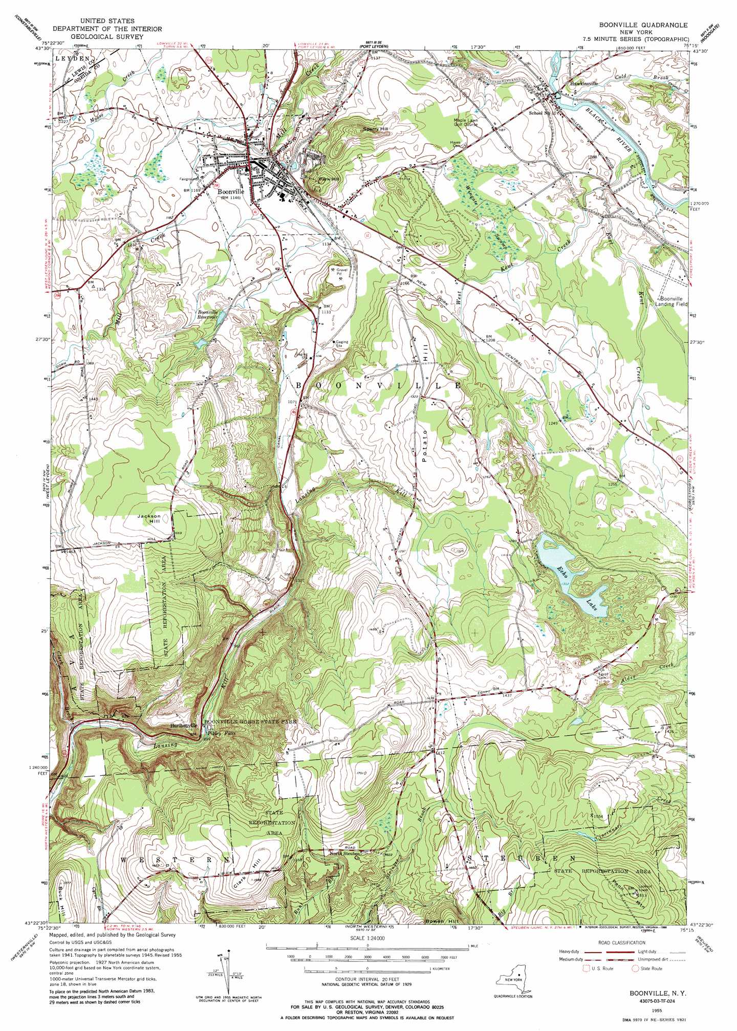
Boonville Topo Map New York
To zoom in, hover over the map of Boonville
USGS Topo Quad 43075d3 - 1:24,000 scale
| Topo Map Name: | Boonville |
| USGS Topo Quad ID: | 43075d3 |
| Print Size: | ca. 21 1/4" wide x 27" high |
| Southeast Coordinates: | 43.375° N latitude / 75.25° W longitude |
| Map Center Coordinates: | 43.4375° N latitude / 75.3125° W longitude |
| U.S. State: | NY |
| Filename: | o43075d3.jpg |
| Download Map JPG Image: | Boonville topo map 1:24,000 scale |
| Map Type: | Topographic |
| Topo Series: | 7.5´ |
| Map Scale: | 1:24,000 |
| Source of Map Images: | United States Geological Survey (USGS) |
| Alternate Map Versions: |
Boonville NY 1945, updated 1954 Download PDF Buy paper map Boonville NY 1955, updated 1957 Download PDF Buy paper map Boonville NY 1955, updated 1965 Download PDF Buy paper map Boonville NY 1955, updated 1986 Download PDF Buy paper map Boonville NY 2010 Download PDF Buy paper map Boonville NY 2013 Download PDF Buy paper map Boonville NY 2016 Download PDF Buy paper map |
1:24,000 Topo Quads surrounding Boonville
Page |
Glenfield |
Brantingham |
Thendara |
|
High Market |
Constableville |
Port Leyden |
Otter Lake |
|
Point Rock |
West Leyden |
Boonville |
Forestport |
North Wilmurt |
Lee Center |
Westernville |
North Western |
Remsen |
Hinckley |
Verona |
Rome |
Oriskany |
South Trenton |
Newport |
> Back to 43075a1 at 1:100,000 scale
> Back to 43074a1 at 1:250,000 scale
> Back to U.S. Topo Maps home
Boonville topo map: Gazetteer
Boonville: Airports
Boonville Landing Field elevation 356m 1167′Boonville: Canals
Black River Canal elevation 342m 1122′Boonville: Falls
Pixley Falls elevation 256m 839′Boonville: Lakes
Echo Lake elevation 397m 1302′Boonville: Mines
Boonville Quarry elevation 351m 1151′Boonville: Parks
Boonville Gorge State Park elevation 336m 1102′Erwin Park elevation 346m 1135′
Boonville: Populated Places
Boonville elevation 350m 1148′Hawkinsville elevation 327m 1072′
Hurlbutville elevation 332m 1089′
Boonville: Reservoirs
Boonville Reservoir elevation 379m 1243′Boonville: Streams
Big Branch elevation 444m 1456′Clark Brook elevation 237m 777′
Cold Brook elevation 318m 1043′
Crystal Creek elevation 327m 1072′
Cummings Creek elevation 308m 1010′
East Kent Creek elevation 317m 1040′
West Kent Creek elevation 328m 1076′
Boonville: Summits
Clark Hill elevation 483m 1584′Jackson Hill elevation 512m 1679′
Park Hill elevation 396m 1299′
Penn Mountain elevation 551m 1807′
Potato Hill elevation 416m 1364′
Sperry Hill elevation 424m 1391′
Boonville: Swamps
Wingate Swamp elevation 353m 1158′Boonville digital topo map on disk
Buy this Boonville topo map showing relief, roads, GPS coordinates and other geographical features, as a high-resolution digital map file on DVD:
New York, Vermont, Connecticut & Western Massachusetts
Buy digital topo maps: New York, Vermont, Connecticut & Western Massachusetts