West Leyden Topo Map New York
To zoom in, hover over the map of West Leyden
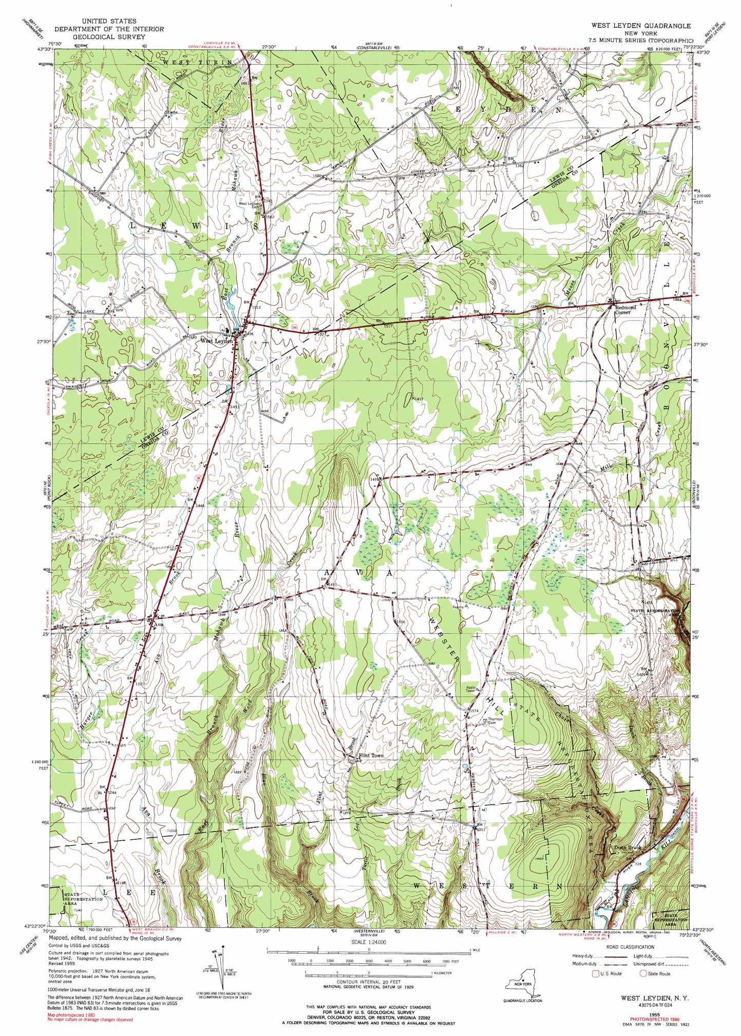
USGS Topo Quad 43075d4 - 1:24,000 scale
| Topo Map Name: | West Leyden |
| USGS Topo Quad ID: | 43075d4 |
| Print Size: | ca. 21 1/4" wide x 27" high |
| Southeast Coordinates: | 43.375° N latitude / 75.375° W longitude |
| Map Center Coordinates: | 43.4375° N latitude / 75.4375° W longitude |
| U.S. State: | NY |
| Filename: | o43075d4.jpg |
| Download Map JPG Image: | West Leyden topo map 1:24,000 scale |
| Map Type: | Topographic |
| Topo Series: | 7.5´ |
| Map Scale: | 1:24,000 |
| Source of Map Images: | United States Geological Survey (USGS) |
| Alternate Map Versions: |
West Leyden NY 1955, updated 1957 Download PDF Buy paper map West Leyden NY 1955, updated 1992 Download PDF Buy paper map West Leyden NY 2010 Download PDF Buy paper map West Leyden NY 2013 Download PDF Buy paper map West Leyden NY 2016 Download PDF Buy paper map |
1:24,000 Topo Quads surrounding West Leyden
Sears Pond |
Page |
Glenfield |
Brantingham |
|
North Osceola |
High Market |
Constableville |
Port Leyden |
|
Florence |
Point Rock |
West Leyden |
Boonville |
Forestport |
Camden East |
Lee Center |
Westernville |
North Western |
Remsen |
Sylvan Beach |
Verona |
Rome |
Oriskany |
South Trenton |
> Back to 43075a1 at 1:100,000 scale
> Back to 43074a1 at 1:250,000 scale
> Back to U.S. Topo Maps home
West Leyden topo map: Gazetteer
West Leyden: Airports
Valenty Mierek Airport elevation 365m 1197′West Leyden: Populated Places
Ava elevation 418m 1371′Dunn Brook elevation 223m 731′
Flint Town elevation 431m 1414′
Redmond Corner elevation 426m 1397′
West Leyden elevation 454m 1489′
West Leyden: Streams
Blue Brook elevation 262m 859′Chase Creek elevation 207m 679′
Dunn Brook elevation 213m 698′
Flint Brook elevation 287m 941′
Wood Creek elevation 316m 1036′
West Leyden: Summits
Webster Hill elevation 488m 1601′West Leyden digital topo map on disk
Buy this West Leyden topo map showing relief, roads, GPS coordinates and other geographical features, as a high-resolution digital map file on DVD:
New York, Vermont, Connecticut & Western Massachusetts
Buy digital topo maps: New York, Vermont, Connecticut & Western Massachusetts