North Osceola Topo Map New York
To zoom in, hover over the map of North Osceola
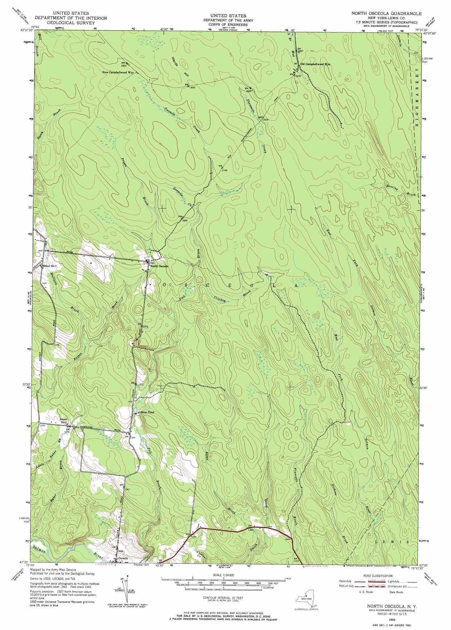
USGS Topo Quad 43075e6 - 1:24,000 scale
| Topo Map Name: | North Osceola |
| USGS Topo Quad ID: | 43075e6 |
| Print Size: | ca. 21 1/4" wide x 27" high |
| Southeast Coordinates: | 43.5° N latitude / 75.625° W longitude |
| Map Center Coordinates: | 43.5625° N latitude / 75.6875° W longitude |
| U.S. State: | NY |
| Filename: | o43075e6.jpg |
| Download Map JPG Image: | North Osceola topo map 1:24,000 scale |
| Map Type: | Topographic |
| Topo Series: | 7.5´ |
| Map Scale: | 1:24,000 |
| Source of Map Images: | United States Geological Survey (USGS) |
| Alternate Map Versions: |
North Osceola NY 1943, updated 1953 Download PDF Buy paper map North Osceola NY 1943, updated 1966 Download PDF Buy paper map North Osceola NY 1943, updated 1966 Download PDF Buy paper map North Osceola NY 2010 Download PDF Buy paper map North Osceola NY 2013 Download PDF Buy paper map North Osceola NY 2016 Download PDF Buy paper map |
1:24,000 Topo Quads surrounding North Osceola
Rodman |
Barnes Corners |
New Boston |
West Lowville |
Lowville |
Boylston Center |
Worth Center |
Sears Pond |
Page |
Glenfield |
Orwell |
Redfield |
North Osceola |
High Market |
Constableville |
Williamstown |
Westdale |
Florence |
Point Rock |
West Leyden |
Panther Lake |
Camden West |
Camden East |
Lee Center |
Westernville |
> Back to 43075e1 at 1:100,000 scale
> Back to 43074a1 at 1:250,000 scale
> Back to U.S. Topo Maps home
North Osceola topo map: Gazetteer
North Osceola: Populated Places
New Campbellwood Wye elevation 547m 1794′North Osceola elevation 485m 1591′
Old Campbellwood Wye elevation 566m 1856′
Osceola elevation 314m 1030′
North Osceola: Reservoirs
Stone Pond elevation 426m 1397′North Osceola: Streams
Baker Brook elevation 298m 977′Crooked Brook elevation 473m 1551′
Keese Brook elevation 375m 1230′
Mulligan Brook elevation 414m 1358′
Onemile Creek elevation 516m 1692′
Threemile Creek elevation 523m 1715′
Twomile Creek elevation 523m 1715′
North Osceola: Summits
Wards Hill elevation 562m 1843′North Osceola digital topo map on disk
Buy this North Osceola topo map showing relief, roads, GPS coordinates and other geographical features, as a high-resolution digital map file on DVD:
New York, Vermont, Connecticut & Western Massachusetts
Buy digital topo maps: New York, Vermont, Connecticut & Western Massachusetts