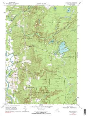
Brantingham Topo Map New York
To zoom in, hover over the map of Brantingham
USGS Topo Quad 43075f3 - 1:24,000 scale
| Topo Map Name: | Brantingham |
| USGS Topo Quad ID: | 43075f3 |
| Print Size: | ca. 21 1/4" wide x 27" high |
| Southeast Coordinates: | 43.625° N latitude / 75.25° W longitude |
| Map Center Coordinates: | 43.6875° N latitude / 75.3125° W longitude |
| U.S. State: | NY |
| Filename: | o43075f3.jpg |
| Download Map JPG Image: | Brantingham topo map 1:24,000 scale |
| Map Type: | Topographic |
| Topo Series: | 7.5´ |
| Map Scale: | 1:24,000 |
| Source of Map Images: | United States Geological Survey (USGS) |
| Alternate Map Versions: |
Brantingham NY 1966, updated 1970 Download PDF Buy paper map Brantingham NY 1966, updated 1990 Download PDF Buy paper map Brantingham NY 1966, updated 1990 Download PDF Buy paper map Brantingham NY 2010 Download PDF Buy paper map Brantingham NY 2013 Download PDF Buy paper map Brantingham NY 2016 Download PDF Buy paper map |
1:24,000 Topo Quads surrounding Brantingham
> Back to 43075e1 at 1:100,000 scale
> Back to 43074a1 at 1:250,000 scale
> Back to U.S. Topo Maps home
Brantingham topo map: Gazetteer
Brantingham: Lakes
Brantingham Lake elevation 376m 1233′Catspaw Lake elevation 361m 1184′
Little Otter Lake elevation 382m 1253′
Pleasant Lake elevation 376m 1233′
Sand Pond elevation 381m 1250′
Brantingham: Parks
Singing Waters Park elevation 304m 997′Brantingham: Populated Places
Brantingham elevation 382m 1253′Greig elevation 246m 807′
Lyons Falls elevation 253m 830′
Otter Creek elevation 240m 787′
Brantingham: Streams
Copper Creek elevation 364m 1194′Crooked Creek elevation 357m 1171′
Douglass Creek elevation 224m 734′
Fish Creek elevation 225m 738′
Little Otter Creek elevation 350m 1148′
Little Pine Creek elevation 366m 1200′
Mill Creek elevation 223m 731′
Brantingham digital topo map on disk
Buy this Brantingham topo map showing relief, roads, GPS coordinates and other geographical features, as a high-resolution digital map file on DVD:
New York, Vermont, Connecticut & Western Massachusetts
Buy digital topo maps: New York, Vermont, Connecticut & Western Massachusetts


