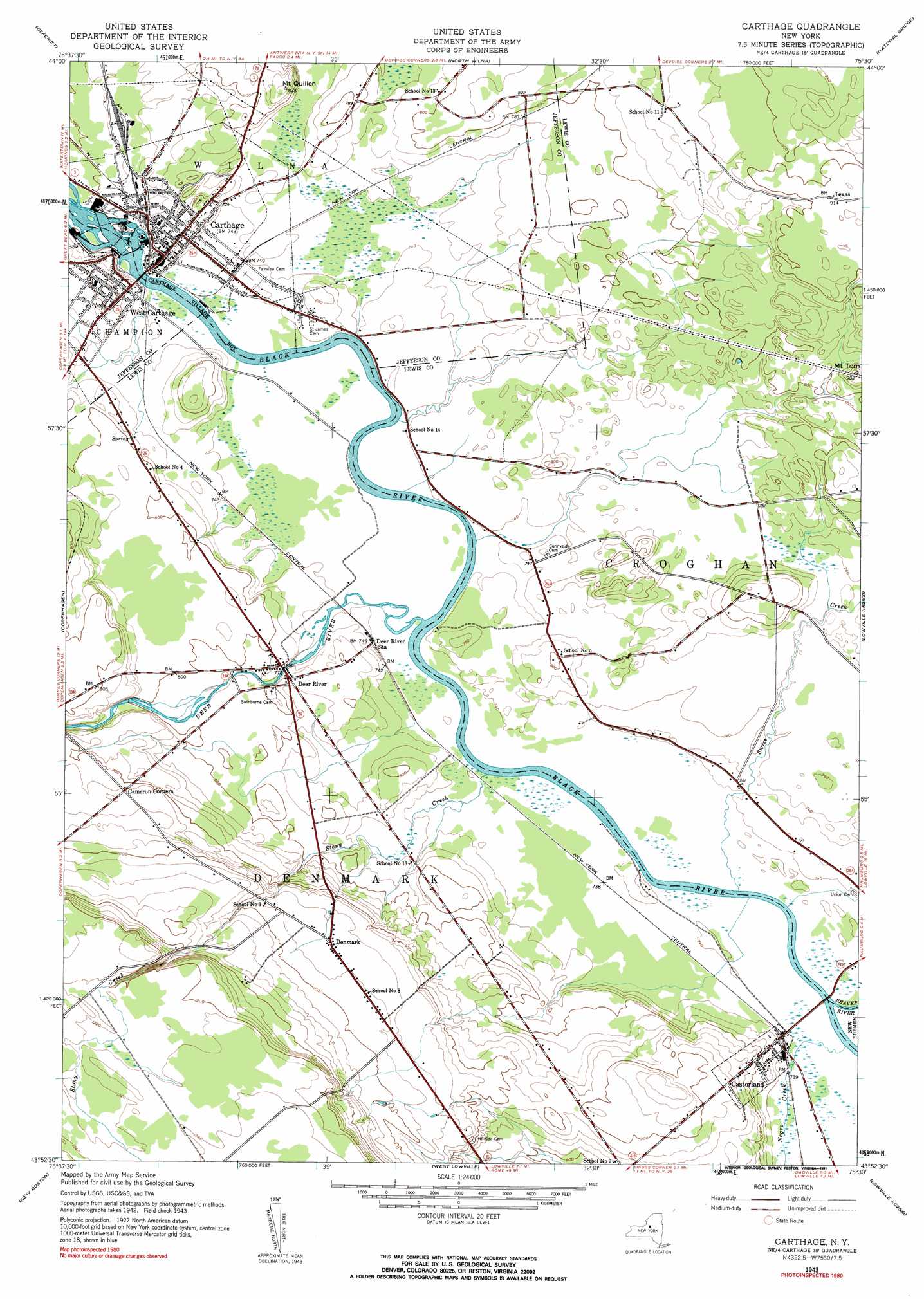
Carthage Topo Map New York
To zoom in, hover over the map of Carthage
USGS Topo Quad 43075h5 - 1:24,000 scale
| Topo Map Name: | Carthage |
| USGS Topo Quad ID: | 43075h5 |
| Print Size: | ca. 21 1/4" wide x 27" high |
| Southeast Coordinates: | 43.875° N latitude / 75.5° W longitude |
| Map Center Coordinates: | 43.9375° N latitude / 75.5625° W longitude |
| U.S. State: | NY |
| Filename: | o43075h5.jpg |
| Download Map JPG Image: | Carthage topo map 1:24,000 scale |
| Map Type: | Topographic |
| Topo Series: | 7.5´ |
| Map Scale: | 1:24,000 |
| Source of Map Images: | United States Geological Survey (USGS) |
| Alternate Map Versions: |
Carthage NY 1943, updated 1960 Download PDF Buy paper map Carthage NY 1943, updated 1960 Download PDF Buy paper map Carthage NY 1943, updated 1991 Download PDF Buy paper map Carthage NY 2010 Download PDF Buy paper map Carthage NY 2013 Download PDF Buy paper map Carthage NY 2016 Download PDF Buy paper map |
1:24,000 Topo Quads surrounding Carthage
Theresa |
Philadelphia |
Antwerp |
Lake Bonaparte |
Harrisville |
Black River |
Deferiet |
North Wilna |
Natural Bridge |
Remington Corners |
Rutland Center |
Copenhagen |
Carthage |
Croghan |
Belfort |
Barnes Corners |
New Boston |
West Lowville |
Lowville |
Crystal Dale |
Worth Center |
Sears Pond |
Page |
Glenfield |
Brantingham |
> Back to 43075e1 at 1:100,000 scale
> Back to 43074a1 at 1:250,000 scale
> Back to U.S. Topo Maps home
Carthage topo map: Gazetteer
Carthage: Airports
Countrymans Landing Strip elevation 238m 780′Carthage: Islands
Tannery Island elevation 214m 702′Wind Island elevation 215m 705′
Carthage: Populated Places
Carthage elevation 234m 767′Castorland elevation 226m 741′
Deer River elevation 238m 780′
Denmark elevation 296m 971′
Texas elevation 277m 908′
West Carthage elevation 237m 777′
Carthage: Streams
Beaver River elevation 219m 718′Deer River elevation 219m 718′
Negro Creek elevation 220m 721′
Potash Creek elevation 219m 718′
Stony Creek elevation 219m 718′
Swiss Creek elevation 219m 718′
Carthage: Summits
Mount Quillen elevation 264m 866′Mount Tom elevation 273m 895′
Carthage digital topo map on disk
Buy this Carthage topo map showing relief, roads, GPS coordinates and other geographical features, as a high-resolution digital map file on DVD:
New York, Vermont, Connecticut & Western Massachusetts
Buy digital topo maps: New York, Vermont, Connecticut & Western Massachusetts