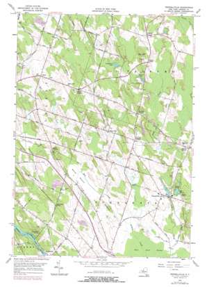
Pennellville Topo Map New York
To zoom in, hover over the map of Pennellville
USGS Topo Quad 43076c3 - 1:24,000 scale
| Topo Map Name: | Pennellville |
| USGS Topo Quad ID: | 43076c3 |
| Print Size: | ca. 21 1/4" wide x 27" high |
| Southeast Coordinates: | 43.25° N latitude / 76.25° W longitude |
| Map Center Coordinates: | 43.3125° N latitude / 76.3125° W longitude |
| U.S. State: | NY |
| Filename: | o43076c3.jpg |
| Download Map JPG Image: | Pennellville topo map 1:24,000 scale |
| Map Type: | Topographic |
| Topo Series: | 7.5´ |
| Map Scale: | 1:24,000 |
| Source of Map Images: | United States Geological Survey (USGS) |
| Alternate Map Versions: |
Pennellville NY 1956, updated 1958 Download PDF Buy paper map Pennellville NY 1956, updated 1975 Download PDF Buy paper map Pennellville NY 1956, updated 1978 Download PDF Buy paper map Pennellville NY 1956, updated 1978 Download PDF Buy paper map Pennellville NY 2010 Download PDF Buy paper map Pennellville NY 2013 Download PDF Buy paper map Pennellville NY 2016 Download PDF Buy paper map |
1:24,000 Topo Quads surrounding Pennellville
> Back to 43076a1 at 1:100,000 scale
> Back to 43076a1 at 1:250,000 scale
> Back to U.S. Topo Maps home
Pennellville topo map: Gazetteer
Pennellville: Flats
Beaver Meadow elevation 114m 374′Pennellville: Lakes
Goodfellows Pond elevation 135m 442′Hidden Lake elevation 126m 413′
Lake Temalo elevation 124m 406′
Stewarts Pond elevation 132m 433′
Pennellville: Populated Places
Bowen Corners elevation 131m 429′Gilbert Mills elevation 127m 416′
Ingalls Crossing elevation 120m 393′
Loomis Corner elevation 145m 475′
Palermo elevation 143m 469′
Pennellville elevation 126m 413′
Suttons Corner elevation 130m 426′
Volney elevation 135m 442′
Pennellville: Springs
Great Bear Springs elevation 117m 383′Pennellville: Streams
Bell Creek elevation 112m 367′Pennellville: Summits
Bristol Hill elevation 154m 505′Woodchuck Hill elevation 135m 442′
Pennellville digital topo map on disk
Buy this Pennellville topo map showing relief, roads, GPS coordinates and other geographical features, as a high-resolution digital map file on DVD:
New York, Vermont, Connecticut & Western Massachusetts
Buy digital topo maps: New York, Vermont, Connecticut & Western Massachusetts


