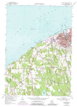
Oswego West Topo Map New York
To zoom in, hover over the map of Oswego West
USGS Topo Quad 43076d5 - 1:24,000 scale
| Topo Map Name: | Oswego West |
| USGS Topo Quad ID: | 43076d5 |
| Print Size: | ca. 21 1/4" wide x 27" high |
| Southeast Coordinates: | 43.375° N latitude / 76.5° W longitude |
| Map Center Coordinates: | 43.4375° N latitude / 76.5625° W longitude |
| U.S. State: | NY |
| Filename: | o43076d5.jpg |
| Download Map JPG Image: | Oswego West topo map 1:24,000 scale |
| Map Type: | Topographic |
| Topo Series: | 7.5´ |
| Map Scale: | 1:24,000 |
| Source of Map Images: | United States Geological Survey (USGS) |
| Alternate Map Versions: |
Oswego West NY 1954, updated 1955 Download PDF Buy paper map Oswego West NY 1954, updated 1970 Download PDF Buy paper map Oswego West NY 1954, updated 1978 Download PDF Buy paper map Oswego West NY 1954, updated 1988 Download PDF Buy paper map Oswego West NY 2010 Download PDF Buy paper map Oswego West NY 2013 Download PDF Buy paper map Oswego West NY 2016 Download PDF Buy paper map |
1:24,000 Topo Quads surrounding Oswego West
West Of Texas |
Texas |
|||
West Ninemile Point |
Oswego West |
Oswego East |
New Haven |
|
North Wolcott |
Fair Haven |
Hannibal |
Fulton |
Pennellville |
Wolcott |
Victory |
Cato |
Lysander |
Baldwinsville |
> Back to 43076a1 at 1:100,000 scale
> Back to 43076a1 at 1:250,000 scale
> Back to U.S. Topo Maps home
Oswego West topo map: Gazetteer
Oswego West: Bars
Ford Shoals elevation 75m 246′Oswego West: Canals
New York State Barge Canal elevation 75m 246′Oswego West: Capes
Burt Point elevation 79m 259′Oswego West: Dams
Lock Number 8 elevation 75m 246′Oswego West: Lakes
Glimmerglass Lagoon elevation 79m 259′Mud Pond elevation 106m 347′
Oswego West: Parks
Breitbeck Park elevation 76m 249′Franklin Park elevation 89m 291′
Kingsford Park elevation 98m 321′
Washington Square elevation 94m 308′
Oswego West: Populated Places
Fruit Valley elevation 82m 269′Furniss elevation 112m 367′
Oswego elevation 87m 285′
Oswego Beach elevation 79m 259′
Oswego Center elevation 111m 364′
Southwest Oswego elevation 113m 370′
Oswego West: Streams
Eightmile Creek elevation 75m 246′Oswego River elevation 75m 246′
Rice Creek elevation 75m 246′
Snake Creek elevation 76m 249′
Oswego West: Summits
Bunker Hill elevation 125m 410′Cornish Hill elevation 129m 423′
Gardner Hill elevation 129m 423′
Tug Hill elevation 128m 419′
Oswego West: Swamps
Snake Swamp elevation 76m 249′Oswego West digital topo map on disk
Buy this Oswego West topo map showing relief, roads, GPS coordinates and other geographical features, as a high-resolution digital map file on DVD:
New York, Vermont, Connecticut & Western Massachusetts
Buy digital topo maps: New York, Vermont, Connecticut & Western Massachusetts


