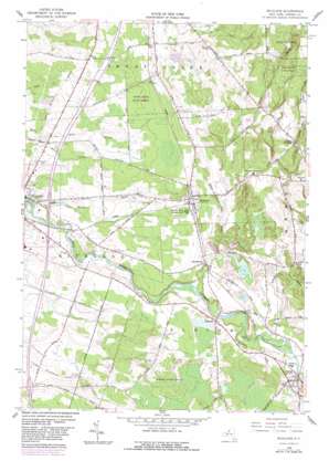
Richland Topo Map New York
To zoom in, hover over the map of Richland
USGS Topo Quad 43076e1 - 1:24,000 scale
| Topo Map Name: | Richland |
| USGS Topo Quad ID: | 43076e1 |
| Print Size: | ca. 21 1/4" wide x 27" high |
| Southeast Coordinates: | 43.5° N latitude / 76° W longitude |
| Map Center Coordinates: | 43.5625° N latitude / 76.0625° W longitude |
| U.S. State: | NY |
| Filename: | o43076e1.jpg |
| Download Map JPG Image: | Richland topo map 1:24,000 scale |
| Map Type: | Topographic |
| Topo Series: | 7.5´ |
| Map Scale: | 1:24,000 |
| Source of Map Images: | United States Geological Survey (USGS) |
| Alternate Map Versions: |
Richland NY 1958, updated 1960 Download PDF Buy paper map Richland NY 1958, updated 1972 Download PDF Buy paper map Richland NY 1958, updated 1983 Download PDF Buy paper map Richland NY 2010 Download PDF Buy paper map Richland NY 2013 Download PDF Buy paper map Richland NY 2016 Download PDF Buy paper map |
1:24,000 Topo Quads surrounding Richland
> Back to 43076e1 at 1:100,000 scale
> Back to 43076a1 at 1:250,000 scale
> Back to U.S. Topo Maps home
Richland topo map: Gazetteer
Richland: Airports
Oswego County at Pulaski Heliport elevation 134m 439′Pulaski Airport elevation 131m 429′
Pulaski Municipal Airport (historical) elevation 154m 505′
Richland Airport elevation 177m 580′
Richland: Populated Places
Altmar elevation 175m 574′Centerville elevation 167m 547′
Pineville elevation 165m 541′
Richland elevation 166m 544′
Richland: Streams
Orwell Creek elevation 153m 501′Pekin Brook elevation 169m 554′
Spring Brook elevation 104m 341′
Trout Brook elevation 144m 472′
Richland: Woods
Noyes Woods elevation 183m 600′Richland digital topo map on disk
Buy this Richland topo map showing relief, roads, GPS coordinates and other geographical features, as a high-resolution digital map file on DVD:
New York, Vermont, Connecticut & Western Massachusetts
Buy digital topo maps: New York, Vermont, Connecticut & Western Massachusetts


