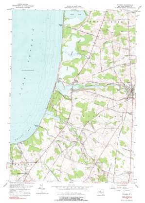
Pulaski Topo Map New York
To zoom in, hover over the map of Pulaski
USGS Topo Quad 43076e2 - 1:24,000 scale
| Topo Map Name: | Pulaski |
| USGS Topo Quad ID: | 43076e2 |
| Print Size: | ca. 21 1/4" wide x 27" high |
| Southeast Coordinates: | 43.5° N latitude / 76.125° W longitude |
| Map Center Coordinates: | 43.5625° N latitude / 76.1875° W longitude |
| U.S. State: | NY |
| Filename: | o43076e2.jpg |
| Download Map JPG Image: | Pulaski topo map 1:24,000 scale |
| Map Type: | Topographic |
| Topo Series: | 7.5´ |
| Map Scale: | 1:24,000 |
| Source of Map Images: | United States Geological Survey (USGS) |
| Alternate Map Versions: |
Pulaski NY 1956, updated 1958 Download PDF Buy paper map Pulaski NY 1956, updated 1970 Download PDF Buy paper map Pulaski NY 1956, updated 1978 Download PDF Buy paper map Pulaski NY 1956, updated 1990 Download PDF Buy paper map Pulaski NY 1956, updated 1990 Download PDF Buy paper map Pulaski NY 2010 Download PDF Buy paper map Pulaski NY 2013 Download PDF Buy paper map Pulaski NY 2016 Download PDF Buy paper map |
1:24,000 Topo Quads surrounding Pulaski
> Back to 43076e1 at 1:100,000 scale
> Back to 43076a1 at 1:250,000 scale
> Back to U.S. Topo Maps home
Pulaski topo map: Gazetteer
Pulaski: Airports
Kidder Field elevation 111m 364′Pulaski: Lakes
Black Hole elevation 91m 298′South Pond elevation 75m 246′
Pulaski: Parks
Selkirk Shores State Park elevation 85m 278′Pulaski: Populated Places
Bethel Corners elevation 86m 282′Daysville elevation 96m 314′
Daysville Corner elevation 83m 272′
Farmers Corner elevation 126m 413′
North Church Corner elevation 88m 288′
Port Ontario elevation 86m 282′
Pulaski elevation 113m 370′
Rainbow Shores elevation 79m 259′
Ramona Beach elevation 76m 249′
Selkirk elevation 75m 246′
Tinker Tavern Corner elevation 127m 416′
Tylers Corner elevation 99m 324′
Pulaski: Streams
Alder Creek elevation 78m 255′Deer Creek elevation 75m 246′
Grindstone Creek elevation 75m 246′
Little Deer Creek elevation 75m 246′
Little Grindstone Creek elevation 76m 249′
Mud Creek elevation 75m 246′
Sage Creek elevation 75m 246′
Salmon River elevation 75m 246′
Snake Creek elevation 75m 246′
Pulaski: Swamps
Deer Creek Marsh elevation 75m 246′Pulaski digital topo map on disk
Buy this Pulaski topo map showing relief, roads, GPS coordinates and other geographical features, as a high-resolution digital map file on DVD:
New York, Vermont, Connecticut & Western Massachusetts
Buy digital topo maps: New York, Vermont, Connecticut & Western Massachusetts


