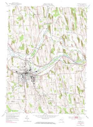
Newark Topo Map New York
To zoom in, hover over the map of Newark
USGS Topo Quad 43077a1 - 1:24,000 scale
| Topo Map Name: | Newark |
| USGS Topo Quad ID: | 43077a1 |
| Print Size: | ca. 21 1/4" wide x 27" high |
| Southeast Coordinates: | 43° N latitude / 77° W longitude |
| Map Center Coordinates: | 43.0625° N latitude / 77.0625° W longitude |
| U.S. State: | NY |
| Filename: | o43077a1.jpg |
| Download Map JPG Image: | Newark topo map 1:24,000 scale |
| Map Type: | Topographic |
| Topo Series: | 7.5´ |
| Map Scale: | 1:24,000 |
| Source of Map Images: | United States Geological Survey (USGS) |
| Alternate Map Versions: |
Newark NY 1952, updated 1953 Download PDF Buy paper map Newark NY 1952, updated 1971 Download PDF Buy paper map Newark NY 1952, updated 1971 Download PDF Buy paper map Newark NY 1952, updated 1971 Download PDF Buy paper map Newark NY 2010 Download PDF Buy paper map Newark NY 2013 Download PDF Buy paper map Newark NY 2016 Download PDF Buy paper map |
1:24,000 Topo Quads surrounding Newark
> Back to 43077a1 at 1:100,000 scale
> Back to 43076a1 at 1:250,000 scale
> Back to U.S. Topo Maps home
Newark topo map: Gazetteer
Newark: Airports
Newark Airport (historical) elevation 140m 459′Newark: Lakes
Sheers Pond elevation 135m 442′Newark: Parks
Colburn Park elevation 134m 439′Rose Gardens elevation 149m 488′
Newark: Populated Places
Fairville elevation 134m 439′Green Meadows Park elevation 138m 452′
Hydesville elevation 129m 423′
Marbletown elevation 148m 485′
Mayo Park elevation 135m 442′
Mud Mills elevation 130m 426′
Newark elevation 135m 442′
Vienna Estates elevation 170m 557′
Newark: Streams
Butternut Run elevation 121m 396′Ganargua Creek elevation 121m 396′
Military Run elevation 127m 416′
Trout Brook elevation 122m 400′
Newark: Summits
Bailey Hill elevation 173m 567′Jackson Hill elevation 201m 659′
Silver Hill elevation 178m 583′
Newark digital topo map on disk
Buy this Newark topo map showing relief, roads, GPS coordinates and other geographical features, as a high-resolution digital map file on DVD:
New York, Vermont, Connecticut & Western Massachusetts
Buy digital topo maps: New York, Vermont, Connecticut & Western Massachusetts


