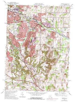
Fairport Topo Map New York
To zoom in, hover over the map of Fairport
USGS Topo Quad 43077a4 - 1:24,000 scale
| Topo Map Name: | Fairport |
| USGS Topo Quad ID: | 43077a4 |
| Print Size: | ca. 21 1/4" wide x 27" high |
| Southeast Coordinates: | 43° N latitude / 77.375° W longitude |
| Map Center Coordinates: | 43.0625° N latitude / 77.4375° W longitude |
| U.S. State: | NY |
| Filename: | o43077a4.jpg |
| Download Map JPG Image: | Fairport topo map 1:24,000 scale |
| Map Type: | Topographic |
| Topo Series: | 7.5´ |
| Map Scale: | 1:24,000 |
| Source of Map Images: | United States Geological Survey (USGS) |
| Alternate Map Versions: |
Fairport NY 1932 Download PDF Buy paper map Fairport NY 1934 Download PDF Buy paper map Fairport NY 1952, updated 1954 Download PDF Buy paper map Fairport NY 1952, updated 1958 Download PDF Buy paper map Fairport NY 1952, updated 1966 Download PDF Buy paper map Fairport NY 1952, updated 1970 Download PDF Buy paper map Fairport NY 1971, updated 1974 Download PDF Buy paper map Fairport NY 1971, updated 1978 Download PDF Buy paper map Fairport NY 1971, updated 1978 Download PDF Buy paper map Fairport NY 2010 Download PDF Buy paper map Fairport NY 2013 Download PDF Buy paper map Fairport NY 2016 Download PDF Buy paper map |
1:24,000 Topo Quads surrounding Fairport
> Back to 43077a1 at 1:100,000 scale
> Back to 43076a1 at 1:250,000 scale
> Back to U.S. Topo Maps home
Fairport topo map: Gazetteer
Fairport: Bridges
Knapps Bridge elevation 140m 459′Fairport: Crossings
Interchange 45 elevation 197m 646′Fairport: Lakes
Crossmans Pond elevation 156m 511′Kettle Lake elevation 145m 475′
Lake Lacoma elevation 130m 426′
Lilly Pond elevation 136m 446′
Fairport: Parks
Edmund-Lyon Park elevation 126m 413′Kreag Road Park elevation 146m 479′
Legion Eyer Park elevation 113m 370′
Perinton Park elevation 138m 452′
Powder Mill Park elevation 145m 475′
White Haven Memorial Park elevation 127m 416′
Fairport: Populated Places
Bushnell Basin elevation 143m 469′East Rochester elevation 128m 419′
Egypt elevation 160m 524′
Fairport elevation 150m 492′
Fishers elevation 166m 544′
Hannans Corner elevation 168m 551′
Motts Corner elevation 184m 603′
Fairport: Streams
Cross Canal Brook elevation 117m 383′Mill Creek elevation 124m 406′
Thomas Creek elevation 113m 370′
White Brook elevation 141m 462′
Fairport: Summits
Baker Hill elevation 282m 925′Hunt Hills elevation 215m 705′
Turk Hill elevation 264m 866′
Fairport digital topo map on disk
Buy this Fairport topo map showing relief, roads, GPS coordinates and other geographical features, as a high-resolution digital map file on DVD:
New York, Vermont, Connecticut & Western Massachusetts
Buy digital topo maps: New York, Vermont, Connecticut & Western Massachusetts


