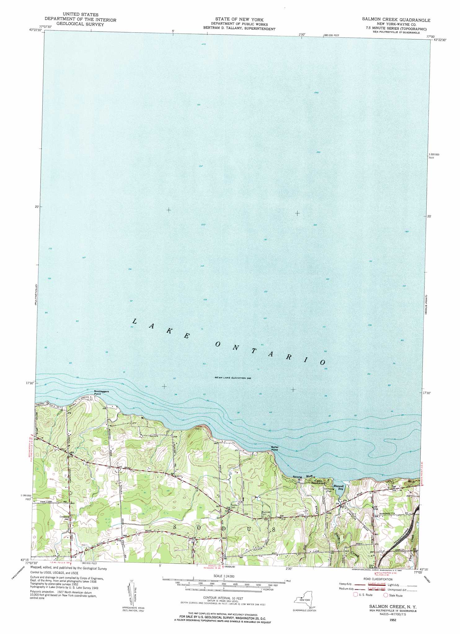
Salmon Creek Topo Map New York
To zoom in, hover over the map of Salmon Creek
USGS Topo Quad 43077c1 - 1:24,000 scale
| Topo Map Name: | Salmon Creek |
| USGS Topo Quad ID: | 43077c1 |
| Print Size: | ca. 21 1/4" wide x 27" high |
| Southeast Coordinates: | 43.25° N latitude / 77° W longitude |
| Map Center Coordinates: | 43.3125° N latitude / 77.0625° W longitude |
| U.S. State: | NY |
| Filename: | o43077c1.jpg |
| Download Map JPG Image: | Salmon Creek topo map 1:24,000 scale |
| Map Type: | Topographic |
| Topo Series: | 7.5´ |
| Map Scale: | 1:24,000 |
| Source of Map Images: | United States Geological Survey (USGS) |
| Alternate Map Versions: |
Salmon Creek NY 1952, updated 1953 Download PDF Buy paper map Salmon Creek NY 2010 Download PDF Buy paper map Salmon Creek NY 2013 Download PDF Buy paper map Salmon Creek NY 2016 Download PDF Buy paper map |
1:24,000 Topo Quads surrounding Salmon Creek
Furnaceville |
Pultneyville |
Salmon Creek |
Sodus Point |
North Wolcott |
Ontario |
Williamson |
Sodus |
Rose |
Wolcott |
Macedon |
Palmyra |
Newark |
Lyons |
Savannah |
> Back to 43077a1 at 1:100,000 scale
> Back to 43076a1 at 1:250,000 scale
> Back to U.S. Topo Maps home
Salmon Creek topo map: Gazetteer
Salmon Creek: Bays
Maxwell Bay elevation 75m 246′Salmon Creek: Capes
Boller Point elevation 75m 246′Bootleggers Point elevation 75m 246′
Salmon Creek: Cliffs
Sprong Bluff elevation 75m 246′Salmon Creek: Populated Places
Idlewood On The Lake elevation 103m 337′Salmon Creek: Streams
Salmon Creek elevation 77m 252′Sill Creek elevation 75m 246′
Salmon Creek: Summits
Negro Hill elevation 103m 337′Salmon Creek digital topo map on disk
Buy this Salmon Creek topo map showing relief, roads, GPS coordinates and other geographical features, as a high-resolution digital map file on DVD:
New York, Vermont, Connecticut & Western Massachusetts
Buy digital topo maps: New York, Vermont, Connecticut & Western Massachusetts